University of Minnesota
http://www.umn.edu/
612-625-5000
http://www.umn.edu/
612-625-5000
Minnesota Biodiversity Atlas
Bell Museum
Dataset: MIN-Plants
Taxa: Myrsinaceae
Search Criteria: excluding cultivated/captive occurrences
Bell Museum plants | |
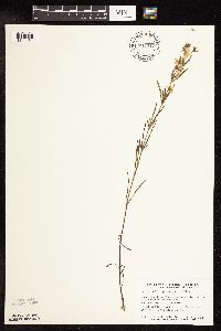
MIN:Plants | 359897[1144456]Rosendahl, C.; et al. 70611938-09-04 United States, Minnesota, Marshall, Near RR tracks, 2 mi S of Holt.;;;;, 48.26297 -96.192531 |
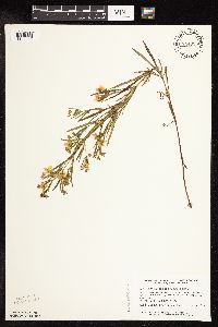
MIN:Plants | 361783[1144461]Rosendahl, C. 67771926-09-09 United States, Minnesota, Scott, W of Savage.;;N;;, 44.764751 -93.384745 |
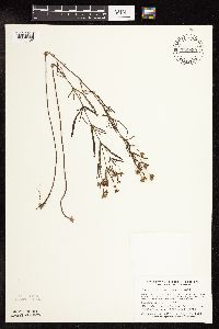
MIN:Plants | 366157[1144473]Rosendahl, C.; et al. 72711939-07-21 United States, Minnesota, Mower, 4 mi N of Rose Creek. Mower Co.;;;;, 43.660212 -92.829374 |
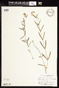
MIN:Plants | 371256[1144382]Moore, John; et al. 148871941-07-19 United States, Minnesota, Swift, 1 mi W of Benson, Swift Co.;;121N;40W;, 45.2820462 -95.6859058 |
MIN:Plants | 373840[1144373]Moore, John; et al. 151171941-09-19 United States, Minnesota, Dakota, 1/2 mi S of Nicols;;027N;23W;19, 44.8119507 -93.2176521 |
MIN:Plants | 382119[1144368]Stevens, O. 7321943-07-21 United States, Minnesota, Clay, Muskoda [historic RR station near Hawley];;139N;45W;17, 46.8545484 -96.3967683 |
MIN:Plants | 396792[1144391]Stevens, O. s.n.1947-07-18 United States, Minnesota, Clay, [no further data];Buffalo River State Park;139N;46W;10, 46.8693271 -96.4734276 |
MIN:Plants | 405919[1144401]Rosendahl, C. 79211948-09-22 United States, Minnesota, Scott, 1/4 mi. W of Savage.;;115N;21W;, 44.7536055 -93.3443494 |
MIN:Plants | 444657[1144476]Moore, John; Huff, N. 183861945-10-16 United States, Minnesota, Stearns, 1/2 mi S of Cold Springs. Stearns Co.;;123N;30W;, 45.4564982 -94.4449 |
MIN:Plants | 444856[1144459]Moore, John; Huff, N. 187821946-07-31 United States, Minnesota, Benton, 1/2 mi E of East St. Cloud adjacent to Hwy No. 23.;;N;;, 45.568649 -94.13256 |
MIN:Plants | 457980[1144447]Garrison, J. s.n.1880-00-00 United States, Minnesota, Itasca, Pokegama Falls;;;;, 47.188454 -93.589294 |
MIN:Plants | 459119[1144387]Smith, Welby 131831987-06-27 United States, Minnesota, Pipestone, Pipestone Co.; Altona State Wildlife Management Area, about 1.5 mi SE of Verdi; NW1/4 NW1/4 sec.1, T108N R46W;Altona Wildlife Management Area;108N;46W;1, 44.1966667 -96.3249969 |
MIN:Plants | 460972[1144440]Smith, Welby 181731990-08-29 United States, Minnesota, Dodge, Pheasants Forever Wildlife Management Area. Dodge Co.; 'Pheasants Forever'State Wildlife Management Area, about 2.5 miles west-southwest of Mantorville Dodge Co.; 'Pheasants Forever'State Wildlife Management Area, about 2.5 miles west-southwest of Mantorville. T 107N R 17W SW1/4 of SE1/4 of Sec 24.. 107N 17W 24, 44.0530548 -92.9300003 |
MIN:Plants | 475329[1144412]Smith, Welby 171881990-07-11 United States, Minnesota, Dodge, Wasioja Wildlife Management Area. Dodge County ... In Wasioja State Wildlife Management Area, about 4 miles west of Wasioja ... T 107N R 17W SE1/4 of SW1/4 of Sec 17. 107N 17W 17, 44.0672226 -92.8916702 |
MIN:Plants | 504926[1144365]Smith, Welby 170601990-06-27 United States, Minnesota, Martin, Luedtke Wildlife Management Area. Martin Co.; Luedtke State Wildlife Management Area, about 4 mi S-SE of Granada; T102N R2 Martin Co.; Luedtke State Wildlife Management Area, about 4 mi S-SE of Granada; T102N R29W SW1/4 of NW1/4 of Sec 15. 102N 29W 15, 43.6397209 -94.4313889 |
MIN:Plants | 506805[1144363]Smith, Welby 180861990-08-28 United States, Minnesota, Carver, Raquet Wildlife Management Area. Carver Co. ... At the base of a south-facing bluff in the Minnesota River Valley, about 2 mi northwest of Shakopee ... T116N R23W NE1/4 of SW1/4 of sec 35. 116N 23W 35, 44.8111115 -93.5575027 |
MIN:Plants | 508205[1144361]Smith, Welby 121211986-07-10 United States, Minnesota, Pipestone, Prairie Coteau Scientific Natural Area. Pipestone County...Aetna Prairie State Scientific and Natural Area; on the northwest side of State Highway 23 about 2.5 mi northeast of Holland. SW1/4 SE1/4 section 32 T 108N R 44W. 108N 44W 32, 44.1125 -96.1522222 |
MIN:Plants | 508699[1144441]Smith, Welby 143871988-06-30 United States, Minnesota, Nobles, Nobles Co. About 2 mi SW of Worthington; on the right-of-way of the C&NW Railroad; SW1/4 SE1/4 sec.32, T102N R40W;;102N;40W;32, 43.5877762 -95.6616669 |
MIN:Plants | 514573[1144477]Smith, Welby 155661989-07-04 United States, Minnesota, Freeborn, Halls Lake Wildlife Management Area. Freeborn Co.; Halls Lake National Waterfowl Production Area, about 3.5 miles NE of Alden; NW1/4 NE1/4 sec.30, T 103N R 2 Freeborn Co.; Halls Lake National Waterfowl Production Area, about 3.5 miles NE of Alden; NW1/4 NE1/4 sec.30, T 103N R 22W. 103N 22W 30, 43.6948687 -93.5185318 |
MIN:Plants | 515687[1144435]Schik, K. 95-3381995-08-14 United States, Minnesota, Polk, Polk Co. T149N R45W NW1/4 of the SE1/4 of S36; at Pembina Trail Nature Conservancy Preserve.;Pembina Trail Preserve Scientific Natural Area;149N;45W;36, 47.6802832 -96.3626937 |
MIN:Plants | 53385[1144366]Whitney, Myrtle 221888-08-07 United States, Minnesota, Waseca, Found near Waseca;;N;;, 44.077741 -93.507443 |
MIN:Plants | 553994[1144469]Moore, John 226261955-07-26 United States, Minnesota, Norman, 1/2 mi S of Syre.;;;;, 47.173002 -96.258671 |
MIN:Plants | 554674[1144371]Moore, John 230271956-09-14 United States, Minnesota, Clay, Muskoda [historic RR station near Hawley];;139N;45W;17, 46.8545484 -96.3967683 |
MIN:Plants | 566292[1144458]Moore, John; Heig, V. 241101958-09-10 United States, Minnesota, Kittson, 3 mi N of Halma.;;N;;, 48.704505 -96.600321 |
MIN:Plants | 568758[1144372]Moore, John 252621960-08-17 United States, Minnesota, Blue Earth, 1 mi W of Judson;;N;;, 44.196353 -94.21544 |
MIN:Plants | 574742[1144454]Moore, John 247391959-07-29 United States, Minnesota, Kittson, 3 mi N of Halma.;;N;;, 48.704505 -96.600321 |
MIN:Plants | 578747[1144475]Ownbey, Gerald; Bloom, W. 34431962-08-22 United States, Minnesota, Clearwater, About 6.3 mi due N of Clearbrook, Rte 5. T150N, R37W, NW1/4 Sec 29.;;150N;37W;29, 47.7826086 -95.4199196 |
MIN:Plants | 591982[1144468]Moore, John 267771965-08-11 United States, Minnesota, Blue Earth, Along the Blue Earth River 1 mi S of Mankato.;;N;;, 44.150847 -94.03204 |
MIN:Plants | 607522[1144379]Westkaemper, Remberta s.n.1967-07-00 United States, Minnesota, Stearns, Stearns Co. Rockville;;123N;29W;, 45.4574203 -94.3224782 |
MIN:Plants | 670602[1144385]Heitlinger, M. 2001971-07-07 United States, Minnesota, McLeod, Schaefer Prairie. SE1/4 Sec34, T115N, R29W.;Schaefer Prairie, The Nature Conservancy;115N;29W;34, 44.7250496 -94.3049103 |
MIN:Plants | 670890[1144386]Gordon, William s.n.1939-08-02 United States, Minnesota, Mower, Ill. Central RR right of way, Lyle Twp, Sec30;;101N;18W;, 43.5214685 -93.0394361 |
MIN:Plants | 679045[1144380]Ownbey, Gerald 49901975-07-15 United States, Minnesota, Polk, Polk County...T148N, R45W, Sec 26, SE1/4; 2.4 mi SE of jcn of Rte 102 and Rte 44 at Melvin, E side of Rte 102;;148N;45W;26, 47.6084406 -96.3553092 |
MIN:Plants | 690571[1144457]Siemers, Ross 751977-07-13 United States, Minnesota, Stearns, Stearns Co. Roscoe Prairie. 2 mi SW of Roscoe on Hwy 16. T123N, R32W, Sec.35.;Roscoe Prairie Scientific Natural Area;123N;32;35, 45.4195202 -94.6709243 |
MIN:Plants | 708045[1144455]Smith, Welby 13881979-08-22 United States, Minnesota, Clay, T139N, R45W; SW1/4 Sec 32. "Audubon Prairie". 5.5 mi SW of Hawley.;Audubon Prairie, The Nature Conservancy;139N;45W;32, 46.8112046 -96.3982237 |
MIN:Plants | 715452[1144367]Ottoson, S. 911979-07-25 United States, Minnesota, Clay, Blazing Star Prairie: 4 mi SE of Felton, NE1/4 Sec5, T141N, R45W.;Felton Prairie-Blazing Star Prairie Scientific Natural Area;141N;45W;5, 47.0567136 -96.4173556 |
MIN:Plants | 721552[1144381]Farrell, P. 1161979-07-18 United States, Minnesota, Polk, 7 mi. SE of Crookston. S1/2 of section;Pankratz Memorial Prairie, The Nature Conservancy;149N;45W;08, 47.73852 -96.44879 |
MIN:Plants | 724040[1144474]Smith, Welby 28751980-07-17 United States, Minnesota, Mower, T101N, R15W; NE1/4 NW1/4 Sec24. Between the Chicago, Milwaukee & Pacific RR tracks and hwy 56; 1.8 mi SE of its jcn with T101N, R15W; NE1/4 NW1/4 Sec24. Between the Chicago, Milwaukee & Pacific RR tracks and hwy 56; 1.8 mi SE of its jcn with hwy 11.. 101N 15W 24, 43.5365013 -92.5787398 |
MIN:Plants | 727208[1144403]Herman, J. 1101979-07-17 United States, Minnesota, Norman, Twin Valley Prairie: 5 mi. W of Syre, NW1/4 and E1/2 of SW1/4 of Sec. 23, T143N, R45W (TNC).;Twin Valley Prairie Scientific Natural Area;143N;45N;23, 47.1875161 -96.3538078 |
MIN:Plants | 727616[1144451]Farrell, P. 1031979-07-10 United States, Minnesota, Polk, Pembina Trail Preserve Scientific Natural Area. Pembina Trail Preserve: 6 1/2 mi E of Harold, all sec. 36, frac. sec. 25, 30, 31, T149N, R45W, frac. sec. 1, 2, T148N, R Pembina Trail Preserve: 6 1/2 mi E of Harold, all sec. 36, frac. sec. 25, 30, 31, T149N, R45W, frac. sec. 1, 2, T148N, R45W.. N, 47.7167669 -96.416687 |
MIN:Plants | 727776[1144452]Severson, M. 1031979-07-25 United States, Minnesota, Polk, Pankratz Prairie South: 7 mi. SE of Crookston, SE1/4 of Sec. 17, NE1/4 of Sec. 20, T149N, R45W (TNC).;Pankratz Memorial Prairie, The Nature Conservancy;149N;45W;, 47.7167669 -96.416687 |
MIN:Plants | 728026[1144405]Severson, M. 931979-07-18 United States, Minnesota, Polk, Pankratz Prairie South: 7 mi. SE of Crookston, SE1/4 of Sec. 17, NE1/4 of Sec. 20, T149N, R45W (TNC).;Pankratz Memorial Prairie, The Nature Conservancy;149N;45W;, 47.7167669 -96.416687 |
MIN:Plants | 728844[1144470]Woolsey, Henry; et al. s.n.1980-09-09 United States, Minnesota, Rice, On Cannon River 4 mi SW of Northfield.;Cannon River Wilderness Park;111N;20W;34, 44.3776536 -93.2113107 |
MIN:Plants | 728919[1144402]Herman, J. 1391979-08-01 United States, Minnesota, Mahnomen, Mahnomen Co. Santee Prairie: 3 mi SE of Bejou, Sec. 6, 7, T145N, R41W (TNC).;Santee Prairie Scientific Natural Area / White Earth Indian Reservation;145N;41W;, 47.3684247 -95.8691217 |
MIN:Plants | 730927[1144453_1;1144453_2]Cross-Cella, J. 2351980-07-08 United States, Minnesota, Clay, Audubon Prairie: 16.5 mi E-SE of Moorhead. NW1/4 NE1/4 Sec32, T139N, R45W. Near woods.;Audubon Prairie, The Nature Conservancy;139N;45W;32, 46.8112046 -96.3982237 |
MIN:Plants | 732705[1144471]Severson, M. 5001980-07-14 United States, Minnesota, Becker, Zimmerman Prairie: 10 mi W of Ogema. NE1/4 SW1/4 Sec16, T142N, R43W.;Zimmerman Prairie [TNC];142N;43W;16, 47.1150258 -96.1414196 |
MIN:Plants | 734532[1144404]Severson, M. 4491980-07-08 United States, Minnesota, Clay, Bluestem Prairie: 13 mi. E of Moorhead. NE1/4 NE1/4 Sec. 22, T139N, R46W.;Bluestem Prairie Scientific Natural Area;139N;46W;22, 46.8404624 -96.4734507 |
MIN:Plants | 744859[1144355]Smith, Welby 49731981-07-21 United States, Minnesota, Mower, Wild Indigo Scientific and Natural Area. Ca. 2 1/2 mi. W of Dexter. SW1/4 NE1/4 Sec. 16, T103N, R16W.;Wild Indigo Scientific Natural Area;103N;16W;16, 43.7248832 -92.759467 |
MIN:Plants | 744876[1144433]Smith, Welby 52671981-08-05 United States, Minnesota, Steele, Steele Co. About 3 mi NW of Bixby and 200 meters NW of Turtle Creek crossing; between Hwy. 218 and the Chicago, Milwauke Steele Co. About 3 mi NW of Bixby and 200 meters NW of Turtle Creek crossing; between Hwy. 218 and the Chicago, Milwaukee, St. Paul, and the Pacific railroad tracks. SE1/4 SE1/4 sec.17, T106N R19W. 106N 19W 17, 43.9864174 -93.1360604 |
MIN:Plants | 744912[1144431]Smith, Welby 51551981-07-31 United States, Minnesota, Norman, On the E side of Hwy. 40, ca. 2 1/2 mi. S of Faith. SW1/4 NW1/4 Sec. 25, T144N, R43W.;;144N;43W;25, 47.2603679 -96.0775731 |
MIN:Plants | 744925[1144356]Smith, Welby 51881981-08-01 United States, Minnesota, Clay, Ca. 3 mi. E-SE of the jct. of Hwy. 9 and Hwy. 34 in Felton. NE1/4 SE1/4 Sec. 36, T142N, R46W.;;142N;46W;36, 46.8110919 -96.4311729 |
MIN:Plants | 744950[1144432]Smith, Welby 57311981-09-06 United States, Minnesota, Scott, Scott co. On the W side of Savage, 1/2 mi. S of Hwy. 13, in the Minnesota Valley. SE1/4 NE1/4 Sec. 17, T115N, R21W.;Savage Fen Scientific Natural Area;115N;21W;17, 44.7681257 -93.3690033 |
MIN:Plants | 744958[1144434]Smith, Welby 53051981-08-06 United States, Minnesota, Jackson, Ca. 6 1/2 mi. NE of Lakefield. In the des Moines River Valley. NE1/4 NE1/4 Sec. 7, T103N, R35W.;;103N;35W;7, 43.7393406 -95.0849166 |
MIN:Plants | 745176[1144449]Smith, Welby 57441981-07-20 United States, Minnesota, Dakota, About 1 mi S of Black Dog Lake, in the Minnesota Valley. NW1/4 NE1/4 of section;Black Dog Preserve Scientific Natural Area;027N;24W;34, 44.7831331 -93.2786176 |
MIN:Plants | 745177[1144418]Smith, Welby 49031981-07-20 United States, Minnesota, Dakota, Dakota Co. About 1 mi S of Black Dog Lake, in the Minnesota Valley. NW1/4 NE1/4 Sec. 34, T27N, R24W.;Black Dog Preserve Scientific Natural Area;027N;24W;34, 44.7831331 -93.2786176 |
MIN:Plants | 745186[1144419]Smith, Welby 48101981-07-13 United States, Minnesota, Polk, Polk County...About 3 mi. NE of Harold....SW1/4 NE1/4 Sec. 17, T149N, R45W.;Pankratz Memorial Prairie, The Nature Conservancy;149N;45W;17, 47.7239745 -96.4488993 |
MIN:Plants | 745192[1144439]Smith, Welby 49391981-07-20 United States, Minnesota, Scott, Scott Co. On the W side of Savage, 1/2 mi. S of Hwy. 13, in the Minnesota Valley. SE1/4 NE1/4 Sec. 17, T115N, R21N.;Savage Fen Scientific Natural Area;115N;21W;17, 44.7681257 -93.3690033 |
MIN:Plants | 745279[1144357]Smith, Welby 52891981-08-05 United States, Minnesota, Waseca, Ca. 2 1/2 mi. W-NW of the jct. of Hwy. 14 and 13 in Waseca. Prairie strip between Hwy. 14 and the Chicago and Northwest Ca. 2 1/2 mi. W-NW of the jct. of Hwy. 14 and 13 in Waseca. Prairie strip between Hwy. 14 and the Chicago and Northwestern Railroad tracks. NW1/4 NE1/4 Sec. 11, T107N, R23W.. 107N 23W 11, 44.0875435 -93.5570583 |
MIN:Plants | 745283[1144438]Smith, Welby 53221981-08-06 United States, Minnesota, Martin, On the N side of Hwy. 50, ca. 2 1/4 mi. W if its jct. with Hwy. 15 in Truman. SW1/4 SE1/4 Sec. 7, T104N, R30W.;;104N;30W;7, 43.8254659 -94.4801099 |
MIN:Plants | 745331[1144430]Smith, Welby 52481981-08-04 United States, Minnesota, Fillmore, Fillmore Co. About 9 mi S-SE of Ostrander. SE1/4 Sec. 27, T101N, R13W.;;101N;13W;27, 43.522286 -92.3793529 |
MIN:Plants | 745332[1144429]Smith, Welby 53491981-08-06 United States, Minnesota, Faribault, Ca. 3.5 mi. SE of Wells. Prairie strip between Hwy. 109 and the Chicago, Milwaukee, St. Paul and Pacific Railroad trac Ca. 3.5 mi. SE of Wells. Prairie strip between Hwy. 109 and the Chicago, Milwaukee, St. Paul and Pacific Railroad tracks. SE1/4 SE1/4 Sec. 14, T103N, R24W.. 103N 24W 14, 43.7243423 -93.6782662 |
MIN:Plants | 746915[1144400]Lee, Craig 831982-07-15 United States, Minnesota, Kandiyohi, Regal Meadow: t122N, R33W, NE1/4 SE1/4 and part of NE1/4 NE1/4 of Sec. 16.;Regal Meadow, The Nature Conservancy;122N;33W;16, 45.3769223 -94.8351163 |
MIN:Plants | 757805[1144420]Smith, Welby 66621982-07-09 United States, Minnesota, Norman, Agassiz-Nelson State Wildlife Management Area. Ca. 5 mi. NW of Gary. NW1/4 NW1/4 Sec. 36, T146N, R45W.;Agassiz-Nelson Wildlife Management Area;146N;45W;36, 47.4202091 -96.3337317 |
MIN:Plants | 757844[1144422]Smith, Welby 66751982-07-10 United States, Minnesota, Norman, On the E side of Hwy. 40, ca. 2 1/2 mi. S of Faith. SW1/4 NW1/4 Sec. 25, T144N, R43W.;;144N;43W;25, 47.2603679 -96.0775731 |
MIN:Plants | 758169[1144421]Smith, Welby 67731982-07-17 United States, Minnesota, Dakota, Dakota County...In the Minnesota Valley, about 1/4 mi. N of Nicols. NE1/4 SW1/4 Sec. 18, T27N, R23W.;Fort Snelling State Park;027N;23W;18, 44.8258841 -93.2169988 |
MIN:Plants | 758378[1144427]Smith, Welby 67321982-07-14 United States, Minnesota, Norman, Agassiz-Olson State Wildlife Management Area, ca. 12 mi. N-NE of Ada. SW1/4 NW1/4 Sec. 22, T146N, R45W.;Agassiz-Olson Wildlife Management Area;146N;45W;22, 47.4487406 -96.3764891 |
MIN:Plants | 758755[1144425]Smith, Welby 72261982-08-12 United States, Minnesota, Polk, Polk County...On the N side of Hwy. 45, about 12-1/2 mi. E-SE of Crookston...SW1/4 SW1/4 Sec. 19, T149N, R44W.;Pembina Trail Preserve Scientific Natural Area;149N;44W;19, 47.7092275 -96.3410879 |
MIN:Plants | 759205[1144426]Smith, Welby 69191982-07-28 United States, Minnesota, Mower, Racine Prairie Scientific Natural Area. Racine Prairie State Scientific and Natural Area. Prairie strip adjacent to the E side of Hwy. 63, ca. 2 mi. N of Racin Racine Prairie State Scientific and Natural Area. Prairie strip adjacent to the E side of Hwy. 63, ca. 2 mi. N of Racine. NE1/4 NE1/4 Sec. 22, T104N, R14W.. 104N 14W 22, 43.7976425 -92.4992666 |
MIN:Plants | 759224[1144423]Smith, Welby 73431982-08-19 United States, Minnesota, Le Sueur, LeSueur Co. On the W side of Hwy. 23, about 2 mi NE of St. Peter, in the Minnesota Valley. NE1/4 NW1/4 Sec. 11, T110N, LeSueur Co. On the W side of Hwy. 23, about 2 mi NE of St. Peter, in the Minnesota Valley. NE1/4 NW1/4 Sec. 11, T110N, R26W.. 110N 26W 11, 44.348192 -93.9191723 |
MIN:Plants | 759294[1144424]Smith, Welby 67531982-07-17 United States, Minnesota, Dakota, Fort Snelling State Park. Dakota Co. Fort Snelling State Park. In the Minnesota Valley 1/2 mi. E of Gun Club Lake. SE1/4 NW1/4 Sec. 4, T27N, R23 Dakota Co. Fort Snelling State Park. In the Minnesota Valley 1/2 mi. E of Gun Club Lake. SE1/4 NW1/4 Sec. 4, T27N, R23W.. 027N 23W 4, 44.8549971 -93.1772975 |
MIN:Plants | 763573[1144397]Lugger, O. s.n.1900-07-00 United States, Minnesota, Nicollet, Nicollet.;;109N;28W;03, 44.2758679 -94.1803444 |
MIN:Plants | 770018[1144398]Smith, Welby 87401983-08-28 United States, Minnesota, Watonwan, Watonwan Co.; on the right-of-way of the Chicago and Northwestern R.R, ca. 4 mi. SW of Madelia. SW1/4 NE1/4 Sec. 36, T Watonwan Co.; on the right-of-way of the Chicago and Northwestern R.R, ca. 4 mi. SW of Madelia. SW1/4 NE1/4 Sec. 36, T107N, R31W.. 107N 31W 36, 44.0292105 -94.4989062 |
MIN:Plants | 770667[1144399]Smith, Welby 84731983-07-27 United States, Minnesota, Fillmore, Fillmore Co. About 3 mi SE of Spring Valley. NW1/4 SE1/4 Sec. 12, T102N, R13W.;;102N;13W;12, 43.6527076 -92.3393776 |
MIN:Plants | 775030[1144395]Morley, T. 15771984-09-23 United States, Minnesota, Rice, Rice Co. Cannon River Valley, T111N, R20W, center of E 1/4 Sec. 22, E of river, between the river and a house, directly Rice Co. Cannon River Valley, T111N, R20W, center of E 1/4 Sec. 22, E of river, between the river and a house, directly E of the sharp bend in the river.. 111N 20W 22, 44.4065997 -93.2109442 |
MIN:Plants | 781941[1144428]Smith, Welby 93761984-06-27 United States, Minnesota, Jackson, Kilen Woods State Park. Kilen Wood State Park. Ca. 1/4 mi. W of the Des Moines River on a steep N-facing slope above a small unnamed tributary Kilen Wood State Park. Ca. 1/4 mi. W of the Des Moines River on a steep N-facing slope above a small unnamed tributary stream. SE1/4 NW1/4 Sec. 17, T103N, R35W.. 103N 35W 17, 43.7248138 -95.0646485 |
MIN:Plants | 787211[1144388]Smith, Welby 110281985-08-10 United States, Minnesota, Dodge, Iron Horse Prairie Scientific Natural Area. Dodge County... Iron Horse Prairie State Scientific and Natural Area, about 1 1/2 mi. S of Hayfield. NW1/4 SE1/4 Sec. 27, T105N, R17W. 105N 17W 27, 43.8675 -92.8486111 |
MIN:Plants | 789611[1144394]Smith, Welby 112921985-09-07 United States, Minnesota, Olmsted, Olmsted Co. About 2 mi S-SE of Rock Dell and 1/4 mi N of Hwy. 30. NW1/4 SW1/4 SE1/4 Sec. 16, T105N, R15W;;105N;15W;16, 43.894722 -92.6255569 |
MIN:Plants | 792080[1144393]Smith, Welby 109371985-07-24 United States, Minnesota, Cottonwood, Expandere State Wildlife Management Area, ca. 13 mi. W-NW of Windom. SE1/4 SW1/4 Sec. 1, T105N, R38W.;Expandere Wildlife Management Area;105N;38W;1, 43.9275728 -95.3504697 |
MIN:Plants | 792267[1144396]Smith, Welby 107891985-07-19 United States, Minnesota, Marshall, Ca. 1/8 mi. N of the Marshall-Pennington Co. line, and 3 mi. S-SE of Viking. SW1/4 NE14 Sec. 12, T154N, R45W Ca. 1/8 mi. N of the Marshall-Pennington Co. line, and 3 mi. S-SE of Viking. SW1/4 NE14 Sec. 12, T154N, R45W. 154N 45W 12, 48.1755562 -96.3777771 |
MIN:Plants | 793943[1144392]Clark, A. 171986-06-30 United States, Minnesota, Wilkin, Tanberg Twp, R.R. easement NW of Rothsay. T135N, R45W, S10.;;135N;45W;10, 46.5223799 -96.3334256 |
MIN:Plants | 800419[1144362]Smith, Welby 120391986-07-08 United States, Minnesota, Olmsted, Olmsted Co. About 2 mi S-SE of Rock Dell and about 1/4 mi N of Hwy. 30. NW1/4 SW1/4 SE1/4 Sec. 16, T105N, R15W;;105N;15W;16, 43.894722 -92.6255569 |
MIN:Plants | 800460[1144437]Smith, Welby 120871986-07-08 United States, Minnesota, Mower, Brandt-Larson Wildlife Management Area. Mower County...Brandt-Larson State Wildlife Management Area, about 4 mi. NE of Lyle. Along Otter Creek...NE1/4 SW1/4 Sec. 16, T101N, R17W. 101N 17W 16, 43.5469444 -92.8813889 |
MIN:Plants | 804647[1144358]Smith, Welby 122251986-07-23 United States, Minnesota, Marshall, Florian State Wildlife Management Area. ca. 6 mi. SW of Strandquist. NE1/4 NW1/4 Sec. 11, T157N, R46W;Florian Wildlife Management Area;157N;46W;11, 48.4402771 -96.5550003 |
MIN:Plants | 805845[1144359]Cholewa, A. 18341989-09-01 United States, Minnesota, Dakota, Fort Snelling State Park. Dakota Co. 'Nicols Fen,' ca. 100 yds. NE of the jct. of Cedar Ave. and the Chicago Northwestern R.R. T27N, R23W, Sec 18, just SW of the center.. 027N 23W 18, 44.8258841 -93.2169988 |
MIN:Plants | 814676[1144407]Wheeler, Gerald 116991988-08-13 United States, Minnesota, Norman, Norman County...Ca. 2 mi. S-SE of Faith...Faith Prairie. SE1/4 NW1/4 Sec. 25, T144N, R43W, Fossum Twp.;Faith Wildlife Management Area;144N;43W;25, 47.2603679 -96.0775731 |
MIN:Plants | 815635[1144389]Wheeler, Gerald 116111988-08-10 United States, Minnesota, Norman, Norman County...Ca. 6 mi. N of Gary on Rte. 32; N of co. rd. S1/2 SE1/4 Sec. 17, T146N, R44W, Sundal Twp.;Prairie Smoke Dunes Scientific Natural Area;146N;44W;17, 47.4637297 -96.2921143 |
MIN:Plants | 815639[1144408]Wheeler, Gerald 118751988-08-18 United States, Minnesota, Norman, Ca. 7 mi. E-SE of Twin Valley; ca. 0.6 mi. W of Rte. 40. SW1/4 NW1/4 Sec. 35, T144N, R43W, Fossum Twp.;;144N;43W;35, 47.2459001 -96.0987797 |
MIN:Plants | 817767[1144406]Delaney, B. 892441989-08-18 United States, Minnesota, Isanti, 0.25 mi. NE of Tennyson Lake. NE1/4 SE1/4 Sec. 17, T35N, R25W.;;034N;25W;17, 45.4355126 -93.4803938 |
MIN:Plants | 829417[1144436]Delaney, B. 902441990-09-12 United States, Minnesota, Sherburne, Sherburne Co.; 1 mi W of St. Cloud airport on S side of Co.Rd.7. NW1/4 SW1/4 sec.4, T35N, r30W;;035N;30W;4, 45.5519476 -94.0791493 |
MIN:Plants | 829572[1144360]Boe, J. 920814011992-08-14 United States, Minnesota, Roseau, Roseau Co. Polonia WMA; SW1/4 NE1/4 Sec 16 T161N R44W.;Polonia Wildlife Management Area;161N;44W;16, 48.7682312 -96.3502399 |
MIN:Plants | 834367[1144414]Smith, Welby 201361991-09-21 United States, Minnesota, Hennepin, Hennepin Co. Elm Creek Park Preserve, about 2 mi SW of Champlin. S side of Hayden Lake. T120N R22W SE1/4 of SE1/4 of Sec Hennepin Co. Elm Creek Park Preserve, about 2 mi SW of Champlin. S side of Hayden Lake. T120N R22W SE1/4 of SE1/4 of Sec 26. 120N 22W 26, 45.1737928 -93.4321192 |
MIN:Plants | 838327[1144364]Smith, Welby 177881990-08-07 United States, Minnesota, Red Lake, Marcoux Wildlife Management Area. Red Lake Co. In Marcoux State Wildlife Management Area, about 5 mi W-SW of Terrebonne; Red Lake Co. In Marcoux State Wildlife Management Area, about 5 mi W-SW of Terrebonne; T150N R44W SE1/4 of NE1/4 of Sec 24. 150N 44W 24, 47.793335 -96.2258301 |
MIN:Plants | 841287[1144442]Smith, Welby 144681988-07-02 United States, Minnesota, Nobles, Nobles Co. About 2 mi W-NW of Adrian; on the right-of-way of the C&NW Railroad; SW1/4 SW1/4 sec.11, T102N R43W;;102N;43W;11, 43.6458321 -95.9694443 |
MIN:Plants | 841672[1144413]Smith, Welby 133071987-07-02 United States, Minnesota, Dodge, Hythecker Prairie Scientific Natural Area. Dodge County...Hythecker Prairie State Scientific and Natural Area, about 9 mi SE of Owatonna; SW1/4 SE1/4 sec.31, T107N R18W. 107N 18W 31, 44.0241667 -93.0319444 |
MIN:Plants | 599008[1188838]Tryon, R. 30851936-07-16 United States, Indiana, Porter, Dune Acres;Indiana Dunes National Lakeshore;;;, 41.663093 -87.032128 |
MIN:Plants | 456484[1144410]Lee, Michael MDL18261997-07-16 United States, Minnesota, Stearns, Stearns Co.; On the east shore of Maria Lake 3-1/2 miles west-southwest of Clearwater; T122N R27W NW1/4 of SW1/4 of SW1/4 Sec. 5. 122N 27W 5, 45.4055579 -94.107218 |
MIN:Plants | 476947[1144411]Wheeler, Gerald 201831999-08-01 United States, Minnesota, Le Sueur, Le Sueur County ... Ca. 2.5 mi. NE of St. Peter on Rte. 23, W of road ... W1/2 SE1/4 Sec. 11 T110N R26W;Ottawa Wildlife Management Area;110N;26W;11, 44.348192 -93.9191723 |
MIN:Plants | 909196[1144390]Smith, Welby 217431992-08-27 United States, Minnesota, Brown, Tauer Prairie Scientific Natural Area. Brown County...Tauer Prairie State Scientific and Natural Area, about 7 miles south-southwest of New Ulm...T 109N R 31W NW1/4 of SW1/4 of Sec 35. 109N 31W 35, 44.2013889 -94.5302778 |
MIN:Plants | 924503[1144444]Smith, Welby 214701992-08-12 United States, Minnesota, Pennington, About 16 miles SW of Thief River Falls. NW1/4 of SE1/4 of section.;Pembina Wildlife Management Area;152N;45W;18, 47.9838889 -96.4658333 |
MIN:Plants | 922233[1144443]Smith, Welby 233321993-08-03 United States, Minnesota, Renville, About 4 miles east of Sacred Heart. SE1/4 of SE1/4 of Sec.;;115N;37W;02, 44.7913889 -95.2602778 |
MIN:Plants | 934354[1144445]Smith, Welby R. 215161992-08-13 United States, Minnesota, Roseau, On the north side of TH 11, about 8 miles west-southwest of Greenbush. NW1/4 of NE1/4 of section;;T160N R44W S29, 48.652872 -96.355271 |
Google Map
Google Maps is a web mapping service provided by Google that features a map that users can pan (by dragging the mouse) and zoom (by using the mouse wheel). Collection points are displayed as colored markers that when clicked on, displays the full information for that collection. When multiple species are queried (separated by semi-colons), different colored markers denote each individual species.
