University of Minnesota
http://www.umn.edu/
612-625-5000
http://www.umn.edu/
612-625-5000
Minnesota Biodiversity Atlas
Bell Museum
Dataset: MIN-Plants
Taxa: Eleocharis
Search Criteria: excluding cultivated/captive occurrences
Bell Museum plants | |
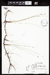
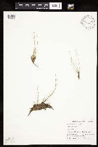
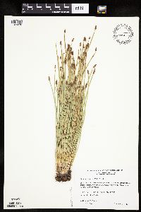
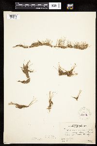
MIN:Plants | Eleocharis ovata (Roth) Roemer & Schultes 915053[1020579]Smith, Welby; et al. 314122009-08-28 United States, Minnesota, Cook, Boundary Waters Canoe Area Wilderness / Superior National Forest. Cook County...Boundary Waters Canoe Area Wilderness, Superior National Forest...unnamed lake/pond between Wanihigan and Mulligan Lakes...T 63N R 3W NW1/4 of SE1/4 of Sec 1. 063N 03W 1, 47.9655556 -90.6427778 |
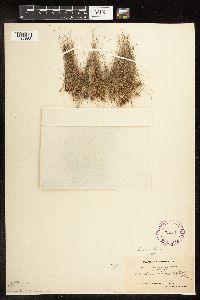
MIN:Plants | Eleocharis compressa Sullivant 499028[1019996]Lee, Michael MDL30392001-07-13 United States, Minnesota, Cook, Cook County ... Between Hwy 61 and the Lake Superior shoreline, one mile southwest of Schroeder. Just northeast of mining company property at Taconite Harbor ... T58N R5W SE1/4 of NE1/4 of SW1/4 Sec.1. 058N 05W 1, 47.538322 -90.907999 |
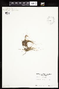
MIN:Plants | Eleocharis elliptica Kunth 431799[1020051]Carlson, Bruce 011662001-09-06 United States, Minnesota, Itasca, Itasca County...11.4 miles WNW of Bear River, 0.1 miles east of MN Hwy 1...T061N R23W NWSE06;George Washington State Forest;061N;23W;06, 47.800543 -93.328288 |
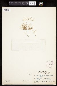
MIN:Plants | Eleocharis palustris (L.) Roemer & Schultes 478209[1020663]Myhre, K. 65361996-08-08 United States, Minnesota, Crow Wing, Crow Wing County ... Located 10 miles north of Brainerd. Plants occur along the shores of Guida Lake ... T 135N R 28W SE1/4 of SW1/4 of Sec 16. 135N 28W 16, 46.508086 -94.214113 |
MIN:Plants | Eleocharis elliptica Kunth 439033[1020041]Gerdes, Lynden 49192004-08-16 United States, Minnesota, Lake, Superior National Forest. T61N R09W S25NWNEN. Lake County...Superior National Forest. Approximately 9.23 miles NW of Isabella, MN and 1.5 miles SW down the Tomahawk Road (FR 377) from its junction with the Northwest Road (FR 373). Pond on N side of FR 377.. 061N 09W 25, 47.737043 -91.415884 |
MIN:Plants | Eleocharis compressa var. compressa Sullivant 482629[1020013]Harris, Fred 990281999-05-30 United States, Minnesota, Scott, Scott County ... Carver Rapids Wayside, Minn. Valley State Recreation Area ... T115N R23W SE1/4 of NE1/4 of NW1/4 Sec 32;Minnesota Valley State Park;115N;23W;32, 44.725535 -93.612653 |
MIN:Plants | Eleocharis palustris (L.) Roemer & Schultes 478113[1020682]Lee, Michael MDL23531998-08-06 United States, Minnesota, Stearns, Stearns County ... Two miles northwest of Rockville ... T123N R29W SW1/4 of SE1/4 Sec. 6;;123N;29W;6, 45.493235 -94.374426 |
MIN:Plants | Eleocharis ovata (Roth) Roemer & Schultes 901010[1020528]Lee, Michael MDL4162A2005-09-08 United States, Minnesota, Benton, BENTON COUNTY ... Graham's Island in the Mississippi River at the State Hwy 15 bridge in Sartell/Sauk Rapids ...T36N R31W NE1/4 of SE1/4 of NW1/4 Sec.22 (small, irregular section) also SE1/4 of NE1/4 of NW1/4 Sec.22. 036N 31W 22, 45.598931 -94.181749 |
MIN:Plants | Eleocharis wolfii (A. Gray) A. Gray ex Britton 509201[1102789]Wheeler, Gerald; et al. United States, Minnesota, Scott, Detailed locality information protected. This is typically done to protect rare or threatened species localities. |
MIN:Plants | Eleocharis palustris (L.) Roemer & Schultes 499318[1020717]Budelsky, R. RAB5411998-07-16 United States, Minnesota, Washington, Washington Co, T30N R21W S22;;030N;21W;22, 45.072217 -92.913898 |
MIN:Plants | Eleocharis acicularis (Leiberg, J.B.) 438163[1019784]Carlson, Bruce Wypt 7992005-08-24 United States, Minnesota, Saint Louis, St. Louis County ... 4.4km east of Hoyt Lakes, 7.5km NW of Skibo, 0.8km NNE of the Allen Junction bridge...Partridge River ... T58N R14W SWSW 11. 058N 14W 11, 47.525163 -92.081885 |
MIN:Plants | Eleocharis suksdorfiana Beauverd 83764[1020827]Nelson, Aven; et al. 61591899-07-26 United States, Wyoming, Park, Yellowstone National Park...Sylvan Geysers;Yellowstone National Park |
MIN:Plants | Eleocharis ovata (Roth) Roemer & Schultes 917095[1020526]Gerdes, Lynden; et al. 59212009-09-10 United States, Minnesota, Cook, Boundary Waters Canoe Area Wilderness / Superior National Forest. T65N R03E S33 NENW Cook County ... Superior National Forest. Boundary Waters Canoe Area Wilderness. At northern end of inlet channel at the NW corner John Lake, ~0.21 miles north of lake ... NAD 83 / 718338 / 5329056. 065N 03E 33, 48.0772222 -90.0686111 |
MIN:Plants | Eleocharis palustris (L.) Roemer & Schultes 909834[1020623]Lee, Michael; et al. MDL44022007-06-21 United States, Minnesota, Becker, Becker County...along the Toad River nine miles northeast of Frazee...east side of the river...T138N R38W SE1/4 of SE1/4 of NW1/4 Sec. 7...UTM: 5184124N 306688E. 138N 38W 7, 46.781797 -95.531076 |
MIN:Plants | Eleocharis nitida Fernald 499706[1020365]Gerdes, Lynden United States, Minnesota, Lake, Detailed locality information protected. This is typically done to protect rare or threatened species localities. |
MIN:Plants | Eleocharis obtusa (Willdenow) Schultes 234330[1020456]Congdon, J. s.n.1890-08-15 United States, California, Mariposa, Yosemite Valley, Mariposa County;Yosemite National Park |
MIN:Plants | Eleocharis macrostachya Britton 543203[1020316]Lakela, Olga 218331957-08-04 United States, Minnesota, Saint Louis, small lake southeast of Gilbert, St. Louis Co.;;058N;17W;, 47.502874 -92.49693 |
MIN:Plants | Eleocharis palustris (L.) Roemer & Schultes 454436[1020680]Lee, Michael MDL28692000-07-28 United States, Minnesota, Lake, North Shore. Lake County ... Along the shore of Lake Superior on the southwest edge of the city limits of Beaer Bay ... T55N R8W NE1/4 of SE1/4 of NE1/4 Sec. 14. 055N 08W 14, 47.250955 -91.316943 |
MIN:Plants | Eleocharis ovata (Roth) Roemer & Schultes 910589[1020527]Lee, Michael MDL45582007-09-07 United States, Minnesota, Wadena, Lyons State Forest. Wadena County...one mile northwest of Knob Hill- Crow Wing River campground, 3.5 miles south-southwest of Oylen... ~40-acre lake...T135N R33W SW1/4 of NW1/4 Sec. 3, SE1/4 of NW1/4 Sec. 3...UTM: 5155324N 358845E. 135N 33W 3, 46.499962 -94.807535 |
MIN:Plants | Eleocharis tenuis var. verrucosa (Svenson) Svenson 492445[1020828]Capistrant, A. AMC14921998-08-05 United States, Minnesota, Carver, [no further data];;116N;23W;16, 44.855973 -93.592079 |
MIN:Plants | Eleocharis compressa var. compressa Sullivant 476864[1020017]Wheeler, Gerald 162951997-06-27 United States, Minnesota, Redwood, Redwood County ... Ca. 3.9 mi. N of Belview on Rte. 7, E of road ... N12 NW1/4 Sec. 20 T114N R37W (Swedes Forest 20);;114N;37W;20, 44.664942 -95.329922 |
MIN:Plants | Eleocharis acicularis (Leiberg, J.B.) 454520[1019908]Lee, Michael MDL13371996-07-02 United States, Iowa, Allamakee, Upper Mississippi National Wildlife Refuge. Allamakee County ... Upper Mississippi National Wildlife & Fish Refuge. New Albin Public Boat Landing ... at edge of parking lot along Mississippi River backwater channel 2 miles east of New Albin ... T100N R3W SW1/4 Sec. 7. 100N 03W 7 |
MIN:Plants | Eleocharis quinqueflora (Hartmann) O. Schwarz 436796[1020783]Aaseng, N. United States, Minnesota, Roseau, Detailed locality information protected. This is typically done to protect rare or threatened species localities. |
MIN:Plants | Eleocharis quinqueflora (Hartmann) O. Schwarz 906187[1020781]Aaseng, N. United States, Minnesota, Roseau, Detailed locality information protected. This is typically done to protect rare or threatened species localities. |
MIN:Plants | Eleocharis palustris (L.) Roemer & Schultes 505390[1020716]Capistrant, A. AMC0571998-07-02 United States, Minnesota, Nicollet, T110N R27W S19;Swan-Oshawa Wildlife Management Area;110N;27W;19, 44.319339 -94.120035 |
MIN:Plants | Eleocharis ovata (Roth) Roemer & Schultes 438814[1020558]Gerdes, Lynden 50622005-08-09 United States, Minnesota, Saint Louis, Superior National Forest. T60N R12W S25C-NWSW St. Louis County ... Superior National Forest. SE of Babbitt...Small unamed pond, approximately 2.89 miles south down FR 112 from its junction with FR 424. East side of FR 112.. 060N 12W 25, 47.651272 -91.805106 |
MIN:Plants | Eleocharis NULL 486767[]Churchill, J. s.n.1901-07-24 Canada, Prince Edward Island, Tracadie Beach, Prince Edward Island |
MIN:Plants | Eleocharis palustris (L.) Roemer & Schultes 461734[1020684]Mensing, D. 96-2681996-07-17 United States, Minnesota, Carlton, Carlton Co, T48N R18W SE1/4 of the SW1/4 of S20; Park Lake.;;048N;18W;20, 46.628015 -92.649915 |
MIN:Plants | Eleocharis obtusa (Willdenow) Schultes 478505[]Wheeler, Gerald 175521997-09-01 United States, Minnesota, Renville, Renville County ... W side of Morton, Morton Outcrop complex ... SW1/4 NW1/4 NW1/4 Sec. 31 T113N R34W (Birch Cooley 31);;113N;34W;31, 44.543269 -94.990327 |
MIN:Plants | Eleocharis erythropoda Steudel 699679[1020249]Ziegler, S.; et al. 15931975-07-07 United States, Wisconsin, Vernon, Vernon Co.; Island 1; Mississippi River-mile #685; T14N R7W Sec 32 ... Small island W side of main channel;Upper Mississippi National Wildlife Refuge;014N;07W;32, 192m |
MIN:Plants | Eleocharis erythropoda Steudel 477332[1020080]Smith, Welby 206941992-07-08 United States, Minnesota, Goodhue, Dorer Memorial Hardwood State Forest. Goodhue County ... About 3 miles west of Red Wing ... bluff in the Cannon River Valley ... T 113N R 15W SW1/4 of SE1/4 of Sec 21. 113N 15W 21, 44.5738907 -92.6194458 |
MIN:Plants | Eleocharis ovata (Roth) Roemer & Schultes 438794[1020554]Gerdes, Lynden 50582005-08-04 United States, Minnesota, Saint Louis, Superior National Forest. T60N R12W S15NESWNE St. Louis County ... Superior National Forest. SE of Babbit ... Approximately 0.06 mile south down FR 112 from its junction with FR 424. East side of FR 112. 060N 12W 15, 47.679999 -91.84956 |
MIN:Plants | Eleocharis palustris (L.) Roemer & Schultes 477788[1020674]Lee, Michael MDL22201998-07-02 United States, Minnesota, Stearns, Stearns County ... On west side of County Road 10 one mile north of Roscoe ... slope forming the bank of ancient river channel ... T123N R32W S1/2 of NE1/4 of SE1/4 Sec. 24. 123n 32W 24, 45.448285 -94.650389 |
MIN:Plants | Eleocharis intermedia Schultes 438338[1020294]Whitfeld, T.J.S. 6522005-08-16 United States, Minnesota, Clearwater, Clearwater County...On canoe launch, Ponsford Landing on east side of Lower Rice Lake...T145N R38W NESE35;White Earth Indian Reservation;145N;38W;35, 47.332524 -95.456278 |
MIN:Plants | Eleocharis erythropoda Steudel 913607[1020101]Smith, Welby 230171993-07-21 United States, Minnesota, Meeker, Meeker County... At the north end of Little Swan Lake, about 3 miles north of Dassel... T119N R29W SW1/4 of NW1/4 of Sec 11. 119N 29W 11, 45.1344444 -94.2919444 |
MIN:Plants | Eleocharis flavescens var. olivacea (Torrey) Gleason 438960[1020264]Myhre, K. United States, Minnesota, Becker, Detailed locality information protected. This is typically done to protect rare or threatened species localities. |
MIN:Plants | Eleocharis erythropoda Steudel 490592[1020102]Smith, Welby 155731989-07-04 United States, Minnesota, Freeborn, Halls Lake Wildlife Management Area. Freeborn County...Halls Lake National Waterfowl Production Area, about 3.5 miles northeast of Alden...NW1/4 NE1/4 section 30, T103N R22W.. 103N 22W 30, 43.7008324 -93.5222244 |
MIN:Plants | Eleocharis acicularis (Leiberg, J.B.) 681044[1019907]Swanson, Steven 3271975-06-10 United States, Wisconsin, La Crosse, Mississippi River (Navigation Pool #8) ... La Crosse Co, Site 1 ... [between] rip-rap bank and ... backwater pool;Upper Mississippi National Wildlife Refuge |
MIN:Plants | Eleocharis erythropoda Steudel 477626[1020093]Smith, Welby 171041990-06-28 United States, Minnesota, Waseca, Waseca County ... At the north end of Buffalo Lake, about 3 miles south of Janesville ... T107N R24W NE1/4 of NE1/4 of Sec 20. 107N 24W 20, 44.065834 -93.7300034 |
MIN:Plants | Eleocharis wolfii (A. Gray) A. Gray ex Britton 897404[1020836]McKenzie, Paul United States, Minnesota, Rock, Detailed locality information protected. This is typically done to protect rare or threatened species localities. |
MIN:Plants | Eleocharis elliptica Kunth 917125[1020038]Gerdes, Lynden; et al. 58472009-07-29 United States, Minnesota, Cook, Boundary Waters Canoe Area Wilderness / Superior National Forest. T65N R05W S36SESW. Cook County, MN. Superior National Forest. Boundary Waters Canoe Area Wilderness. Bat Lake. Small island near southern shore of lake; along the SSE-facing shores of island...NAD 83 / 655652 / 5325595. 065N 05W 36, 48.0647222 -90.9147222 |
MIN:Plants | Eleocharis obtusa (Willdenow) Schultes 491073[1020420]Capistrant, A. AMC14951998-08-05 United States, Minnesota, Carver, [no further data];;116N;23W;16, 44.855973 -93.592079 |
MIN:Plants | Eleocharis compressa Sullivant 552982[1019975]Tester, John s.n.1958-07-02 United States, Minnesota, Mahnomen, Mahnomen County...Waubun Prairie. 3-4 miles W. and 1 mile S. of Waubun. Sec. 33, T. 143N, R. 42W.;Waubun Prairie Wildlife Management Area / White Earth Indian Reservation;143N;42W;33, 47.158904 -96.00743 |
MIN:Plants | Eleocharis intermedia Schultes 908469[1020278]Lee, Michael MDL43412006-09-13 United States, Minnesota, Becker, Becker County...Along the Otter Tail River at Frazee...immediately downstream from the State Higheay 87 bridge... T138N R40W SE1/4 of SW1/4 of SE1/4 Sec. 26 (&NE1/4 of NW!/4 of NE1/4 Sec. 35?). 138N 40W 0, 46.759572 -95.731921 |
MIN:Plants | Eleocharis ovata (Roth) Roemer & Schultes 681223[1020585]Swanson, Steven 24571975-10-03 United States, Wisconsin, La Crosse, Mississippi River (Navigation Pool #8) ... La Crosse Co, Site 17, inlet off a side channel;Upper Mississippi National Wildlife Refuge |
MIN:Plants | Eleocharis palustris (L.) Roemer & Schultes 233784[1020766]Congdon, J. s.n.1885-06-29 United States, California, Mariposa, Big Tree Grove, Mariposa County;Yosemite National Park |
MIN:Plants | Eleocharis palustris (L.) Roemer & Schultes 920296[1020622]Smith, Welby 257351995-07-09 United States, Minnesota, Isanti, Isanti County ... At Mud Lake, in Crooked Road State Wildlife Management Area ... T35N R25W NW1/4 of NE1/4 of Sec 33;Crooked Road Wildlife Management Area;035N;25W;33, 45.485 -93.4575 |
MIN:Plants | Eleocharis quinqueflora (Hartmann) O. Schwarz 234047[1020803]Congdon, J. United States, California, Tuolumne, Detailed locality information protected. This is typically done to protect rare or threatened species localities. |
MIN:Plants | Eleocharis erythropoda Steudel 680908[1020254]Swanson, Steven 4351975-06-12 United States, Wisconsin, La Crosse, Mississippi River (Navigation Pool #8) ... La Crosse Co, Site 7, area on S edge of I-90 levee.;Upper Mississippi National Wildlife Refuge |
MIN:Plants | Eleocharis bolanderi A. Gray 234337[1019914]Congdon, J. s.n.1897-06-06 United States, California, Mariposa, Yosemite Valley, Mariposa County;Yosemite National Park |
MIN:Plants | Eleocharis palustris (L.) Roemer & Schultes 453573[1020660]Gerdes, Lynden; et al. 26411998-06-08 United States, Minnesota, Cook, T65N R02W S29SWNW. Cook County; Superior National Forest, BWCAW. At the NE end of Crab Lake.;Boundary Waters Canoe Area Wilderness / Superior National Forest;065N;02W;29, 48.084718 -90.609098 |
MIN:Plants | Eleocharis elliptica Kunth 438806[1020044]Gerdes, Lynden 50512005-07-28 United States, Minnesota, Lake, Superior National Forest. T61N R09W S25NENEN Lake County ... Superior National Forest. NW of Isabella ... and 1.5 miles SW down the Tomahawk Road (FR 377) from its junction with the Northwest Road (FR 373). Pond on N side of FR 377.. 061N 09W 25, 47.737043 -91.415884 |
MIN:Plants | Eleocharis acicularis (Leiberg, J.B.) 499048[1019900]Capistrant, A. AMC11211998-06-26 United States, Minnesota, Washington, Washington Co.;;030N;21W;22, 45.072217 -92.913898 |
MIN:Plants | Eleocharis macrostachya Britton 444084[1102650]Bright, R. 73-2441973-00-00 United States, Idaho, Franklin, [no further data] |
MIN:Plants | Eleocharis quinqueflora (Hartmann) O. Schwarz 499011[1020784]Gerdes, Lynden United States, Minnesota, Lake, Detailed locality information protected. This is typically done to protect rare or threatened species localities. |
MIN:Plants | Eleocharis obtusa (Willdenow) Schultes 478502[1020370]Wheeler, Gerald 172731997-08-16 United States, Minnesota, Yellow Medicine, Yellow Medicine County ... Ca. 1.5 NW of Granite Falls; E of Rte. 212 ... NE1/4 SW1/4 SE1/4 Sec. 29 T116N R39W;;116N;39W;29, 44.826175 -95.575365 |
MIN:Plants | Eleocharis ovata (Roth) Roemer & Schultes 221982[1020587]Rosendahl, C. 4141a1921-08-31 United States, Wisconsin, Saint Croix, St. Croix River about 2-1/2 miles N. of Stillwater, St. Croix County;Saint Croix National Riverway;;;, 45.093688 -92.758563 |
MIN:Plants | Eleocharis palustris (L.) Roemer & Schultes 499521[1020616]Juhnke, C. 098 CMJ FRO2000-08-29 United States, Minnesota, Goodhue, Frontenac State Park. Frontenac State Park Goodhue County ... Along Well's Creek 10 meters from confluence with Mississippi River south of Sand Point ... T112N R13W SE NW NE 13. 112N 13W 13, 44.505359 -92.319092 |
MIN:Plants | Eleocharis acicularis (Leiberg, J.B.) 915085[1019823]Smith, Welby; et al. 314062009-08-28 United States, Minnesota, Cook, Boundary Waters Canoe Area Wilderness / Superior National Forest. Cook County...Boundary Waters Canoe Area Wilderness, Superior National Forest...unnamed lake/pond between Wanihigan and Mulligan Lakes...T 63N R 3W NW1/4 of SE1/4 of Sec 1. 063N 03W 1, 47.9655556 -90.6427778 |
MIN:Plants | Eleocharis ovata (Roth) Roemer & Schultes 462422[1020516]Lee, Michael MDL31132001-08-30 United States, Minnesota, Lake, Crosby Manitou State Park / North Shore. Lake County ... George H. Crosby-Manitou State Park ... Along the Manitou River between the County Road 7 bridge and The Cascades (first waterfall downstream the bridge) ... T58N R6W NE1/4 of NE1/4 Sec.20. 058N 06W 20, 47.49856 -91.111035 |
MIN:Plants | Eleocharis ovata (Roth) Roemer & Schultes 480808[1020521]Husveth, J. 96-1831996-07-02 United States, Minnesota, Wright, Wright Co, T120N R25W SE1/4 of the NW1/4 of S25;M Schmidt Crawford Woods Scientific Natural Area;120N;25W;25, 45.172755 -93.775987 |
MIN:Plants | Eleocharis intermedia Schultes 900996[1020277]Lee, Michael MDL41622005-09-08 United States, Minnesota, Benton, BENTON COUNTY ... Graham's Island in the Mississippi River at the State Hwy 15 bridge in Sartell/Sauk Rapids ...T36N R31W NE1/4 of SE1/4 of NW1/4 Sec.22 (small, irregular section) also SE1/4 of NE1/4 of NW1/4 Sec.22. 036N 31W 22, 45.598931 -94.181749 |
MIN:Plants | Eleocharis acicularis (Leiberg, J.B.) 905448[1019750]Gerdes, Lynden 48162003-08-07 United States, Minnesota, Lake, Superior National Forest. T60N R06W S16SENW. Lake County...Superior National Forest. Approx. 12.87 miles ENE of Isabella, MN and 0.55 mile NW of Wilson Lake. Northeastern bay of large wetland-drainage.. 060N 06W 16, 47.68095 -91.097607 |
MIN:Plants | Eleocharis occulta S.G. Smith 335331[1020458]Demaree, Delzie 122501936-04-19 United States, Oklahoma, Murray, Platt National Park. Murray Co, Sulphur;Platt National Park |
MIN:Plants | Eleocharis palustris (L.) Roemer & Schultes 913924[1020627]Lee, Michael MDL40062005-06-30 United States, Minnesota, Todd, Grey Eagle Wildlife Management Area. Todd County...Grey Eagle State Wildlife Management Area...Bunker Lake, four miles west-southwest of the town of Grey Eagle...T127N R33W NW1/4 of NE1/4 Sec. 16. 127N 33W 16, 45.810621 -94.839552 |
MIN:Plants | Eleocharis nitida Fernald 897408[1020352]Greenlee, Jack United States, Minnesota, Lake, Detailed locality information protected. This is typically done to protect rare or threatened species localities. |
MIN:Plants | Eleocharis nitida Fernald 914844[1020348]Walton, G. United States, Minnesota, Saint Louis, Detailed locality information protected. This is typically done to protect rare or threatened species localities. |
MIN:Plants | Eleocharis compressa var. compressa Sullivant 477677[1020015]Whitfeld, T.J.S.; Harris, Fred 2242001-06-05 United States, Minnesota, Kandiyohi, Regal Meadow, The Nature Conservancy. Kandiyohi County ... Regal Meadow Nature Preserve. 2 miles southeast of Regal, 2 miles north of Hawick, 1/2 mile west of 160 St. NE ... T 122N R 33W SE1/4 of NW1/4 of NE1/4 of Section 16. 122N 33W 16, 45.376922 -94.835116 |
MIN:Plants | Eleocharis compressa Sullivant 453773[1019965]Schik, K. 96-161996-06-05 United States, Minnesota, Polk, Polk Co, T148N R45W SW1/4 of the SE1/4 of S14; at Burnham Wildlife Management Area.;Burnham Wildlife Management Area;148N;45W;14, 47.637433 -96.355778 |
MIN:Plants | Eleocharis palustris (L.) Roemer & Schultes 234336[1020768]Congdon, J. s.n.1890-05-00 United States, California, Mariposa, Aqua Fria Canyon, Mariposa County;Yosemite National Park |
MIN:Plants | Eleocharis elliptica Kunth 921193[1020037]Lee, Michael MDL34452003-07-10 United States, Minnesota, Todd, Three miles east of Rose City, seven miles south-southwest of Eagle Bend; wetland complex forming headwaters of Dismal anc Eagle creeks. E1/2 of NE1/4 of NW1/4 of section;Burleene WMA;130N;35W;16, 46.070804 -95.094254 |
MIN:Plants | Eleocharis palustris (L.) Roemer & Schultes 482466[1020763]Lee, Michael MDL13381996-07-02 United States, Iowa, Allamakee, Upper Mississippi National Wildlife Refuge. Allamakee County ... Upper Mississippi National Wildlife & Fish Refuge. New Albin Public Boat Landing ... parking lot along Mississippi River backwater channel 2 miles east of New Albin. |
MIN:Plants | Eleocharis acicularis (Leiberg, J.B.) 699595[1019905]Ziegler, S.; et al. 13211975-06-19 United States, Wisconsin, La Crosse, LaCrosse Co.; Island 21; Mississippi River-mile #695; T15N R7W Sec 17 ... narrow island E side of main channel ... S end;Upper Mississippi National Wildlife Refuge;15N;07W;17, 193m |
MIN:Plants | Eleocharis acicularis (Leiberg, J.B.) 439342[1102528]Smith, Welby 143221988-06-24 United States, Minnesota, Kanabec, At the NW end of Pomroy Lake, about 6 mi N of Quamba. NE1/4 SW1/4 of section;;041N;23W;24, 46.0155556 -93.1944444 |
MIN:Plants | Eleocharis obtusa (Willdenow) Schultes 439351[1020450]Smith, Welby 143231988-06-24 United States, Minnesota, Kanabec, Kanabek [sic] County ... At the NW end of Pomroy Lake, about 6 mi N of Quamba ... NE1/4 SW1/4 sec.24, T41N R23W;;041N;23W;24, 46.0155563 -93.1944427 |
MIN:Plants | Eleocharis palustris (L.) Roemer & Schultes 820351[1020619]Monson, Paul 46341964-08-23 United States, Minnesota, Mahnomen, Mahnomen-Becker Co. line, R-40W T-143N S-32. White Earth River near bridge crossing outlet from White Earth Lake.;White Earth Indian Reservation / White Earth State Forest;143N;40W;32, 47.157692 -95.773685 |
MIN:Plants | Eleocharis engelmannii Steudel 413139[1020076]Moore, John; Moore, Marjorie 105511938-09-15 United States, Minnesota, Pipestone, 1/2 mi. north of Pipestone. Pipestone County;;106N;46W;, 43.979723 -96.367859 |
MIN:Plants | Eleocharis engelmannii Steudel 448434[1020074]Moore, John; Hall, Robert 163941944-06-10 United States, Minnesota, Pipestone, Pipestone County ... Pipestone quarry.;Pipestone National Monument;106N;46W;, 43.979723 -96.367859 |
MIN:Plants | Eleocharis engelmannii Steudel 488557[1020073]Moore, John; Huff, N. 197811947-08-27 United States, Minnesota, Nicollet, Nicollet County ... 3-4 miles west of Courtland;;110N;30W;, 44.326359 -94.431802 |
MIN:Plants | Eleocharis engelmannii Steudel 542616[1020069]Moore, John 218481954-07-20 United States, Minnesota, Wilkin, Wilkin County ... 3-1/2 miles south west of Campbell.;;130N;45W;, 46.065081 -96.327433 |
MIN:Plants | Eleocharis engelmannii Steudel 558146[1020072]Stevens, O. 21611959-08-10 United States, Minnesota, Clay, Kragnes (Clay Co.0;;141N;48W;, 47.020558 -96.75325 |
MIN:Plants | Eleocharis engelmannii Steudel 707910[1020066]Smith, Welby 12291979-08-02 United States, Minnesota, Redwood, Redwood County ... T112N R34W; NW1/4 SE1/4 sec 14. 6.5 mi N-NE of Morgan, S of Wabasha Creek and N of county highway 10;;112N;34W;14, 44.506793 -94.895945 |
MIN:Plants | Eleocharis engelmannii Steudel 709623[1020068]Wheeler, Gerald 46241979-08-02 United States, Minnesota, Redwood, Redwood County ... Approx. 6.5 mi. N-NE of Morgan. About 1/16 to 1/8 mi. W of Route 11 ... T112N R34W Sec.14;;112N;34W;14, 44.506793 -94.895945 |
MIN:Plants | Eleocharis engelmannii Steudel 743637[1020067]Nietering, E. 1471982-07-07 United States, Minnesota, Redwood, Redwood County ... NW1/4 NW1/4 sec. 18, R 37W, T 114N. N of Belview;;114N;37W;18, 44.679529 -95.35007 |
MIN:Plants | Eleocharis engelmannii Steudel 743658[1020064]Nietering, E. 1651982-07-12 United States, Minnesota, Renville, Renville County ... NW1/4 NW1/4 Sec. 31, R 34W, T 113N. Morton Outcrop, Morton;;113N;34W;31, 44.543269 -94.990327 |
MIN:Plants | Eleocharis engelmannii Steudel 743664[1020063]Nietering, E. 1431982-06-30 United States, Minnesota, Yellow Medicine, Yellow Medicine County ... NE1/4 NE1/4 sec. 13 R 38 W, T 114 N. N of Belview;Swedes Forest Scientific Natural Area;114N;38W;13, 44.679767 -95.370594 |
MIN:Plants | Eleocharis engelmannii Steudel 744741[1020075]Converse, C. 20411982-08-12 United States, Minnesota, Chippewa, Chippewa and Swift Counties ... SW1/4 NE1/4 Sec. 13. Chippewa Prairie: T119N R43W;Chippewa Prairie, The Nature Conservancy;119N;43W;13, 45.110235 -95.996766 |
MIN:Plants | Eleocharis engelmannii Steudel 746067[1020065]Smith, Welby 50821981-07-27 United States, Minnesota, Big Stone, Big Stone County ... Minnesota Valley, about 3 miles southeast of Ortonville. NE1/4 NE1/4 section 27, T 121N R 46W;Big Stone National Wildlife Refuge;121N;46W;27, 45.260809 -96.423244 |
MIN:Plants | Eleocharis engelmannii Steudel 81807[1020071]Rosendahl, C.; et al. s.n.1917-09-09 United States, Minnesota, Anoka, Moore Lake, Anoka County;;030N;24W;, 45.080985 -93.255535 |
MIN:Plants | Eleocharis engelmannii Steudel 81815[1020070]Moyer, Lycurgus 584-1/21907-08-25 United States, Minnesota, Chippewa, David Boene's [place], Montevideo.;;117N;40W;, 44.934626 -95.675774 |
MIN:Plants | Eleocharis acicularis (Leiberg, J.B.) 221989[1019856]Rosendahl, C.; Butters, F. 41291921-08-31 United States, Minnesota, Anoka, Linwood Lake, NE Anoka Co.;;033N;22W;, 45.340658 -93.081463 |
MIN:Plants | Eleocharis acicularis (Leiberg, J.B.) 264467[1102553]Holzinger, John s.n.1897-00-00 United States, Minnesota, Winona, Winona Co.;;N;;, 43.934526 -91.690349 |
MIN:Plants | Eleocharis acicularis (Leiberg, J.B.) 270853[1019846]Sanford, J. s.n.1948-08-06 United States, Minnesota, Clearwater, Itasca State Park, Squaw Lake;Itasca State Park;143N;36W;, 47.19557 -95.233216 |
MIN:Plants | Eleocharis acicularis (Leiberg, J.B.) 275908[1019796]Grant, Martin 32671929-09-06 United States, Minnesota, Becker, Itasca Park. Becker Co. De Soto Lake; NE-NW-3 T142 R36;Itasca State Park;142N;36W;3, 47.145259 -95.222785 |
MIN:Plants | Eleocharis acicularis (Leiberg, J.B.) 276693[1019802]Fassett, N.; Hotchkiss, N. 30801926-08-23 United States, Minnesota, Wabasha, Half Moon Lake, Weaver.;Dorer Memorial Hardwood State Forest;109N;09W;, 44.233108 -91.917245 |
MIN:Plants | Eleocharis acicularis (Leiberg, J.B.) 277636[1019888]Hotchkiss, N.; et al. 3611930-08-05 United States, Minnesota, Chippewa, Shakopee Lake, Louriston Twp. Chippewa Co.;;119N;38W;, 45.108611 -95.430859 |
MIN:Plants | Eleocharis acicularis (Leiberg, J.B.) 284546[1019805]Cooper, William H.K.S.1930-08-08 United States, Minnesota, Saint Louis, Sturgeon Lake;;N;;, 47.68053 -93.04956 |
MIN:Plants | Eleocharis acicularis (Leiberg, J.B.) 306686[1019780]Oosting, H. 291001929-08-27 United States, Minnesota, Anoka, Ham Lake.;;032N;23W;, 45.254503 -93.203833 |
MIN:Plants | Eleocharis acicularis (Leiberg, J.B.) 306823[1019895]Moyle, J. 24501935-09-17 United States, Minnesota, Anoka, Moore Lake;;030N;24W;, 45.080985 -93.255535 |
MIN:Plants | Eleocharis acicularis (Leiberg, J.B.) 307091[1019834]Oosting, H. 29271929-08-04 United States, Minnesota, Scott, Prior Lake;;N;;, 44.713297 -93.422727 |
Google Map
Google Maps is a web mapping service provided by Google that features a map that users can pan (by dragging the mouse) and zoom (by using the mouse wheel). Collection points are displayed as colored markers that when clicked on, displays the full information for that collection. When multiple species are queried (separated by semi-colons), different colored markers denote each individual species.
