University of Minnesota
http://www.umn.edu/
612-625-5000
http://www.umn.edu/
612-625-5000
Minnesota Biodiversity Atlas
Bell Museum
Dataset: MIN-Plants
Taxa: Eleocharis
Search Criteria: excluding cultivated/captive occurrences
Bell Museum plants | |
 MIN:Plants | 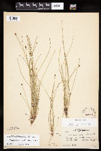 Eleocharis ovata (Roth) Roemer & Schultes 222011[1020538]Rosendahl, C. 54101927-08-26 United States, Minnesota, Anoka, N of Bunker Lake.;Bunker Hills County Park;032N;24W;, 45.218819 -93.275736 |
MIN:Plants | 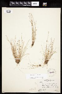 Eleocharis ovata (Roth) Roemer & Schultes 222030[1020546]Rosendahl, C.; Butters, F. 50961926-08-03 United States, Minnesota, Anoka, Shores of Moore Lake.;;030N;24W;, 45.080985 -93.255535 |
MIN:Plants | 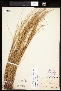 Eleocharis erythropoda Steudel 264490[1020247]Holzinger, John s.n.1897-07-00 United States, Minnesota, Winona, [no further data].;;;;, 43.934526 -91.690349 |
MIN:Plants | 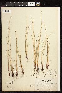 Eleocharis erythropoda Steudel 271185[1102592]Rosendahl, C.; Butters, F. 28611915-06-11 United States, Minnesota, Anoka, Southern Anoka County.;;;;, 45.275799 -93.238627 |
MIN:Plants | 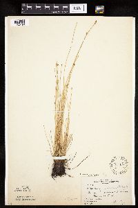 Eleocharis erythropoda Steudel 271187[1020190]Rosendahl, C.; et al. 40201921-06-17 United States, Minnesota, Yellow Medicine, Granite Falls.;;116N;39W;, 44.809958 -95.545575 |
MIN:Plants | 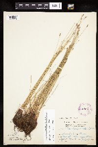 Eleocharis erythropoda Steudel 275907[1020118]Grant, Martin 28611929-07-19 United States, Minnesota, Clearwater, Itasca State Park ... County: Clearwater. Loc.: Mississippi River. Sec. SESE35 T. 144 R. 36;Itasca State Park;144N;36W;35, 47.246503 -95.201577 |
MIN:Plants | 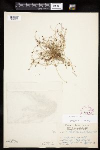 Eleocharis ovata (Roth) Roemer & Schultes 275909[1020499]Grant, Martin 32501929-09-04 United States, Minnesota, Clearwater, Itasca State Park. Lake Bohall.;Itasca State Park;143N;36W;9, 47.217133 -95.244473 |
MIN:Plants |  Eleocharis ovata (Roth) Roemer & Schultes 281890[1020537]Cooper, William s.n.1930-10-12 United States, Minnesota, Anoka, Margin of a pond, near Coon Lake.;;N;;, 45.340658 -93.081463 |
MIN:Plants | 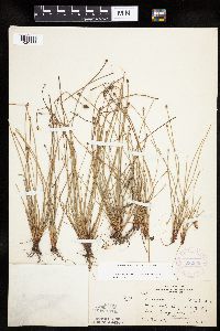 Eleocharis obtusa (Willdenow) Schultes 282056[1020383]Rosendahl, C. 61601929-10-18 United States, Minnesota, Chisago, Big Lake, Chisago County, Lindstrom [no lake by this name];;;;, 45.389408 -92.847992 |
MIN:Plants | 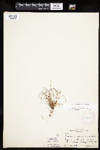 Eleocharis obtusa (Willdenow) Schultes 282071[1020410]Rosendahl, C. 61561929-10-18 United States, Minnesota, Washington, 4-1/2 miles west of Marine, Washington County;;031N;20W;, 45.166786 -92.835908 |
MIN:Plants | 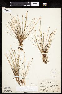 Eleocharis obtusa (Willdenow) Schultes 282389[1020432]Rosendahl, C. 61291929-09-17 United States, Minnesota, Washington, Big Marine Lake, Washington County;;032N;20W;, 45.253127 -92.835368 |
MIN:Plants | 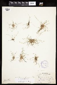 Eleocharis ovata (Roth) Roemer & Schultes 306816[1020574]Moyle, J. 25281935-09-23 United States, Minnesota, Saint Louis, Dark Horse Creek.;;N;;, 47.5833 -92.5 |
MIN:Plants | 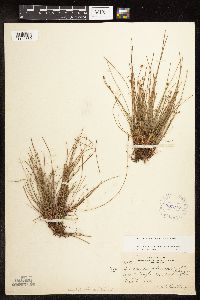 Eleocharis obtusa (Willdenow) Schultes 307247[1102669]Oosting, H. 291991929-10-11 United States, Minnesota, Washington, N. Washington County;;;;, 45.020589 -92.89 |
MIN:Plants | 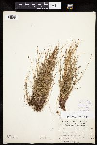 Eleocharis ovata (Roth) Roemer & Schultes 307320[1020495]Grant, Martin 67681935-09-05 United States, Minnesota, Becker, Itasca Park; SE-SE-2 T142 R36;Itasca State Park;142N;36W;2, 47.145291 -95.20136 |
MIN:Plants | 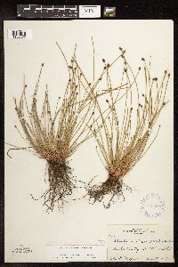 Eleocharis obtusa (Willdenow) Schultes 333662[1102670]Cooper, William 891927-08-24 United States, Minnesota, Anoka, Anoka County [highway] 29;;;;, 45.275799 -93.238627 |
MIN:Plants | 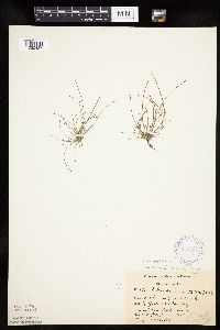 Eleocharis ovata (Roth) Roemer & Schultes 336535[1020487]Reif, Charles; Moyle, J. A231936-07-14 United States, Minnesota, Cook, Mark Creek. Cook Co.;;N;;, 47.79263 -90.5564 |
MIN:Plants | 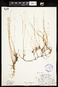 Eleocharis erythropoda Steudel 337048[1020218]Lakela, Olga 15941936-07-29 United States, Minnesota, Saint Louis, bayside, Sec 18; under 3 ft. of sand, under the reconstruction and improvement program, Duluth.;;050N;14W;18, 46.784213 -92.07774 |
MIN:Plants | 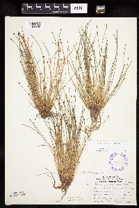 Eleocharis ovata (Roth) Roemer & Schultes 337731[1020479]Lakela, Olga 16011936-07-30 United States, Minnesota, Saint Louis, Duluth.;;N;;, 46.783273 -92.106579 |
MIN:Plants | 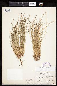 Eleocharis ovata (Roth) Roemer & Schultes 337733[1020481]Lakela, Olga 17311936-08-16 United States, Minnesota, Saint Louis, Oatka Beach Addition at 42nd St, Duluth.;Minnesota Point;049N;13W;18, 46.75082 -92.072247 |
MIN:Plants | 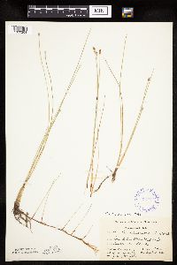 Eleocharis erythropoda Steudel 337777[1020208]Smith, L.; Moyle, J. 5011936-09-02 United States, Minnesota, Itasca, County: Bena dist. Loc.: Ball Club Lake;Chippewa National Forest / Leech Lake Indian Reservation;145N;26W;, 47.368566 -93.967398 |
MIN:Plants | 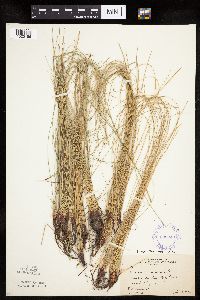 Eleocharis erythropoda Steudel 338043[1020186]Rosendahl, C.; Moyle, J. 21711936-07-18 United States, Minnesota, Koochiching, Mouth of the Big Fork River, Koochiching Co.;;070N;26W;, 48.512778 -93.671436 |
MIN:Plants | 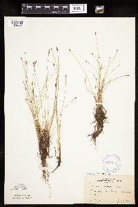 Eleocharis erythropoda Steudel 338115[1020225]Moyle, J. 20401935-07-03 United States, Minnesota, Clearwater, Iron Springs, Clearwater Co.;Iron Springs Bog Scientific Natural Area;144N;36W;, 47.282324 -95.233417 |
MIN:Plants | 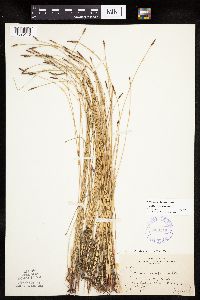 Eleocharis erythropoda Steudel 338119[1020140]Rosendahl, C.; Moyle, J. 22421936-07-18 United States, Minnesota, Beltrami, 8 mi. north of Waskish, near the lookout tower.;Red Lake Wildlife Management Area;155N;30W;, 48.236089 -94.488691 |
MIN:Plants |  Eleocharis ovata (Roth) Roemer & Schultes 338120[1020486]Webb, W. 26831936-10-07 United States, Minnesota, Anoka, Carlos Avery Game Refuge.;Carlos Avery Wildlife Management Area;;;, 45.316179 -93.08681 |
MIN:Plants | 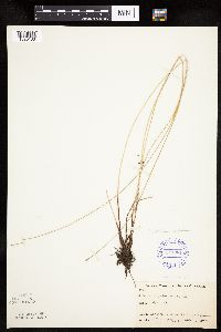 Eleocharis erythropoda Steudel 347981[1020133]Buell, Murray; Buell, Helen 6581933-08-01 United States, Minnesota, Anoka, Decodon Pond, Anoka Co.;Cedar Creek National History Area;034N;23W;27, 45.406779 -93.193727 |
MIN:Plants | 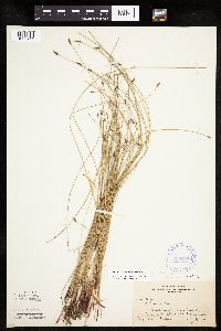 Eleocharis erythropoda Steudel 350408[1020241]Nielsen, E. 32661935-07-07 United States, Minnesota, Becker, Birchwood, Long Lake, Becker Co. [there's a Long Lake near Detroit Lakes and one near Cormorant];;;;, 46.797563 -96.025761 |
MIN:Plants | 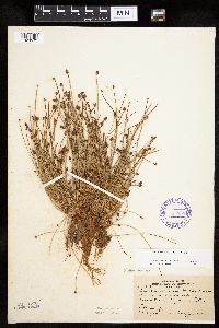 Eleocharis ovata (Roth) Roemer & Schultes 353395[1020573]Moyle, J.; et al. 18861934-08-20 United States, Minnesota, Saint Louis, On the N side of Bass Lake, Ely.;;;;, 47.933092 -91.861065 |
MIN:Plants | 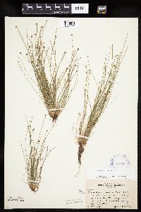 Eleocharis ovata (Roth) Roemer & Schultes 354659[1020565]Moyle, J. 12771934-07-20 United States, Minnesota, Clearwater, [Itasca State Park];Itasca State Park;143N;36W;29, 47.173717 -95.265521 |
MIN:Plants | 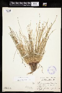 Eleocharis ovata (Roth) Roemer & Schultes 354660[1020497]Moyle, J. 12771934-07-20 United States, Minnesota, Clearwater, Itasca State Park.;Itasca State Park;143N;36W;29, 47.173717 -95.265521 |
MIN:Plants | 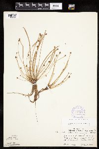 Eleocharis obtusa (Willdenow) Schultes 356555[1020393]Lakela, Olga 33741939-10-07 United States, Minnesota, Saint Louis, along Highway No. 4, about 9 mi. N. of Duluth.;;051N;14W;, 46.894542 -92.111506 |
MIN:Plants | 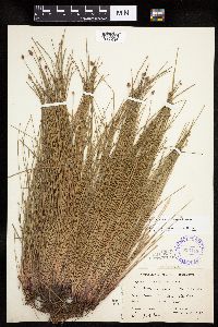 Eleocharis obtusa (Willdenow) Schultes 359119[1020436]Moyle, J. 33581939-08-22 United States, Minnesota, Sherburne, County: Stearns. Along Elk River. prob. meant Sherburne Co.; no Elk River in Stearns];;;;, 45.423033 -93.864695 |
MIN:Plants | 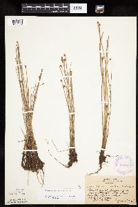 Eleocharis obtusa (Willdenow) Schultes 360176[1020382]Rosendahl, C.; Butters, F. 67331936-08-31 United States, Minnesota, Pine, north end of Sturgeon Lake, Pine County;;045N;19W;, 46.374946 -92.7409 |
MIN:Plants | 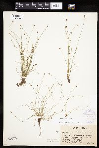 Eleocharis ovata (Roth) Roemer & Schultes 360179[1020544]Rosendahl, C.; Butters, F. 67341936-08-31 United States, Minnesota, Pine, N end of Sturgeon Lake, Pine Co.;;045N;19W;, 46.374946 -92.7409 |
MIN:Plants |  Eleocharis ovata (Roth) Roemer & Schultes 360672[1020483]Rosendahl, C.; Butters, F. 67121936-09-01 United States, Minnesota, Pine, W of Finlayson.;;N;;, 46.201614 -92.931828 |
MIN:Plants |  Eleocharis erythropoda Steudel 361732[1020184]Jacobs, D. 3351940-07-17 United States, Minnesota, Wright, Cedar Lake ... Wright Co. [two Cedar Lakes in the county];;;;, 45.263182 -93.873624 |
MIN:Plants |  Eleocharis erythropoda Steudel 361733[1102591]Jacobs, D. 16335A1940-07-17 United States, Minnesota, Wright, Cedar Lake ... Wright Co. [two Cedar Lakes in the county];;;;, 45.263182 -93.873624 |
MIN:Plants |  Eleocharis erythropoda Steudel 361734[1020185]Jacobs, D. 3161940-07-17 United States, Minnesota, Wright, Pleasant Lake ... Wright Co.;;121N;27W;, 45.282397 -94.07601 |
MIN:Plants | 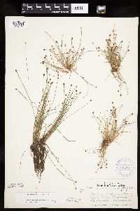 Eleocharis ovata (Roth) Roemer & Schultes 362281[1020475]Lakela, Olga 38321940-08-01 United States, Minnesota, Saint Louis, Sand Lake, Hwy. 53.;;N;;, 47.648931 -92.635203 |
MIN:Plants | 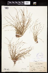 Eleocharis ovata (Roth) Roemer & Schultes 362659[1020491]Butters, F.; et al. 65911934-09-11 United States, Minnesota, Clearwater, Lower Twin Lake, Itasca State Paek.;Itasca State Park;143N;36W;, 47.19557 -95.233216 |
MIN:Plants | 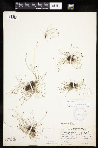 Eleocharis ovata (Roth) Roemer & Schultes 362794[1020489]Butters, F.; Moore, John 136111940-09-18 United States, Minnesota, Chisago, 5 mi. E of Sunrise.;Saint Croix National Riverway;N;;, 45.546858 -92.751557 |
MIN:Plants | 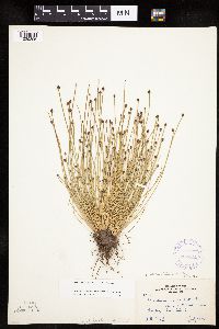 Eleocharis obtusa (Willdenow) Schultes 362871[1020396]Moyle, J. 34601940-07-17 United States, Minnesota, Lake, near Gooseberry River, Lake Co.;Gooseberry Falls State Park / North Shore;054N;09W;00, 47.163947 -91.4853 |
MIN:Plants |  Eleocharis ovata (Roth) Roemer & Schultes 365035[1020490]Buell, Murray 20131940-08-17 United States, Minnesota, Clearwater, 1/4 mi. W of Lyndecker Lake, Itasca State Park.;Itasca State Park;143N;36W;, 47.19557 -95.233216 |
MIN:Plants |  Eleocharis erythropoda Steudel 366104[1020187]Rosendahl, C. 74331940-05-22 United States, Minnesota, Houston, Valley of Riceford Creek, Black Hammer Twp, Houston County;Dorer Memorial Hardwood State Forest;102N;07W;29, 43.60891 -91.700721 |
MIN:Plants |  Eleocharis erythropoda Steudel 366487[1020238]Rosendahl, C.; et al. 72631939-07-21 United States, Minnesota, Mower, railroad right-of-way, near Taopi, Mower Co.;;101N;15W;, 43.543578 -92.628844 |
MIN:Plants |  Eleocharis erythropoda Steudel 366496[1020189]Rosendahl, C.; et al. 72391939-07-20 United States, Minnesota, Freeborn, along Iowa-Minn. State line, east of Emmons, Freeborn County;;101N;22W;, 43.54296 -93.468448 |
MIN:Plants | 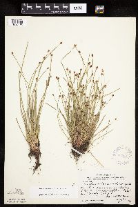 Eleocharis obtusa (Willdenow) Schultes 367479[1020433]Moore, John; Moore, Marjorie 104031938-09-07 United States, Minnesota, Ramsey, slighly S.W. of the intersection of Rice Street and County Road B, Ramsey County;;029N;23W;, 44.992077 -93.166387 |
MIN:Plants | 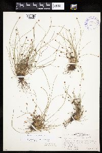 Eleocharis ovata (Roth) Roemer & Schultes 370942[1020545]Moore, John; Moore, Marjorie 136681940-09-28 United States, Minnesota, Anoka, N shore of a lake, Bethel Twp.;;034N;23W;32, 45.392004 -93.234418 |
MIN:Plants | 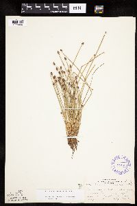 Eleocharis obtusa (Willdenow) Schultes 374092[1020394]Lakela, Olga 51811942-08-30 United States, Minnesota, Pine, on Highway 23, between Kerrick and Bruno. Pine Co.;;;;, 46.306589 -92.624204 |
MIN:Plants | 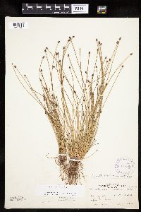 Eleocharis ovata (Roth) Roemer & Schultes 375389[1020476]Lakela, Olga 51401942-08-13 United States, Minnesota, Saint Louis, Shores of Deep Lake, Sparta.;;N;;, 47.46764 -92.46441 |
MIN:Plants | 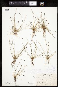 Eleocharis ovata (Roth) Roemer & Schultes 378952[1020480]Lakela, Olga 54921943-09-11 United States, Minnesota, Saint Louis, An artificially made island in Superior Bay, Duluth.;;N;;, 46.749808 -92.075227 |
MIN:Plants | 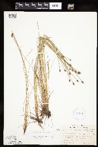 Eleocharis obtusa (Willdenow) Schultes 379020[1020392]Lakela, Olga 53501943-07-18 United States, Minnesota, Saint Louis, northeast of Chester Park School, Duluth.;;050N;14W;, 46.811579 -92.119043 |
MIN:Plants | 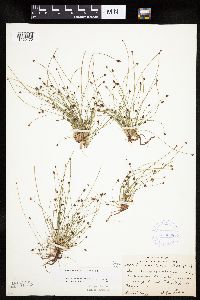 Eleocharis ovata (Roth) Roemer & Schultes 379036[1020470]Lakela, Olga 52291942-09-06 United States, Minnesota, Saint Louis, Normanna Twp, 2 mi. S of Island Lake.;;N;;, 47.01538 -92.19315 |
MIN:Plants | 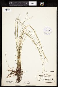 Eleocharis erythropoda Steudel 381855[1020188]Allison, Helen s.n.1944-06-05 United States, Minnesota, Grant, NE Grant County ... NE end of Pelican Lake.;;130N;41W;, 46.06443 -95.831926 |
MIN:Plants | 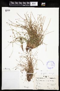 Eleocharis ovata (Roth) Roemer & Schultes 385776[1020484]Moyle, J. 38631944-08-29 United States, Minnesota, Saint Louis, Whiteface River at Fairbanks.;Superior National Forest;N;;, 47.37048 -91.926562 |
MIN:Plants | 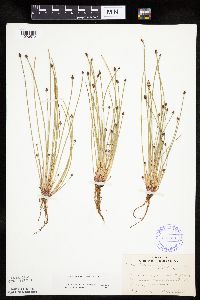 Eleocharis ovata (Roth) Roemer & Schultes 385981[1020572]Lakela, Olga 57921944-08-00 United States, Minnesota, Lake, Hwy. 61, near Manitou River.;;N;;, 47.444015 -91.068992 |
MIN:Plants | 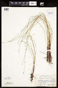 Eleocharis erythropoda Steudel 391738[1020219]Lakela, Olga 62231945-08-24 United States, Minnesota, Saint Louis, Oatka Beach Addition, Minnesota Point, Duluth.;Minnesota Point;049N;13W;18, 46.75082 -92.072247 |
MIN:Plants | 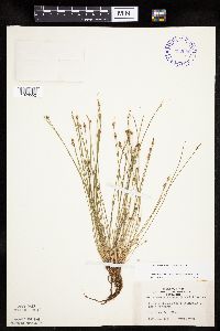 Eleocharis ovata (Roth) Roemer & Schultes 392902[1020552]Lakela, Olga 73681947-09-11 United States, Minnesota, Saint Louis, Helliwig Creek on Hwy. 53, N of Canyon, St. Louis Co.;;053N;17W;, 47.068245 -92.492018 |
MIN:Plants | 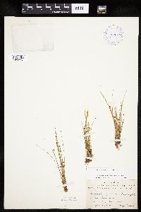 Eleocharis ovata (Roth) Roemer & Schultes 392912[1020553]Lakela, Olga 67531946-09-04 United States, Minnesota, Cook, Hwy. 61 near Schroeder. Cook Co.;North Shore / Superior National Forest;059N;04W;, 47.599359 -90.844189 |
MIN:Plants | 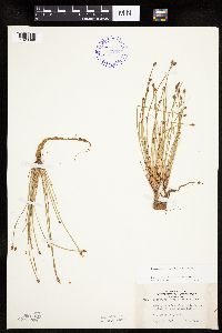 Eleocharis obtusa (Willdenow) Schultes 392944[1020389]Lakela, Olga 73211947-09-02 United States, Minnesota, Saint Louis, on Highway 2, near Grand Lake. St. Louis Co.;;051N;16W;, 46.894711 -92.364816 |
MIN:Plants | 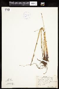 Eleocharis erythropoda Steudel 393027[1020245]Lakela, Olga 64971946-07-01 United States, Minnesota, Saint Louis, Sandbar Island, in the Duluth Harbor, Duluth.;;;;, 46.75082 -92.072247 |
MIN:Plants | 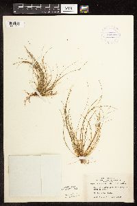 Eleocharis ovata (Roth) Roemer & Schultes 393039[1102679]Lakela, Olga 73691947-09-11 United States, Minnesota, Saint Louis, Helliwig Creek on Hwy. 53, N of Canyon.;;N;;, 47.068245 -92.492018 |
MIN:Plants | 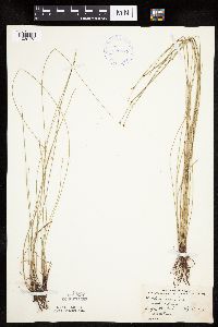 Eleocharis erythropoda Steudel 396877[1020172]Stevens, O. s.n.1948-07-24 United States, Minnesota, Clay, Buffalo State Park.;Buffalo River State Park;139N;46W;10, 46.869327 -96.473428 |
MIN:Plants | 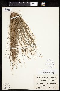 Eleocharis obtusa (Willdenow) Schultes 405425[1020386]Moyle, J. 37331941-09-23 United States, Minnesota, Houston, County: Houston. Location: near Caledonia.;;102N;06W;, 43.630671 -91.551294 |
MIN:Plants | 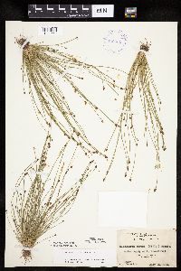 Eleocharis ovata (Roth) Roemer & Schultes 406331[1020550]Jones, George Neville 184711946-07-25 United States, Minnesota, Saint Louis, Armstong Lake, near Ely.;Superior National Forest;062N;14W;, 47.844609 -92.115349 |
MIN:Plants | 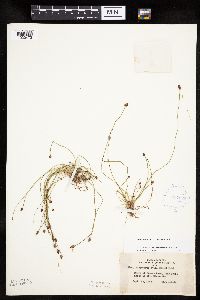 Eleocharis ovata (Roth) Roemer & Schultes 407226[1020473]Lakela, Olga 97651949-09-12 United States, Minnesota, Saint Louis, Shore of Fenske Lake, Echo Trail, N of Ely.;Superior National Forest;064N;12W;, 47.994422 -91.904667 |
MIN:Plants | 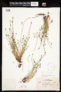 Eleocharis ovata (Roth) Roemer & Schultes 407346[1020478]Lakela, Olga 100101949-08-29 United States, Minnesota, Saint Louis, Herseth's Vacation Camp, Lake Kabetogama.;Voyageurs National Park;N;;, 48.455458 -92.980682 |
MIN:Plants | Eleocharis erythropoda Steudel 412080[]Moore, John; Moore, Marjorie 103921938-08-30 United States, Minnesota, Roseau, Lake of the Woods, Muskeg Bay. Roseau County;;163N;36W;, 48.930291 -95.287489 |
MIN:Plants | Eleocharis erythropoda Steudel 412081[]Moore, John; Moore, Marjorie 103901938-08-30 United States, Minnesota, Roseau, Shores of Lake of the Woods, Muskeg Bay. Roseau County;;163N;36W;, 48.930291 -95.287489 |
MIN:Plants | 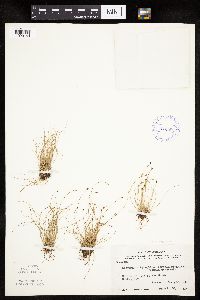 Eleocharis erythropoda Steudel 412082[1020144]Moore, John; Moore, Marjorie 103881938-08-30 United States, Minnesota, Roseau, Shores of Lake of the Woods, Muskeg Bay. Roseau County;;163N;36W;, 48.930291 -95.287489 |
MIN:Plants | 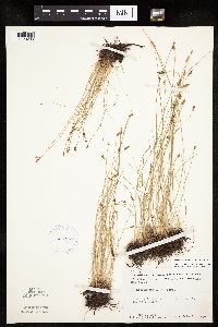 Eleocharis erythropoda Steudel 412286[1020236]Moore, John; Moore, Marjorie 113231939-07-31 United States, Minnesota, Lake of the Woods, Lake of the Woods County...American Point.;Northwest Angle;168N;33W;, 49.33962 -94.925446 |
MIN:Plants | 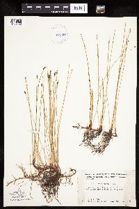 Eleocharis erythropoda Steudel 412337[1020192]Moore, John; Moore, Marjorie 120941939-08-23 United States, Minnesota, Koochiching, Koochiching County ... south bank of the Rainy River west of Birchdale.;;160N;27W;, 48.636117 -94.105012 |
MIN:Plants | 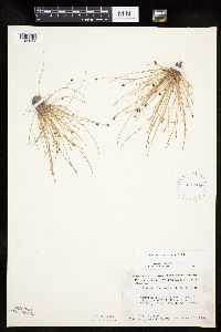 Eleocharis ovata (Roth) Roemer & Schultes 412828[1020562]Moore, John; Moore, Marjorie 119381939-08-19 United States, Minnesota, Koochiching, Koochiching Co.; Along the E bank of the Little Fork River between Hwy. 11 and the Rainy River. Along the E bank of the Little Fork River between Hwy. 11 and the Rainy River.. 070N 25W , 48.51885 -93.540946 |
MIN:Plants | 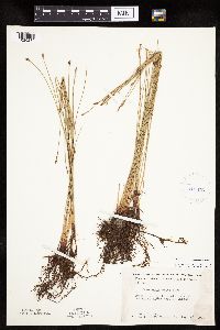 Eleocharis erythropoda Steudel 412876[1020235]Moore, John; Moore, Marjorie 120951939-08-23 United States, Minnesota, Koochiching, Koochiching County...along the S bank of the Rainy River, W of Birchdale.;;160N;27W;, 48.636117 -94.105012 |
MIN:Plants | 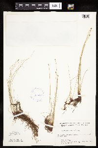 Eleocharis erythropoda Steudel 412973[1020173]Moore, John; et al. 100591937-07-28 United States, Minnesota, Kandiyohi, Kandiyohi County ... island near the south shore of Norway Lake.;;121N;35W;, 45.282269 -95.070706 |
MIN:Plants | 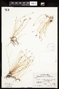 Eleocharis erythropoda Steudel 413047[1020145]Moore, John; Moore, Marjorie 103971938-08-30 United States, Minnesota, Roseau, Shores of Lake of the Woods, Muskeg Bay. Roseau County;;163N;36W;, 48.930291 -95.287489 |
MIN:Plants | Eleocharis erythropoda Steudel 413049[]Moore, John; Moore, Marjorie 103911938-08-30 United States, Minnesota, Roseau, Lake of the Woods, Muskeg Bay, Roseau County;;163N;36W;, 48.930291 -95.287489 |
MIN:Plants | Eleocharis erythropoda Steudel 413050[]Moore, John; Moore, Marjorie 103891938-08-30 United States, Minnesota, Roseau, Shores of Lake of the Woods, Muskeg Bay. Roseau County;;163N;36W;, 48.930291 -95.287489 |
MIN:Plants | 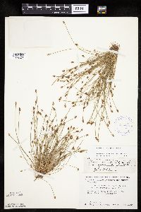 Eleocharis ovata (Roth) Roemer & Schultes 415425[1020547]Moore, John; Moore, Marjorie 121021939-08-24 United States, Minnesota, Lake of the Woods, Along the Rainy River at Clementson.;;160N;30W;, 48.663969 -94.498266 |
MIN:Plants | 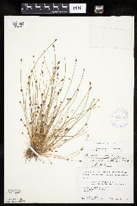 Eleocharis ovata (Roth) Roemer & Schultes 415426[1020549]Moore, John; Moore, Marjorie 120101939-08-22 United States, Minnesota, Lake of the Woods, At the mouth of the Rapid River, Clementson.;;160N;30W;, 48.663969 -94.498266 |
MIN:Plants | 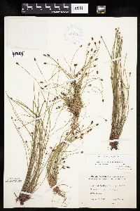 Eleocharis ovata (Roth) Roemer & Schultes 416738[1020551]Lakela, Olga 98051949-09-12 United States, Minnesota, Saint Louis, Shore of a pond, Hwy. 1, S of Ely.;Superior National Forest;N;;, 47.83263 -91.83867 |
MIN:Plants | 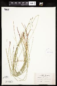 Eleocharis erythropoda Steudel 419418[1020223]Lakela, Olga 12241950-08-08 United States, Minnesota, Saint Louis, Savanna River at Floodwood. St. Louis Co.;;051N;20W;, 46.91894 -92.9176 |
MIN:Plants |  Eleocharis ovata (Roth) Roemer & Schultes 420102[1020561]Lakela, Olga 11147A1950-08-05 United States, Minnesota, Lake, Springy roadside, Langley Creek, Ely-Two Harbors Hwy.;Superior National Forest;N;;, 47.32425 -91.66387 |
MIN:Plants |  Eleocharis ovata (Roth) Roemer & Schultes 424054[1020563]Emanuel, J. 1821946-09-10 United States, Minnesota, Itasca, Nashwauk Township (McCarty Lake).;;057N;23W;21, 47.406646 -93.270038 |
MIN:Plants |  Eleocharis erythropoda Steudel 424179[1102589]Fassett, N. 227201950-08-10 United States, Minnesota, Clearwater, Clearwater County ... Between Park Rapids and Itasca State Park.;;;;, 47.197458 -95.201964 |
MIN:Plants |  Eleocharis erythropoda Steudel 424181[1020210]Fassett, N. 227191950-08-26 United States, Minnesota, Hubbard, Hay Creek, 9 mi. N of Park Rapids, Todd Township, Hubbard County;;140N;35N;, 46.935207 -95.09984 |
MIN:Plants | 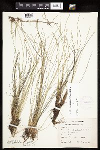 Eleocharis erythropoda Steudel 425862[1020214]Emanuel, J. 5221951-06-29 United States, Minnesota, Winona, County: Winona ... vic. of LaMoille.;Dorer Memorial Hardwood State Forest;106N;06W;, 43.976154 -91.541228 |
MIN:Plants | 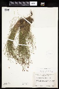 Eleocharis ovata (Roth) Roemer & Schultes 426032[1020482]Moyle, J. s.n.1951-08-03 United States, Minnesota, Lake, In Beaver Meadow, along Mink Creek (Gooseberry River tributary).;North Shore;054N;09W;00, 47.163947 -91.4853 |
MIN:Plants | 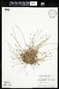 Eleocharis ovata (Roth) Roemer & Schultes 427675[1020556]Smith, Welby 139731987-09-26 United States, Minnesota, Sherburne, Sherburne Co. In Sherburne National Wildlife Refuge, about 3 mi NE of Orrock. NE1/4 SW1/4 sec 34, T35N R27W;Sherburne National Wildlife Refuge;035N;27W;34, 45.4791679 -93.6875 |
MIN:Plants | 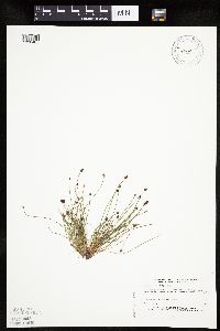 Eleocharis ovata (Roth) Roemer & Schultes 430043[1020465]Myhre, K. 33611992-09-23 United States, Minnesota, Cass, Cass Co.; located on the northwest bay of Town Line Lake; T 142N R 28W SW1/4 of SW1/4 of sec 34;;142N;28W;34, 47.075113 -94.214572 |
MIN:Plants | 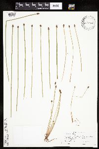 Eleocharis obtusa (Willdenow) Schultes 430420[1020416]Scott, P. 8191995-08-07 United States, Minnesota, Cook, Cook Co. Wetland by Grand Marais Fen T61N R1E sec.8 SW SE SW.;North Shore / Superior National Forest;061N;01E;08, 47.780839 -90.350156 |
MIN:Plants | 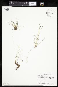 Eleocharis ovata (Roth) Roemer & Schultes 434851[1020524]Myhre, K. 51911994-07-20 United States, Minnesota, Itasca, Itasca Co.; Located one quarter mile southwest of Johnson Lake; T 57N R 36W SE1/4 of NE1/4 of Sec 14;Chippewa National Forest;057N;26W;14, 47.421971 -93.609999 |
MIN:Plants | 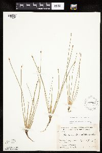 Eleocharis obtusa (Willdenow) Schultes 437053[1020431]Moore, John; Hall, Robert 165981944-06-14 United States, Minnesota, Renville, Renville County ... ear the bridge; Highway 19 at Morton.;;113N;34W;, 44.585501 -94.934085 |
MIN:Plants | 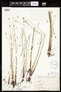 Eleocharis erythropoda Steudel 437170[1020178]Moore, John; Moore, Marjorie 164481944-06-11 United States, Minnesota, Lyon, Lyon County...beside Highway 14, 3/4 mi. W of Florence.;;109N;43W;, 44.239934 -96.018264 |
MIN:Plants | 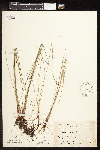 Eleocharis erythropoda Steudel 437171[1102580]Moore, John; Hall, Robert 164491944-06-11 United States, Minnesota, Lyon, Lyon County ... Highway 14, 3/4 mi. west of Florence.;;109N;43W;, 44.239934 -96.018264 |
MIN:Plants | 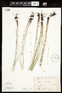 Eleocharis erythropoda Steudel 437251[1020239]Moore, John; Hall, Robert 165361944-06-12 United States, Minnesota, Cottonwood, Cottonwood County...8 mi. east of Fulda, on Hwy. 62.;;105N;38W;, 43.891304 -95.401658 |
MIN:Plants | 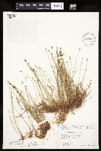 Eleocharis erythropoda Steudel 437272[1020177]Moore, John; Moore, Marjorie 122311939-08-29 United States, Minnesota, Lake of the Woods, Lake of the Woods County ... Morris Point (Oak Point), Lake of the Woods.;Pine & Curry Islands Scientific Natural Area;162N;32W;, 48.844345 -94.762874 |
MIN:Plants | 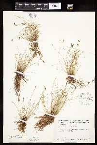 Eleocharis erythropoda Steudel 437361[1020126]Moore, John; Moore, Marjorie 121651939-08-27 United States, Minnesota, Lake of the Woods, Lake of the Woods County ... at Rocky Point, Lake of the Woods.;;163N;34W;, 48.930506 -95.025758 |
MIN:Plants |  Eleocharis ovata (Roth) Roemer & Schultes 437391[1020548]Moore, John; Moore, Marjorie 121441939-08-26 United States, Minnesota, Lake of the Woods, W side of Baudette Bay at Baudette.;;N;;, 48.712474 -94.59993 |
MIN:Plants |  Eleocharis erythropoda Steudel 437420[1020194]Moore, John; Moore, Marjorie 121341939-08-25 United States, Minnesota, Lake of the Woods, Lake of the Woods County ... about 2 mi. west of Clementson.;;160N;30W;, 48.663969 -94.498266 |
MIN:Plants |  Eleocharis ovata (Roth) Roemer & Schultes 443119[1020477]Lakela, Olga 126231951-06-24 United States, Minnesota, Saint Louis, Shore of Bear Island River at Hwy. 1, SE of Ely.;Superior National Forest;062N;12W;, 47.846052 -91.860989 |
Google Map
Google Maps is a web mapping service provided by Google that features a map that users can pan (by dragging the mouse) and zoom (by using the mouse wheel). Collection points are displayed as colored markers that when clicked on, displays the full information for that collection. When multiple species are queried (separated by semi-colons), different colored markers denote each individual species.