University of Minnesota
http://www.umn.edu/
612-625-5000
http://www.umn.edu/
612-625-5000
Minnesota Biodiversity Atlas
Bell Museum
Dataset: MIN-Plants
Taxa: Sapindaceae
Search Criteria: excluding cultivated/captive occurrences
Bell Museum plants | |
 MIN:Plants | 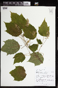 Acer spicatum Lam. 963526[1348910]Nee, M. H. 642182018-06-03 United States, Michigan, Gogebic, Ottawa National Forest; 6.8km N of Hwy 2 in Bessemer along FR 484, 43.307083 -90.333056, 385m |
MIN:Plants | 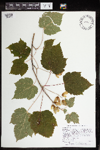 Acer spicatum Lam. 965411[1356274]Lee, Michael MDL53532010-08-06 United States, Minnesota, Cook, Boundary Waters Canoe Area Wilderness, Fairly rugged bedrock terrain north of Swan Lake, 17 miles northwest of Grand Marais. T63N R2W W1/2 of NW1/4 of SW1/4 Sec. 1, 47.96732148 -90.53279196, 594m |
MIN:Plants | 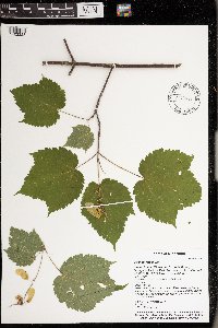 Acer spicatum Lam. 976632[1402223]Timothy J. S. Whitfeld 28792021-07-15 United States, Minnesota, St. Louis, Voyageurs National Park, 1/4 mile east of O’Leary Lake, 48.413716 -92.521935, 388m |
MIN:Plants | 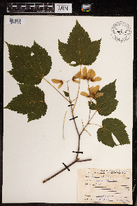 Acer spicatum Lam. 967865[1368470]Drew, L.A. s.n.1969-08-07 United States, Minnesota, Itasca State Park, 47.197458 -95.201964 |
MIN:Plants | 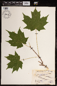 Acer spicatum Lam. 967864[1368471]Drew, L.A. s.n.1969-08-07 United States, Minnesota, Itasca State Park, 47.197458 -95.201964 |
MIN:Plants | 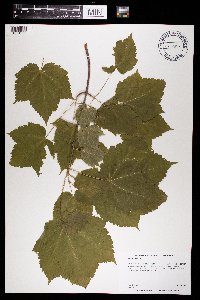 Acer spicatum Lam. 969618[1371209]Dunevitz, Hannah L. 7591992-06-10 United States, Minnesota, Wabasha, North-facing bluff on the south edge of Wabasha, just west of Highway 61., 44.43 -92.26 |
MIN:Plants |  Acer spicatum Lam. 973008[1398561]Lee, Michael MDL58472012-05-23 United States, Minnesota, Winona, Whitewater Wildlife Management Area; Along the South Fork Whitewater River six miles northeast of St. Charles., 44.0244929323 -91.9738870459, 287m |
MIN:Plants |  Acer spicatum Lam. 974406[1396770]Smith, Welby R WRS362002019-06-16 United States, Minnesota, Lake, In the Boundary Waters Canoe Area Wilderness, Superior National Forest. About 44 km (27 miles) east of the approximate center of Ely at 85 degrees. Upland habitat at the north end of Insula Lake., 47.93541 -91.26816 |
MIN:Plants | 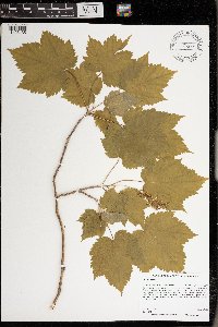 Acer spicatum Lam. 976373[1403135]Dunevitz, Hannah L. 8371993-06-03 United States, Minnesota, Winona, On a north-facing steep bluff above Highway 61, 1.4 miles east of County Road 15., 44.02 -91.53 |
MIN:Plants | Acer circinatum Pursh 511278[]Davis, Owen s.n.1976-00-00 United States, Idaho, Latah, Latah Co. |
MIN:Plants | 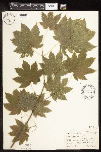 Acer circinatum Pursh 444369[1095065]Abbott, Robinson s.n.1969-07-31 United States, Washington, Grays Harbor, Gray's Har. County ... several miles beyond Lake Quinault, Olympic National Forest.;Olympic National Park;;;, 47.47417 -123.86667 |
MIN:Plants | 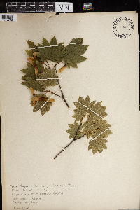 Acer circinatum Pursh 965880[1356638] 1925-07-01 United States, Oregon, St. Vincent's Hospital |
MIN:Plants | 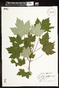 909141[1093566]Smith, Welby 245531994-07-06 United States, Minnesota, Sherburne, Sherburne National Wildlife Refuge. Sherburne County ... Along the Blue Hill Trail in Sherburne National Wildlife Refuge ... T35N R27W SW1/4 of NW1/4 of Sec 28. 035N 27W 28, 45.4966667 -93.7111111 |
MIN:Plants | 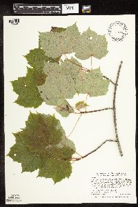 508900[1093594]Smith, Welby 290552000-08-24 United States, Minnesota, Mille Lacs, Mille Lacs County ... Mille Lacs State Wildlife Management Area ... T 40N R 26W SW1/4 of SW1/4 of Sec 14;Mille Lacs Wildlife Management Area;040N;26W;14, 45.9527778 -93.5569444 |
MIN:Plants | 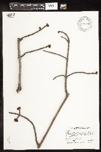 904578[1093568]Smith, Welby 255891995-04-22 United States, Minnesota, Le Sueur, Le Sueur County ... Richter Woods County Park, about 1.5 miles west of Montgomery ... T111N R23W NW1/4 of SE1/4 of Sec 8;Richter Woods County Park;111N;23W;08, 44.4333333 -93.6138889 |
MIN:Plants | 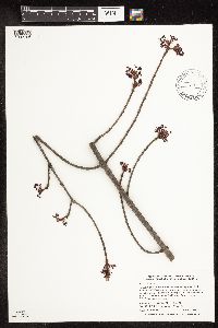 439281[1093706]Smith, Welby 269181998-04-22 United States, Minnesota, Koochiching, Pine Island State Forest. Koochiching County...On the Big Fork River at Hendrickson Landing, about 6 miles north of Big Falls...T 156N R 25W SW1/4 of SE1/4 of Sec 27. 156N 25W 27, 48.2958333 -93.8258333 |
MIN:Plants | 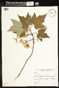 482440[1093611]Gerdes, Lynden 25611998-06-01 United States, Minnesota, Cook, Superior National Forest. T65N R04W S26SESWNE. Cook County; Superior National Forest, approx. .25 miles north of the Gunflint Trail (Cty. 12) / FR 1347 junction, then west off FR 1347 to area of bedrock outcrop.. 065N 04W 26, 48.0845 -90.80375 |
MIN:Plants | 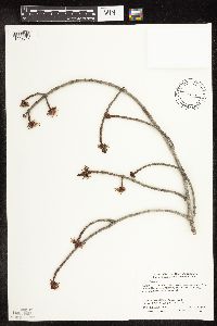 428974[1093617]Smith, Welby 276031999-04-14 United States, Minnesota, Pine, General C C Andrews State Forest. Pine County ... General C.C. Andrews State Forest, about 2.5 miles E of Willow River ... T 44N R 19W NW1/4 of SW1/4 of Sec 5. 044N 19W 5, 46.3241653 -92.7813873 |
MIN:Plants | 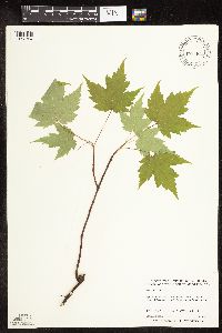 508767[1093704]Anderson, Craig 8752000-06-09 United States, Minnesota, Douglas, Douglas County ... Spruce Center WMA ... T130N R36W: 1/4 of SW1/4 of NE1/4 of Sect. 16;Spruce Creek Wildlife Management Area;130N;36W;16, 46.07045 -95.21859 |
MIN:Plants | 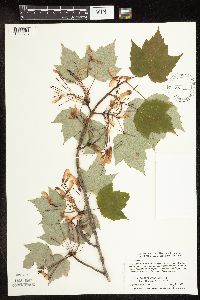 492666[1093613]Smith, Welby 271581998-05-26 United States, Minnesota, Mille Lacs, Mille Lacs Wildlife Management Area. Mille Lacs County ... Mille Lacs State Wildlife Management Area, about 11 miles southeast of Onamania ... T41N R25W NE1/4 of NW1/4 of Sec 26. 041N 25W 26, 46.0099983 -93.464447 |
MIN:Plants | 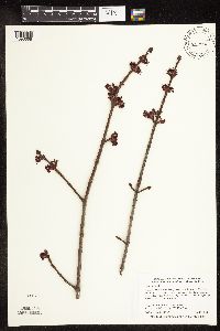 453483[1093668]Smith, Welby 283622000-04-09 United States, Minnesota, Washington, William O'Brien State Park. Washington County ... William O'Brien State Park. In the St. Croix Valley, about 1.5 miles north of Marine ... T32N R19W NW1/4 of NE1/4 of Sec 31. 032N 19W 31, 45.2233315 -92.7613907 |
MIN:Plants | 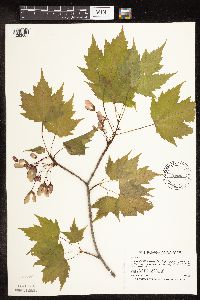 461908[1093605]Smith, Welby 185581991-05-21 United States, Minnesota, Todd, about 4 miles south of Staples (town) . SW1/4 NE1/4 of sec.;Staples Wildlife Management Area;133N;33W;36, 46.2936096 -94.7861099 |
MIN:Plants | 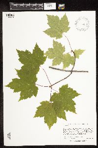 479384[1093618]Lee, Michael MDL38942004-09-24 United States, Minnesota, Otter Tail, OTTERTAIL COUNTY ... Southeast side of Big Pine Lake, six miles east of Perham ...T136N R38W NW1/4 of SW1/4 of NW1/4 Sec.23. 136N 38W 23, 46.57851 -95.43945 |
MIN:Plants | 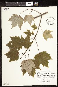 473330[1093620]Lee, Michael MDL22311998-07-08 United States, Minnesota, Carver, Carver County ... Marsh Lake Hunting Club 2-1/2 miles south of Victoria ... T116N R24W SE1/4 of SE1/4 Sec. 26;;116N;24W;26, 44.82698 -93.67245 |
MIN:Plants | 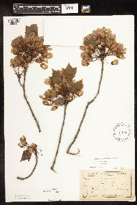 151056[1093587]Anderson, A. A3811893-06-00 United States, Minnesota, Cass, Gull Lake;;;;, 46.41083 -94.35333 |
MIN:Plants | 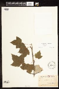 151095[1093634]Arthur, J.; et al. B1861886-07-21 United States, Minnesota, Saint Louis, Vermilion Lake;;;;, 47.89167 -92.36667 |
MIN:Plants | 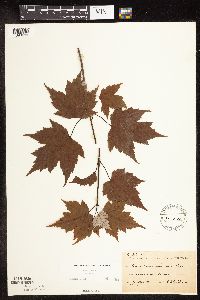 151096[1093699]Sheldon, Edmund S29661892-07-00 United States, Minnesota, Mille Lacs, Milaca;;037N;27W;, 45.69205 -93.69879 |
MIN:Plants | 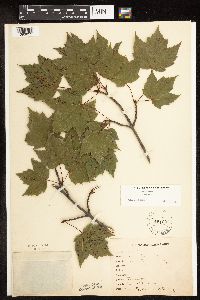 151097[1093651]Bergman, H. 30151914-08-11 United States, Minnesota, Hubbard, Transect 1, Benedict;;143N;32W;35, 47.15806 -94.69028 |
MIN:Plants | 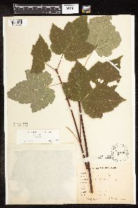 151098[1093657]Bergman, H. 31701914-09-04 United States, Minnesota, Hubbard, Transect 2, Benedict.;;143N;32W;35, 47.15729 -94.6957 |
MIN:Plants | 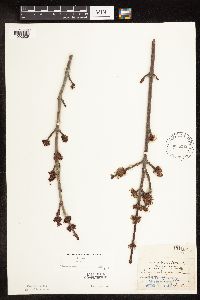 151100[1093629]Aiton, G. s.n.1891-05-00 United States, Minnesota, Hennepin, Near Minneapolis;;N;;, 44.98 -93.26361 |
MIN:Plants | 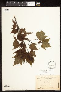 151101[1093700]Sheldon, Edmund S48011893-06-00 United States, Minnesota, Lake, Two Harbors;North Shore;052N;11W;, 47.02278 -91.67056 |
MIN:Plants | 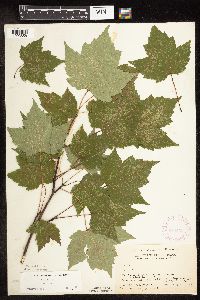 282433[1093658]Buell, Murray 3201932-07-04 United States, Minnesota, Clearwater, Itasca Park. W of Jefferson Hwy, 1/2 mi. S of campus. SE1/4 NW1/4 Sec. 12, T143N, R36W.;Itasca State Park;143N;36W;12, 47.21774 -95.18017 |
MIN:Plants | 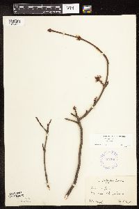 307286[1093604]Moyle, J. s.n.1933-04-23 United States, Minnesota, Ramsey, Ramsey Co.; near Lake Johanna;;030N;23W;, 45.08003 -93.16693 |
MIN:Plants | 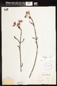 332069[1093603]Zeck, Otto 1561934-05-08 United States, Minnesota, Becker, Sec. 31, Erie Twp, Detroit Lakes, Becker Co.;;139N;40W;31, 46.81085 -95.78526 |
MIN:Plants | 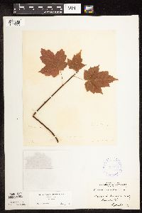 334751[1093673]Anonymous [poss. R.C. Perry] s.n.1884-09-00 United States, Minnesota, Washington, Dellwood;;030N;21W;, 45.07965 -92.9239 |
MIN:Plants | 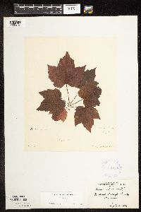 334752[1093672]Anonymous [poss. R.C. Perry] s.n.1884-09-00 United States, Minnesota, Washington, Dellwood;;030N;21W;, 45.07965 -92.9239 |
MIN:Plants | 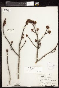 337089[1093626]Lakela, Olga 13511936-05-17 United States, Minnesota, Saint Louis, Dunes past 44th Street, Duluth;;;;, 46.78333 -92.10639 |
MIN:Plants | 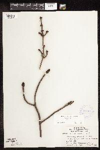 337091[1093624]Lakela, Olga 13351936-04-13 United States, Minnesota, Saint Louis, Dunes at the present bus terminal, 44th St, Duluth;;;;, 46.78333 -92.10639 |
MIN:Plants | 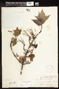 356587[1093586]Lakela, Olga 30171939-06-24 United States, Minnesota, Saint Louis, Bayside, Minnesota Point, Duluth;Minnesota Point;049N;13W;19, 46.72833 -92.04778 |
MIN:Plants | 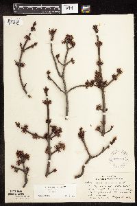 361016[1093602]Lakela, Olga 34171940-05-12 United States, Minnesota, Saint Louis, St. Louis Co.; at the base of the high Nopeming bluff, on hwy 61;;049N;15W;, 46.7218967 -92.2412209 |
MIN:Plants | 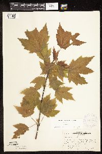 367976[1093669]Moore, John; et al. 127931940-05-27 United States, Minnesota, Otter Tail, Beside hwy 108; NE1/4 Sec. 2 Maplewood Twp.;;;;, 46.50167 -95.96417 |
MIN:Plants | 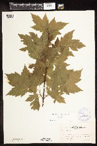 370106[1093644]Moore, John; et al. 141501941-05-25 United States, Minnesota, Pine, Beside Hwy. 23; 1 mi. S of Nickerson, Pine Co.;;045N;17W;, 46.37449 -92.4891 |
MIN:Plants | 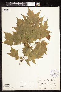 370109[1093639]Moore, John; et al. 141471941-05-25 United States, Minnesota, Pine, Beside hwy 23, 22 mi SW of Blackhoof;;;;, 46.26677 -92.68547 |
MIN:Plants | 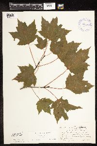 371278[1093650]Moore, John; et al. 150001941-08-07 United States, Minnesota, Aitkin, Along Hwy. 56 [65?], 3 mi. N of Mille Lacs-Aitkin Co. line.;;;;, 46.3346 -93.26294 |
MIN:Plants | 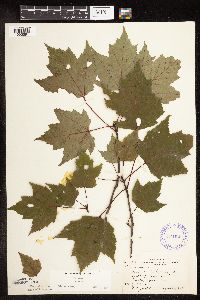 371521[1093691]Moore, John 149481941-08-07 United States, Minnesota, Kanabec, Along the Snake River, 1/2 mi. S of Mora.;;039N;24W;, 45.86068 -93.32753 |
MIN:Plants | 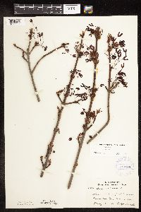 371646[1093591]Lakela, Olga 42891941-05-10 United States, Minnesota, Carlton, Shorewoods of Big Lake;Fond du Lac Indian Reservation;N;;, 46.70167 -92.62889 |
MIN:Plants | 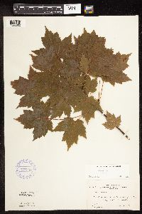 373773[1093662]Moore, John; et al. 150381941-08-08 United States, Minnesota, Crow Wing, Crow Wing County...2 mi. W of Crosby;;;;, 46.48279 -93.98598 |
MIN:Plants | 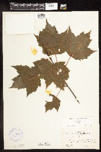 373807[1093677]Moore, John; et al. 150821941-08-09 United States, Minnesota, Beltrami, Beltrami County...2 mi. S of Bemidji on Hwy. 71;;;;, 47.41508 -94.8642 |
MIN:Plants | 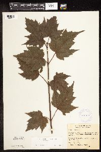 376952[1093642]Hurd, R. 281937-09-02 United States, Minnesota, Lake, Vic. of Halfway Ranger Station. Lake Co.;Superior National Forest;;;, 47.63333 -91.41667 |
MIN:Plants | 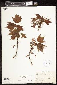 380148[1093595]Lakela, Olga 52991943-06-07 United States, Minnesota, Saint Louis, Swamp on Bayview Heights, Duluth;;;;, 46.74722 -92.19528 |
MIN:Plants | 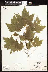 381182[1093675]Moore, John; et al. 152791942-06-11 United States, Minnesota, Isanti, NW1/4 Sec. 32 Stanchfield. Isanti Co.;;037N;23W;32, 45.65161 -93.23425 |
MIN:Plants | 393873[]Stewart, Donald s.n1944-09-15 United States, Minnesota, Cook, Superior NF. Lima Mt. Sec. 35, T64N, R01W.;Superior National Forest;064N;01W;35, 47.983322 -90.415449 |
MIN:Plants | 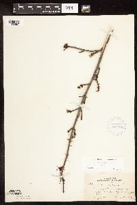 405323[1093597]Lakela, Olga 79291949-05-01 United States, Minnesota, Saint Louis, Shore of Prairie Lake, SW corner of St. Louis Co.;;050N;20W;, 46.80928 -92.87068 |
MIN:Plants | 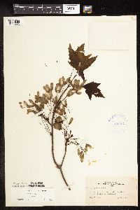 405367[1093583]Lakela, Olga 80741949-05-21 United States, Minnesota, Saint Louis, Terrace of Prairie Lake, SW St. Louis Co.;;050N;20W;, 46.80928 -92.87068 |
MIN:Plants | 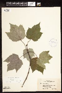 407314[1093638]Lakela, Olga 95131949-08-28 United States, Minnesota, Saint Louis, Lake Kabetogama, near Park Point Resort;Voyageurs National Park;;;, 48.48028 -93.055 |
MIN:Plants | 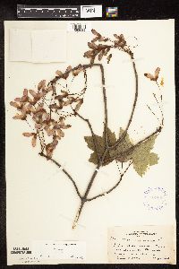 407406[1093589]Lakela, Olga 82421949-06-09 United States, Minnesota, Saint Louis, Near Duluth Heights, Duluth;;;;, 46.80083 -92.13167 |
MIN:Plants | 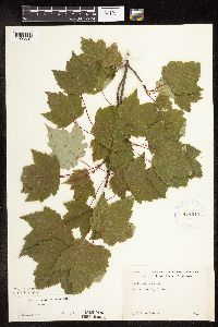 418840[1093697]Ahlgren, Clifford 4861949-00-00 United States, Minnesota, Lake, Quetico-Superior Wilderness Research Center...Lake Co.; Sec. 9 T64N R10W;Boundary Waters Canoe Area Wilderness / Superior National Forest;064N;10W;09, 48.03165 -91.61886 |
MIN:Plants | 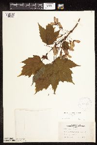 419934[1093582]Lakela, Olga 103911950-06-13 United States, Minnesota, Saint Louis, St. Louis Co.; Top of Laurentian Divide, N of Virginia;Superior National Forest;058N;17W;, 47.50287 -92.49693 |
MIN:Plants | 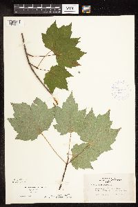 420784[1093653]Lakela, Olga 117081950-08-24 United States, Minnesota, Saint Louis, St. Louis County ... Crooked Lake at Curtain Falls;Boundary Waters Canoe Area Wilderness / Superior National Forest;066N;12W;, 48.18679 -91.86997 |
MIN:Plants | 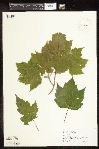 429551[1093631]Scott, P. 10081997-08-12 United States, Minnesota, Cook, Cook Co.; on the upper part of Lima Mountain T64N R1W sec.36 WSWNW;Superior National Forest;064N;01W;36, 47.98331 -90.39351 |
MIN:Plants | 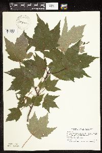 430661[1093575]Smith, Welby 194801991-07-16 United States, Minnesota, Koochiching, Koochiching County...On the west side of Silverdale...T 64N R 22W SW1/4 of NE1/4 of Sec 35;Koochiching State Forest;064N;22W;35, 47.9866676 -93.1188889 |
MIN:Plants | 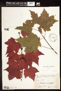 442256[1093689]Moore, John; Huff, N. 191411946-08-29 United States, Minnesota, Koochiching, Koochiching Co.; rr right of way 4 miles north east of Northome;;151N;28W;, 47.88952 -94.22777 |
MIN:Plants | 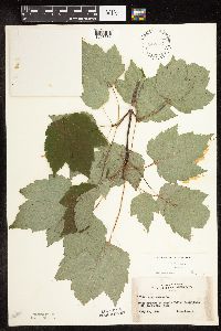 442377[1093654]Lakela, Olga 131441951-07-13 United States, Minnesota, Saint Louis, Hotel grounds at Kettle Falls, Rainy Lake.;Voyageurs National Park;070N;18W;, 48.52144 -92.66536 |
MIN:Plants | 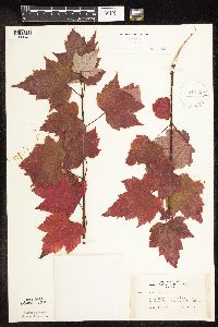 442555[1093661]Lakela, Olga 138011951-09-14 United States, Minnesota, Saint Louis, On Crane Lake Road, N of Buyck. St. Louis Co.;Superior National Forest;066N;17W;, 48.19302 -92.51933 |
MIN:Plants | 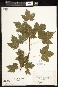 444847[1093696]Moore, John; et al. 187551946-07-25 United States, Minnesota, Anoka, Along the N side of Main Street Road near the crossing with Elwell Road E of Anoka;;031N;24W;, 45.17829 -93.31543 |
MIN:Plants | 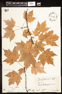 445844[1093656]Moore, John; Huff, N. 183041945-10-04 United States, Minnesota, Chisago, 2 mi. N of Stacy;;N;;, 45.42702 -92.98722 |
MIN:Plants | 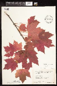 446518[1093688]Moore, John 183521945-10-06 United States, Minnesota, Benton, 2 mi W of Foreston, Benton Co.;;037N;28W;, 45.734404 -93.752011 |
MIN:Plants | 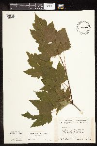 446769[1093640]Moore, John; Huff, N. 178541945-07-24 United States, Minnesota, Morrison, 3 mi. NW of Little Falls;;;;, 46.01532 -94.42131 |
MIN:Plants | 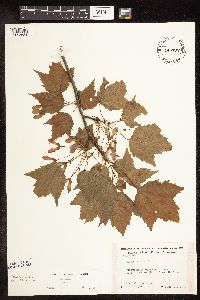 446792[1093581]Moore, John; Huff, N. 195081947-06-11 United States, Minnesota, Itasca, 12 1/2 mi. S of Grand Rapids;;;;, 47.09444 -93.52524 |
MIN:Plants | 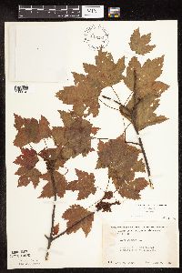 448994[1093701]Moore, John 170821945-06-07 United States, Minnesota, Todd, 1/4 mi E of Staples;;;;, 46.35553 -94.70803 |
MIN:Plants | 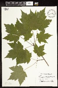 459706[1093610]Lee, Michael MDL3301993-08-23 United States, Minnesota, Dakota, Dakota Co.; Chub Lake; T 113N R 20W NE1/4 of SE1/4 of Sec 28;;113N;20W;28, 44.56554 -93.22792 |
MIN:Plants | 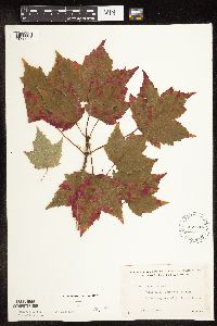 462514[1093633]Lakela, Olga 158121952-09-11 United States, Minnesota, Saint Louis, St. Louis Co.; Sand Point Lake, W of Harrison's Narrows;Voyageurs National Park;068N;17W;, 48.36824 -92.52471 |
MIN:Plants | 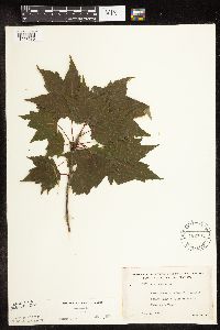 462701[1093630]Lakela, Olga 152331952-07-18 United States, Minnesota, Saint Louis, St Louis Co.; island next to Pine Island in Kabetogama Lake;Voyageurs National Park;070N;21W;, 48.5433 -93.02505 |
MIN:Plants | 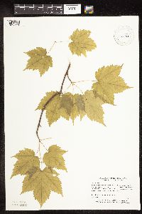 471963[1093571]Myhre, K. 19641992-05-28 United States, Minnesota, Cass, Chippewa National Forest / Leech Lake Indian Reservation. Cass Co.; Located 1 mile northeast of Battle Point in the Battleground State Forest; T 143N R 29W NW1/4 of SW1/4 of Sec Cass Co.; Located 1 mile northeast of Battle Point in the Battleground State Forest; T 143N R 29W NW1/4 of SW1/4 of Sec 25. 143N 29W 25, 47.17589 -94.29655 |
MIN:Plants | 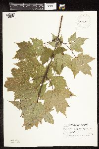 476383[1093579]Smith, Welby 212191992-08-04 United States, Minnesota, Hennepin, Hennepin County ... About 1.5 miles southeast of Chanhassen ... T 116N R 22W NW1/4 of NE1/4 of S;;116N;22W;19, 44.8463898 -93.5077744 |
MIN:Plants | 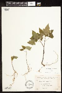 492948[1093678]Lakela, Olga 166711953-08-08 United States, Minnesota, Saint Louis, St. Louis Co.; Lac La Croix near Lac La Croix Resort.;Boundary Waters Canoe Area Wilderness / Superior National Forest;;;, 48.34361 -92.12278 |
MIN:Plants |  515172[1093698]Scott, P. 10581997-08-19 United States, Minnesota, Cook, Cook Co.; on an island in Seagull Lake T65N R4W sec.6 SNW.;Boundary Waters Canoe Area Wilderness / Superior National Forest;065N;04W;6, 48.14264 -90.88978 |
MIN:Plants |  515173[1093703]Scott, P. 10361997-08-18 United States, Minnesota, Cook, Cook Co. Loft Lake; T64N R3E sec.21 NENESW.;Superior National Forest;064N;03E;21, 48.0128 -90.06563 |
MIN:Plants | 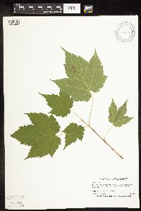 515646[1093562]Smith, Welby 179551990-08-09 United States, Minnesota, Roseau, About 4.5 miles west of the town of Pine Creek. SW1/4 of NW1/4 of section;Roseau River Wildlife Management Area;164N;42W;35, 48.98523 -96.04064 |
MIN:Plants | 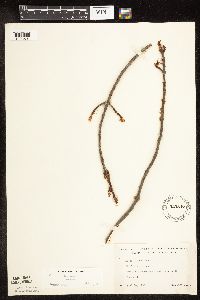 525847[1093601]Lakela, Olga 185381955-04-30 United States, Minnesota, Saint Louis, St. Louis Co.; About 6 mi north of Floodwood;;052N;20W;, 46.98261 -92.86869 |
MIN:Plants | 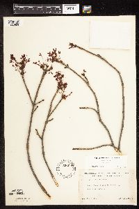 526098[1093599]Lakela, Olga 185531955-05-07 United States, Minnesota, Saint Louis, St. Louis Co.; on hwy 133 east of Meadowlands;;053N;19W;, 47.0678 -92.74388 |
MIN:Plants | 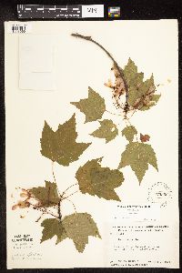 526360[1093590]Moore, John; et al. 210241951-06-09 United States, Minnesota, Itasca, Along the W shore of Coon Lake;Scenic State Park;;;, 47.74486 -93.42362 |
MIN:Plants | 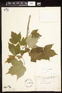 527186[1093695]Lakela, Olga 175781954-06-23 United States, Minnesota, Saint Louis, St. Louis Co. ... S of Second Lake, Echo Trail, northeast of Ely;Boundary Waters Canoe Area Wilderness / Superior National Forest;065N;13W;, 48.10812 -91.996 |
MIN:Plants | 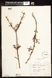 527403[1093625]Lakela, Olga 172341954-05-22 United States, Minnesota, Saint Louis, St. Louis Co. ... Side Lake, north of Hibbing;Sturgeon River State Forest;060N;21W;, 47.67592 -92.9968 |
MIN:Plants | 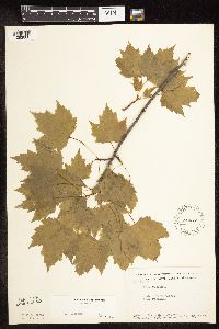 542472[1093660]Moore, John; et al. 215031952-05-18 United States, Minnesota, Anoka, Cedar Creek Forest. 49B.;Cedar Creek National History Area;034N;23W;, 45.42806 -93.204 |
MIN:Plants | 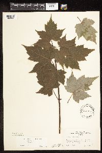 543055[1093655]Lakela, Olga 222631957-09-04 United States, Minnesota, Lake, Farm Lake, Superior National Forest, Timber Trail Resort.;Superior National Forest;063N;11W;34, 47.8985 -91.71746 |
MIN:Plants | 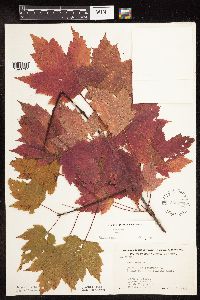 568976[1093707]Moore, John; et al. 253281960-10-06 United States, Minnesota, Rice, 1/2 mi. S of Shields Lake.;;110N;22W;, 44.32669 -93.46404 |
MIN:Plants | 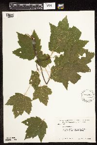 572529[1093632]Moore, John 257141961-08-07 United States, Minnesota, Isanti, Growing at Cornea Cabin, Cedar Creek Natural History Area;Cedar Creek National History Area;034N;23W;, 45.42806 -93.204 |
MIN:Plants | 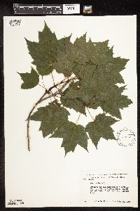 572533[1093674]Moore, John 256441961-07-20 United States, Minnesota, Isanti, Old homestead, W of county access road, N end of Cedar Creek Natural History Area;Cedar Creek National History Area;034N;23W;, 45.42806 -93.204 |
MIN:Plants | 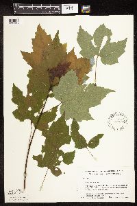 583468[1093659]Kellner, H. 2721956-08-13 United States, Minnesota, Lake, On crumbling rock at station 5, ca. 699 ft. from Lake Superior along the transect line, Shovel Point site.;North Shore / Tettegouche State Park;056N;07W;14, 47.34093 -91.19216 |
MIN:Plants | 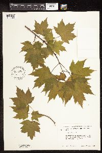 585279[1093643]Moore, John 259241962-05-16 United States, Minnesota, Anoka, W of the laboratory, Cedar Creek Natural History Area.;Cedar Creek National History Area;034N;23W;, 45.42806 -93.204 |
MIN:Plants | 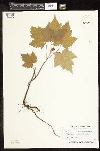 587999[1093612]Myhre, K. 19431992-05-26 United States, Minnesota, Cass, Cass Co.; Located on the west side of Jack Lake; T 141N R 30W NE1/4 of SE1/4 of Sec 3;Chippewa National Forest / Leech Lake Indian Reservation;141N;30W;3, 47.05941 -94.45966 |
MIN:Plants | 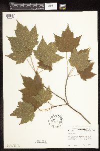 594388[1093641]Thorne, Robert 309231962-07-09 United States, Minnesota, Clearwater, S side of pond, Ice House Pond, Campus, Itasca State Park, NE1/4 Sec. 11, T143N, R36W.;Itasca State Park;143N;36W;11, 47.21752 -95.2015 |
MIN:Plants | 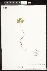 611442[1093652]Lammers, Roberta s.n.1967-07-17 United States, Minnesota, Isanti, W of Beckman Lake, Cedar Creek Natural History Area.;Cedar Creek National History Area;034N;23W;, 45.42806 -93.204 |
MIN:Plants | 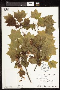 616505[1093588]Moore, John; et al. 1181969-06-04 United States, Minnesota, Crow Wing, Crow Wing Natural History Area, Crow Wing County...SE of the barn; SW1/4 Sec. 22 Garrison Twp.;Crow Wing Natural Area;044N;28W;22, 46.27899 -93.86334 |
MIN:Plants | 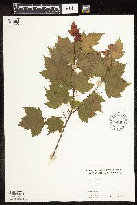 627753[1093692]Westkaemper, Remberta s.n.1970-05-00 United States, Minnesota, Stearns, Stearns Co. Collegeville;;125N;29W;, 45.63025 -94.3255 |
MIN:Plants | 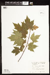 663654[1093647]Noble, Mark; et al. 6281975-07-17 United States, Minnesota, Saint Louis, St. Louis Co. ... Located on Moose Loop, 28 mi NW of Ely, Superior Nat. For.;Superior National Forest;065N;14W;, 48.1891 -92.29441 |
MIN:Plants | 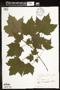 669923[1093646]Grimm, Eric 221974-07-10 United States, Minnesota, Hennepin, Hennepin County...YMCA Camp Ihduhapi, Loretto, swamp surrounding Hidden Lake;;118N;24W;12, 45.04384 -93.65598 |
MIN:Plants | 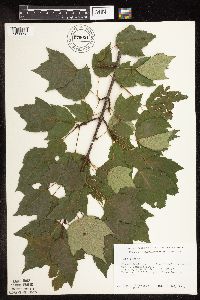 679021[1093693]Ownbey, Gerald 49621975-07-11 United States, Minnesota, Clearwater, Clearwater Co. Itasca State Park, Lake Itasca, Robert's Trail, Douglas Lodge; T143N R36W Sec. 24 NE1/4.;Itasca State Park;143N;36W;24, 47.18875 -95.18007 |
MIN:Plants | 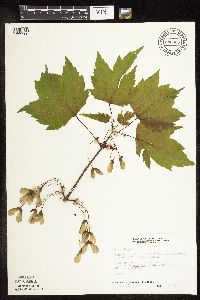 686958[1093580]Wheeler, Gerald; Glaser, Paul 13831977-05-22 United States, Minnesota, Itasca, Collection Site no. 17, ca. 10.5mi NW of Grand Rapids; NE1/4 Sec. 7 T56N R26W;;056N;26W;7, 47.3476 -93.69212 |
Google Map
Google Maps is a web mapping service provided by Google that features a map that users can pan (by dragging the mouse) and zoom (by using the mouse wheel). Collection points are displayed as colored markers that when clicked on, displays the full information for that collection. When multiple species are queried (separated by semi-colons), different colored markers denote each individual species.