University of Minnesota
http://www.umn.edu/
612-625-5000
http://www.umn.edu/
612-625-5000
Minnesota Biodiversity Atlas
Bell Museum
Dataset: MIN-Plants
Taxa: Sapindaceae
Search Criteria: excluding cultivated/captive occurrences
Bell Museum plants | |
 MIN:Plants |  Acer negundo L. 558499[1093399]Moore, John; et al. 235521957-09-19 United States, Minnesota, Isanti, Old house site, Cedar Creek Forest; NW1/4 Sec. 16 Athens Twp.;Cedar Creek National History Area;034N;23W;16, 45.43572 -93.21482 |
MIN:Plants |  Acer negundo L. 574969[1093454]Wertman, Freida 3441960-09-05 United States, Minnesota, Isanti, Cedar Creek Natural History Area. Abandoned home-site, 1/4 mi. from Rte. 65. Sec. 16, Athens Twp.;Cedar Creek National History Area;034N;23W;17, 45.43548 -93.23555 |
MIN:Plants |  Acer negundo L. 583899[1093460]Gunderson, R. 181961-05-08 United States, Minnesota, Washington, St. Croix River, 3 mi N of Stillwater;Saint Croix National Riverway;030N;20W;, 45.09983 -92.80583 |
MIN:Plants |  Acer negundo L. 584009[1093356]Gunderson, R. 5091961-07-18 United States, Minnesota, Washington, Washington County ... St. Croix River, 3 mi N of Stillwater, N shore;Saint Croix National Riverway;030N;20W;, 45.08498 -92.81735 |
MIN:Plants | 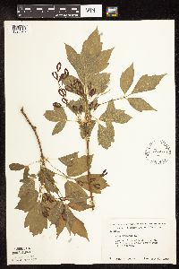 Acer negundo L. 585539[1093375]Moore, John 259141962-05-11 United States, Minnesota, Houston, Along the rr, 7 mi SW of Caledonia;;;;, 43.56298 -91.59573 |
MIN:Plants | 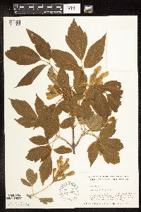 Acer negundo L. 586369[1093402]Coffin, G.; et al. 91962-07-01 United States, Minnesota, Clearwater, Clearwater County...On the S side of Schoolcraft Island, Lake Itasca...SE1/4 NW1/4 Sec. 11 T143N R36W;Itasca State Park;143N;36W;11, 47.21752 -95.2015 |
MIN:Plants | 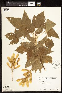 Acer negundo L. 591956[1093391]Moore, John 267661965-08-10 United States, Minnesota, Blue Earth, Ravine 3 mi W of Mankato;;;;, 44.16359 -94.05974 |
MIN:Plants | 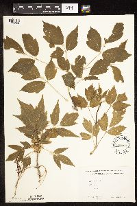 Acer negundo L. 602260[1093390]Westkaemper, Remberta s.n.1962-04-00 United States, Minnesota, Stearns, Stearns County...SBC [St. Benedicts College] campus, St. Joseph;;124N;29W;10, 45.56617 -94.3117 |
MIN:Plants | 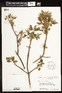 Acer negundo L. 616600[1093327]Moore, John; et al. 361969-05-10 United States, Minnesota, Crow Wing, Crow Wing Natural History Area, Crow Wing County...Cranberry Bog Lake; SE1/4 SE1/4 Sec. 29 Garrison Twp.;Crow Wing Natural Area;044N;28W;29, 46.26514 -93.9045 |
MIN:Plants | 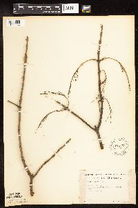 Acer negundo L. 618763[1093286]Monserud, W. 5791958-03-02 United States, Minnesota, Hennepin, Minneapolis, W end of Laurel Ave. rr bridge, Tree #7;;;;, 44.98 -93.26361 |
MIN:Plants | 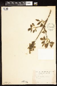 Acer negundo L. 618766[1093290]Monserud, W. 5861958-04-27 United States, Minnesota, Hennepin, W end of Laurel Ave, R.R. bridge. Tree 7.;;;;, 45 -93.47 |
MIN:Plants | 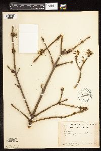 Acer negundo L. 618767[1093341]Monserud, W.; et al. s.n.1953-04-27 United States, Minnesota, Hennepin, Below Heart Hospital, on River Bank above the parking lot;;;;, 45 -93.47 |
MIN:Plants | 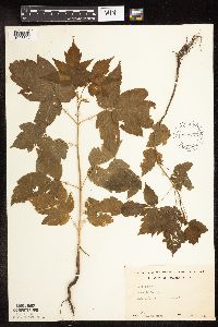 Acer negundo L. 618776[1093360]Monserud, W. 1431949-06-19 United States, Minnesota, Hennepin, Yard 5255 Dupont N. Minneapolis;;;;, 45.09583 -93.59861 |
MIN:Plants | 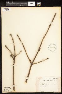 Acer negundo L. 618789[1093361]Monserud, W. 5801958-03-02 United States, Minnesota, Hennepin, W end of Laurel Ave. rr bridge, tree #8;;;;, 45 -93.47 |
MIN:Plants | 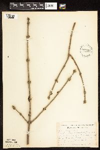 Acer negundo L. 618790[1093285]Monserud, W. s.n.1957-03-17 United States, Minnesota, Hennepin, Tree #1, from W side of large cut down tree stump, N end of Penn Ave. bridge, just N of railing;;;;, 45 -93.47 |
MIN:Plants | 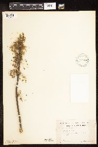 Acer negundo L. 618791[1093414]Monserud, W. 5871958-04-27 United States, Minnesota, Hennepin, Tree #8. W end of Laurel Ave, R.R. bridge.;;;;, 45 -93.47 |
MIN:Plants |  Acer negundo L. 618825[1093275]Monserud, W. 4971957-08-14 United States, Minnesota, Hennepin, Tree #1, below N end of rr bridge, Penn Ave. between 2nd Ave. N and Chestnut St, on bank above creek;;;;, 45 -93.47 |
MIN:Plants |  Acer negundo L. 618832[1093274]Monserud, W. 4971957-05-08 United States, Minnesota, Hennepin, Tree #1, below N end of rr bridge, Penn Ave. between 2nd Ave. N and Chestnut St, on bank above creek;;;;, 45 -93.47 |
MIN:Plants |  Acer negundo L. 631355[1093348]Sohmer, S. s.n.1968-05-12 United States, Minnesota, Houston, 2.8 mi. S of the Root River Bridge on Rte. 26.;;103N;04W;, 43.71854 -91.31739 |
MIN:Plants |  Acer negundo L. 643806[1093283]Ownbey, Gerald 47421973-12-02 United States, Minnesota, Washington, Washington Co.; 0.5 mi W of Afton village, near Afton Hills Drive;;028N;20W;, 44.89782 -92.802 |
MIN:Plants | 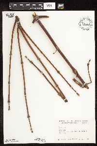 Acer negundo L. 644864[1093338]Neese, E. 10721973-12-19 United States, Minnesota, Ramsey, Ramsey Co.; between Lake Emily and Emmert St, Shoreview.;;030N;23W;, 45.08003 -93.16693 |
MIN:Plants | 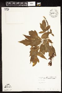 Acer negundo L. 673587[1093465]Borchard, Alma s.n.1976-05-14 United States, Minnesota, Washington, Washington County...Grey Cloud Island;;;;, 44.8086 -92.9944 |
MIN:Plants | 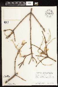 Acer negundo L. 679009[1093381]Ownbey, Gerald 49001975-04-12 United States, Minnesota, Washington, Afton Hills Drive, 0.5 mi W of Afton Village;;028N;20W;, 44.90717 -92.81202 |
MIN:Plants | 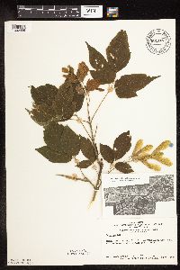 Acer negundo L. 681107[1093446]Swanson, Steven 9291975-06-25 United States, Minnesota, Houston, Mississippi River (Navigation Pool #8). Houston Co, Site 30, railroad levee.;Upper Mississippi National Wildlife Refuge;;;, 43.71156 -91.2854 |
MIN:Plants | 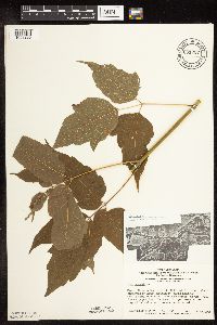 Acer negundo L. 681237[1093295]Swanson, Steven 8051975-06-23 United States, Minnesota, Houston, Mississippi River (Navigation Pool #8). Houston Co, Site 26. N tip of Pettibone Island disturbed by human habitation.;Upper Mississippi National Wildlife Refuge;;;, 43.64899 -91.27853 |
MIN:Plants | 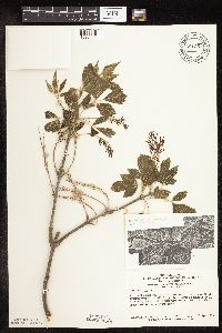 Acer negundo L. 681357[1093444]Swanson, Steven 24981976-04-00 United States, Minnesota, Houston, Mississippi River (Navigation Pool #8). Houston Co, Site 42.;Upper Mississippi National Wildlife Refuge;;;, 43.71951 -91.25519 |
MIN:Plants | 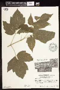 Acer negundo L. 681460[1093445]Swanson, Steven 8521975-06-23 United States, Minnesota, Houston, Mississippi River (Navigation Pool #8). Houston Co, Site 31.;Upper Mississippi National Wildlife Refuge;;;, 43.69171 -91.27441 |
MIN:Plants | 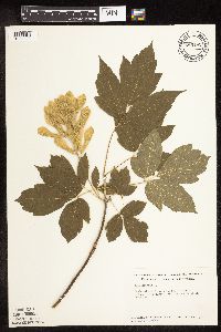 Acer negundo L. 685192[1093322]Stassen, Carol 671977-06-14 United States, Minnesota, Lyon, Camden State Park, Redwood River floodplain, near N picnic grounds; T110N R42W Sec. 5;Camden State Park;110N;42W;5, 44.36318 -95.92744 |
MIN:Plants |  Acer negundo L. 687294[1093345]Wheeler, Gerald; Glaser, Paul 17231977-06-27 United States, Minnesota, Itasca, Itasca Co.; Site 62. NE1/4 SE1/4 Sec. 26, T145N, R25W; Deer River. Adjacent to the Deer River Forestry Station.;Leech Lake Indian Reservation;145N;25W;26, 47.34641 -93.8059 |
MIN:Plants |  Acer negundo L. 689624[1093335]Marshall, John s.n.1966-05-05 United States, Minnesota, Anoka, 1 mi. W of Soderville;;033N;23W;30, 45.31979 -93.25609 |
MIN:Plants |  Acer negundo L. 690486[1093312]Siemers, Ross 311977-06-21 United States, Minnesota, Stearns, Stearns Co. Great Blue Heron Rookery Area, on the edge of the colony; T123N R30W Sec. 13;Cold Spring Heron Colony Scientific Natural Area;123N;30W;13, 45.46397 -94.39432 |
MIN:Plants |  Acer negundo L. 696747[1093314]Smith, Welby 7971978-05-07 United States, Minnesota, Wright, Wright Co. About 2 mi SE of Clearwater, beside Burlington Northern tracks; T122N R26W SW1/4 Sec. 7;;122N;26W;7, 45.39473 -94.00784 |
MIN:Plants | 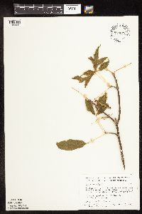 Acer negundo L. 710072[1093337]Wheeler, Gerald 51021979-10-06 United States, Minnesota, Le Sueur, Le Sueur Co. Approx. 1 mi SW of Kasota, bluff overlooking the Minnesota River, High Lime Prairie; T109N R26W Sec. 6;East Minnesota River Wildlife Management Area;109N;26W;6, 44.27458 -93.99848 |
MIN:Plants | 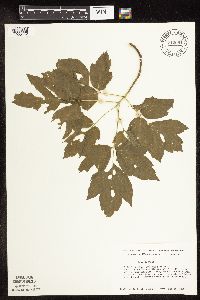 Acer negundo L. 712081[1093442]Smith, Welby 18231979-08-14 United States, Minnesota, Wright, Wright Co. S side of st. hwy 55, 2.0 mi E of its jnc with co. rd 8 in Maple Lake; T120N R26W SW1/4 NW1/4 Sec. 9;;120N;26W;9, 45.21646 -93.96025 |
MIN:Plants | 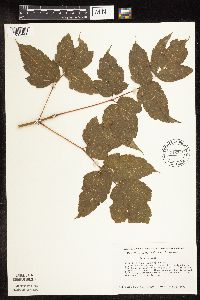 Acer negundo L. 712116[1093441]Smith, Welby 18601979-08-25 United States, Minnesota, Wright, Wright Co. 0.2 mi NE of co. hwy 75, 4 mi SE of its jnc with st. hwy 24 in Clearwater, in ditch between Fish Creek and Bu Wright Co. 0.2 mi NE of co. hwy 75, 4 mi SE of its jnc with st. hwy 24 in Clearwater, in ditch between Fish Creek and Burlington Northern tracks; T122N R26W NE1/4 SW1/4 Sec. 7. 122N 26W 7, 45.39047 -94.00344 |
MIN:Plants | 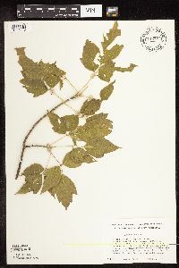 Acer negundo L. 712124[1093443]Smith, Welby 18691979-09-02 United States, Minnesota, Wright, Wright Co. Between Crow River and co. hwy 19, 0.9 mi N of its jcn with st. 55 in Rockford, floodplain of Crow River; T11 Wright Co. Between Crow River and co. hwy 19, 0.9 mi N of its jcn with st. 55 in Rockford, floodplain of Crow River; T119N R24W SE1/4 Sec. 20. 119N 24W 20, 45.09608 -93.72842 |
MIN:Plants |  Acer negundo L. 717757[1093320]Keller, C. 61979-05-24 United States, Minnesota, Norman, Frenchman's Bluff, 2.5 mi N of Flom; Sec. 18 T143N R43W;Frenchmans Bluff Scientific Natural Area;143N;43W;18, 47.20197 -96.18389 |
MIN:Plants |  Acer negundo L. 721271[1093326]Lustig, K. 2541979-05-16 United States, Minnesota, Sherburne, Sherburne Co. Clear Lake-Mississippi Scenic and Recreational River SNA, 12 mi SE of St. Cloud; Sec. 14, 22, 23 T34N R30W;Clear Lake Scientific Natural Area;034N;30W;, 45.44634 -94.04378 |
MIN:Plants |  Acer negundo L. 723637[1093439]Smith, Welby 21031980-05-12 United States, Minnesota, Wright, Wright Co. S side of co. rd 30, 4 mi SE of Waverly; T118N R26W SE1/4 NE1/4 Sec. 24;;118N;26W;24, 45.01415 -93.90022 |
MIN:Plants |  Acer negundo L. 723840[1093438]Smith, Welby 33961980-08-17 United States, Minnesota, Wright, Wright Co. On the NW side of Howard Lake, between the lake and co. rd 6; T119N R27W SW1/4 SE1/4 Sec. 28;;119N;27W;28, 45.08695 -94.08408 |
MIN:Plants |  Acer negundo L. 724018[1093440]Smith, Welby 20671980-05-10 United States, Minnesota, Winona, Winona Co. 0.15 mi NE of the jnc of co. rd 30 and 74, near the town of Beaver; T108N R10W NE1/4 SW1/4 Sec. 14;Whitewater Wildlife Management Area;108N;10W;14, 44.15652 -91.99029 |
MIN:Plants |  Acer negundo L. 724447[1093436]Smith, Welby 19531980-04-28 United States, Minnesota, Wright, Wright Co. 1 mi N of Annandale, on SE side of co. hwy 24 at it's jnc with co. hwy 39; T121N R27W NE1/4 NW1/4 Sec. 20;;121N;27W;20, 45.27547 -94.10664 |
MIN:Plants |  Acer negundo L. 724813[1093350]Smith, Welby 19621980-04-28 United States, Minnesota, Wright, Wright Co. About 4 1/4 mi SE of Silver Creek; T121N R26W NE1/4 SE1/4 Sec. 23;;121N;26W;23, 45.27505 -93.92209 |
MIN:Plants |  Acer negundo L. 728020[1093410]Severson, M. 501979-07-04 United States, Minnesota, Polk, Polk County...Pankratz Prairie South, 7 mi SE of Crookston...SE1/4 Sec. 17, NE1/4 Sec. 20 T149N R45W;Pankratz Memorial Prairie, The Nature Conservancy;149N;45W;, 47.73853 -96.4705 |
MIN:Plants | 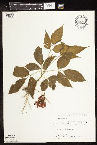 Acer negundo L. 728508[1093404]Lustig, K. 3341979-05-31 United States, Minnesota, Sherburne, Mississippi River Islands Scientific Natural Area. Sherburne & Wright Cos. ...Mississippi Scenic and Recreational River Islands SNA, Mississippi River River Islands between Monticello and Elk River. Sec. 2, 3, 4, T32N, R26, 27W; sec. 7, 9, 18, R23, 24W. 032N 26W 3, 45.27731 -93.53249 |
MIN:Plants | 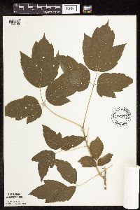 Acer negundo L. 729700[1093403]Cutler, S. 1171980-07-01 United States, Minnesota, Pine, Pine Co. St. Croix Natural Area, 21 mi E of Hinckley; NW1/4 SE1/4 Sec. 32 T41N R17W;Saint Croix State Park;041N;17W;32, 45.99068 -92.51917 |
MIN:Plants | 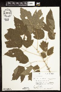 Acer negundo L. 729849[1093289]Converse, C. 5321980-07-29 United States, Minnesota, Pine, Pine Co. Kettle River Natural Area: 5.5 mi E of Hinckley. NE1/4 SE1/4 Sec. 22, T41N, R20W. Edge of Kettle River.;Kettle River Scientific Natural Area / Sandstone National Wildlife Refuge;041N;20W;22, 46.01848 -92.85671 |
MIN:Plants | 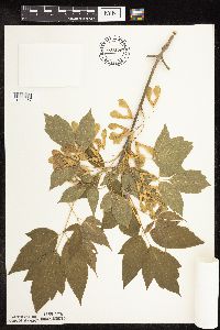 Acer negundo L. 730175[1093457]Converse, C. 1011980-06-03 United States, Minnesota, Chisago, Rush Lake Island Natural Area, 7 mi WSW of Rush City; SE1/4 SW1/4 Sec. 21 T37N R22W;Rush Lake Island Scientific Natural Area;037N;22W;21, 45.6805 -93.09363 |
MIN:Plants | 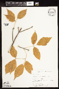 Acer negundo L. 732569[1093405]Petron, T. 4621980-09-25 United States, Minnesota, Becker, Becker Co. Zimmerman Prairie, 10 mi W of Ogema; SE1/4 SW1/4 Sec. 16 T142N R43W;Zimmerman Prairie [TNC];142N;43W;16, 47.11503 -96.14142 |
MIN:Plants | 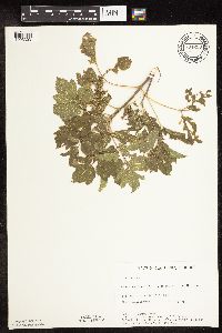 Acer negundo L. 734630[1093303]Petron, T. 3661980-08-27 United States, Minnesota, Clay, Bluestem Prairie: 13 mi. E of Moorhead. NW1/4 NE1/4 Sec. 15, T139N, R46W.;Bluestem Prairie Scientific Natural Area;139N;46W;15, 46.85495 -96.4734 |
MIN:Plants | 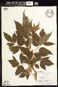 Acer negundo L. 738392[1093307]Galatowitsch, S. 3081982-06-22 United States, Minnesota, Goodhue, Goodhue Co.; Grace Nature Preserve, Zumbro River edge; T109N R18W NW1/4 SW1/4 and SW1/4 SW1/4 Sec. 8;Grace Nature Preserve, The Nature Conservancy;109N;18W;8, 44.262012 -93.010543 |
MIN:Plants | 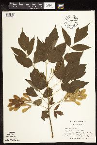 Acer negundo L. 738679[1093332]Galatowitsch, S. 2051982-06-07 United States, Minnesota, Wabasha, SE1/4 and E1/2 NE1/4 of Sec. 7; NW1/4 and W1/2 NE1/4 of Sec. 8;Kellogg-Weaver Dunes Scientific Natural Area / Kellogg-Weaver Dunes, The Nature Conservancy;109N;09W;, 44.2331079 -91.9172451 |
MIN:Plants |  Acer negundo L. 738713[1093308]Galatowitsch, S. 2411982-06-11 United States, Minnesota, Houston, Houston Co.; Caledonia Oaks; T102N R5W E1/2 SW1/4 Sec. 24;Caledonia Oaks, The Nature Conservancy;102N;05W;24, 43.6231 -91.38242 |
MIN:Plants |  Acer negundo L. 739890[1093450]Converse, C. 7381982-05-06 United States, Minnesota, Douglas, Staffanson Prairie; T127N R40W NW1/4 NE1/4 and NE1/4 NW1/4 Sec. 18;Staffanson Prairie, The Nature Conservancy;127N;40W;18, 45.81067 -95.74801 |
MIN:Plants |  Acer negundo L. 739898[1093434]Converse, C. 8281982-05-24 United States, Minnesota, Pope, Ordway Prairie; NE1/4 SW1/4 Sec. 19 T123N R36W;Ordway Prairie, The Nature Conservancy;123N;36W;19, 45.44867 -95.24502 |
MIN:Plants |  Acer negundo L. 740127[1093433]Converse, C. 7341982-05-05 United States, Minnesota, Pope, Moe Woods; SE1/4 SW1/4 Sec. 34 T123N R36W;Moe Woods, The Nature Conservancy;123N;36W;34, 45.41981 -95.18334 |
MIN:Plants | 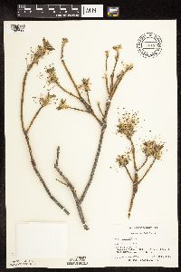 Acer negundo L. 740194[1093302]Converse, C. 7141982-04-27 United States, Minnesota, Chippewa, Chippewa and Swift Counties...SE1/4 SW1/4 Sec. 12. Chippewa Prairie: T119N R43W;Chippewa Prairie, The Nature Conservancy;119N;43W;12, 45.13021 -95.99057 |
MIN:Plants | 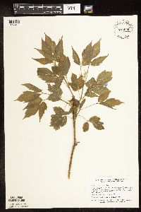 Acer negundo L. 745099[1093406]Smith, Welby 38361981-05-19 United States, Minnesota, Mower, Wild Indigo Scientific Natural Area. Wild Indigo Scientific and Natural Area, ca. 1/2 mi SW of the jnc of st. hwy 56 and co. hwy 2 in Brownsdale; SE1/4 SW1/4 Wild Indigo Scientific and Natural Area, ca. 1/2 mi SW of the jnc of st. hwy 56 and co. hwy 2 in Brownsdale; SE1/4 SW1/4 Sec. 9 T103N R17W. 103N 17W 9, 43.73963 -92.87924 |
MIN:Plants | 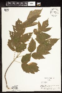 Acer negundo L. 747279[1093334]Galatowitsch, S. 4841982-07-16 United States, Minnesota, Rice, Rice County...Trout Lily Preserve: T110N R20W S1/2 NW1/4 SW1/4 of Sec. 20; part of NE1/4 SE1/4 Sec. 19;Cannon River Trout Lily Scientific Natural Area;110N;20W;00, 44.32689 -93.22194 |
MIN:Plants | 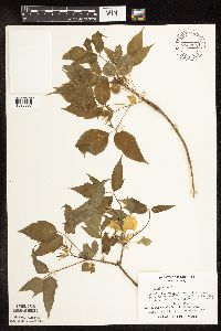 Acer negundo L. 753204[1093357]Boe, J. 18801983-06-06 United States, Minnesota, Kittson, Norway Dunes; SE1/4 SE1/4 Sec. 10 T160N R46W;Norway Dunes, The Nature Conservancy;160N;46W;10, 48.69574 -96.57277 |
MIN:Plants | 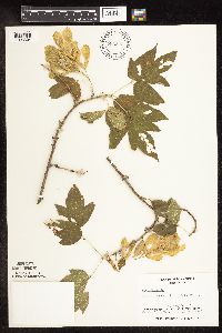 Acer negundo L. 753223[1093304]Boe, J. 20831983-08-27 United States, Minnesota, Kittson, Norway Dunes; NW1/4 SE1/4 Sec. 10 T160N R46W;Norway Dunes, The Nature Conservancy;160N;46W;10, 48.69574 -96.57277 |
MIN:Plants | 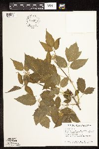 Acer negundo L. 757884[1093359]Smith, Welby 59691982-05-18 United States, Minnesota, Mower, Racine Prairie Scientific Natural Area. Mower Co.; Racine Prairie State Scientific and Natural Area, adjacent to the east side of U.S. Trunk hwy 63, about 2 mi north of Racine; NE1/4 NE1/4 Sec. 22 T104N R14W. 104N 14W 22, 43.79764 -92.49927 |
MIN:Plants | 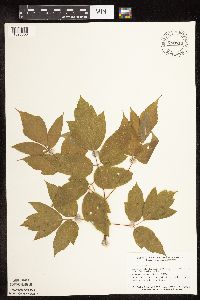 Acer negundo L. 758810[1093358]Smith, Welby 63611982-06-15 United States, Minnesota, Rice, Ca. 3 1/4 mi due S of Dundas, in the Cannon River Valley; NE1/4 NE1/4 Sec.;Cannon River Wilderness Park;111N;20W;34, 44.37765 -93.21131 |
MIN:Plants | 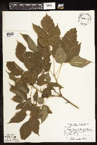 Acer negundo L. 770279[1093336]Smith, Welby 82661983-07-14 United States, Minnesota, Wabasha, Kellogg-Weaver Dunes Scientific Natural Area / Kellogg-Weaver Dunes, The Nature Conservancy. Kellogg-Weaver Dunes State Scientific and Natural Area, ca. 4 mi SE of Kellogg, on the E side of co. rd 84; NW1/4 NE1/4 Kellogg-Weaver Dunes State Scientific and Natural Area, ca. 4 mi SE of Kellogg, on the E side of co. rd 84; NW1/4 NE1/4 Sec. 6 T109N R9W. 109N 09W 6, 44.27261 -91.93898 |
MIN:Plants | 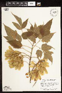 Acer negundo L. 770280[1093389]Smith, Welby 83601983-07-25 United States, Minnesota, Wabasha, Kellogg-Weaver Dunes Scientific Natural Area / Kellogg-Weaver Dunes, The Nature Conservancy. Kellogg-Weaver Dunes State Scientific and Natural Area, ca. 4 mi SE of Kellogg, on the E side of co. rd 84; NW1/4 NE1/4 Kellogg-Weaver Dunes State Scientific and Natural Area, ca. 4 mi SE of Kellogg, on the E side of co. rd 84; NW1/4 NE1/4 Sec. 6 T109N R9W. 109N 09W 6, 44.27261 -91.93898 |
MIN:Plants | 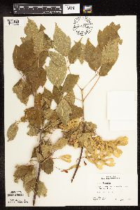 Acer negundo L. 772789[1093388]Boe, J. 13111979-08-03 United States, Minnesota, Lake of the Woods, Zippel Bay State Park, near swimming beach; NW1/4 Sec. 12 T162N R33W;Zippel Bay State Park;162N;33W;12, 48.86589 -94.83897 |
MIN:Plants | 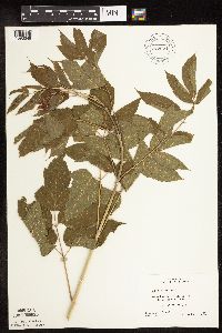 Acer negundo L. 772971[1093349]Boe, J. 17151980-07-22 United States, Minnesota, Lake of the Woods, On bank of south fork of Rapid River; Sec. 14 T157N R33W;;157N;33W;14, 48.4172 -94.85246 |
MIN:Plants | 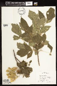 Acer negundo L. 774084[1093387]Boe, J. 15641979-08-18 United States, Minnesota, Lake of the Woods, Northwest Angle, N of Stony Point near mouth of Stony Creek; Sec. 35 T166N R35W;Northwest Angle;166N;35W;35, 49.15707 -95.12582 |
MIN:Plants |  Acer negundo L. 778301[1093435]Duxbury, Alexis 24721983-09-05 United States, Minnesota, Nobles, Nobles Co.; Compass Prairie; SE1/4 SW1/4 Sec. 3 T101N R41W;Compass Prairie Scientific Natural Area;101N;41W;3, 43.58011 -95.74385 |
MIN:Plants |  Acer negundo L. 778302[1093333]Duxbury, Alexis 11581983-06-04 United States, Minnesota, Lincoln, Lincoln County...Hole-in-the Mountain Prairie: Portions of S1/2 Sec. 19, and SW1/4 Sec. 20; T109N, R45W.;Hole-in-the-Mountain Prairie, The Nature Conservancy;109N;45W;00, 44.24108 -96.26172 |
MIN:Plants |  Acer negundo L. 778304[1093386]Duxbury, Alexis 11021983-05-30 United States, Minnesota, Lyon, Glynn Prairie; S1/2 NE1/4 Sec. 7 T109N R40W;Glynn Prairie Scientific Natural Area;109N;40W;7, 44.2755 -95.60351 |
MIN:Plants |  Acer negundo L. 781261[1093413]Smith, Welby 93171984-06-23 United States, Minnesota, Mower, Lake Louise State Park. Lake Louise State Park, ca. 1 mi. NNW of Le Roy. On the banks of the Upper Iowa River. NW1/4 NE1/4 Sec. 28, T101N, R14 Lake Louise State Park, ca. 1 mi. NNW of Le Roy. On the banks of the Upper Iowa River. NW1/4 NE1/4 Sec. 28, T101N, R14W.. 101N 14W 28, 43.5221 -92.51896 |
MIN:Plants |  Acer negundo L. 782370[1093396]Tenney, M. 4391982-07-15 United States, Minnesota, Fillmore, Forestville State Park, beside ditch and road; T102N R12W Sec. 13 NW1/4 NW1/4 SE1/4;Forestville State Park;102N;12W;13, 43.63772 -92.21927 |
MIN:Plants |  Acer negundo L. 782519[1093371]Tenney, M. 2951982-06-29 United States, Minnesota, Winona, Whitewater State Park. Winona Co. T107N, R10W, Sec. 20, SE1/4 SW1/4 SW1/4.;Whitewater Wildlife Management Area;107N;10W;20, 44.0565 -92.04952 |
MIN:Plants |  Acer negundo L. 787632[1093288]Smith, Welby 106811985-07-11 United States, Minnesota, Goodhue, On the banks of the Cannon River, ca. 2.5 mi. E of Welch. SW1/4 SW1/4 of sec;;113N;16W;25, 44.56481 -92.68238 |
MIN:Plants |  Acer negundo L. 787638[1093280]Smith, Welby 106351985-07-01 United States, Minnesota, Wright, Wright Co. Near the SW shore of Schmidt Lake. NW1/4 SE1/4 Sec. 25, T120N, R25W.;M Schmidt Crawford Woods Scientific Natural Area;120N;25W;25, 45.17276 -93.77599 |
MIN:Plants |  Acer negundo L. 788897[1093282]Smith, Welby 103331985-05-30 United States, Minnesota, Le Sueur, Le Sueur County ... Richter Woods County Park, about 2 mi W of Montgomery. NW1/4 SE1/4 Sec. 8. T111N, R23W;Richter Woods County Park;111N;23W;8, 44.4333344 -93.6138916 |
MIN:Plants |  Acer negundo L. 789535[1093344]Smith, Welby 101571985-05-27 United States, Minnesota, Hennepin, Wolsfeld Woods SNA. Hennepin County ... Wolsfeld Woods State Scientific and Natural Area, about 2 1/2 mi. W of Plymouth. SW1/4 NE1/4 Sec. 27, T118N, R23W. 118N 23W 27, 45.002224 -93.5733337 |
MIN:Plants |  Acer negundo L. 789643[1093281]Smith, Welby 101911985-05-28 United States, Minnesota, Jackson, Kilen Woods State Park. Kilen Woods State Park, ca. 8 mi. NNW of Jackson. On a NE-facing bluff in the Des Moines River Valley. SW1/4 NE1/4 Sec Kilen Woods State Park, ca. 8 mi. NNW of Jackson. On a NE-facing bluff in the Des Moines River Valley. SW1/4 NE1/4 Sec. 17, T103N, R35W.. 103N 35W 17, 43.72481 -95.06465 |
MIN:Plants |  Acer negundo L. 792293[1093374]Smith, Welby 107021985-07-12 United States, Minnesota, Olmsted, Olmstead County ... South Branch Zumbro River, about 2.5 mi WSW of Orono; NW1/4 NE1/4 Sec. 23 T108N R15W;;108N;15W;23, 44.148056 -92.5863876 |
MIN:Plants | 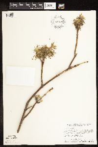 Acer negundo L. 802852[1093325]Smith, Welby 113661986-04-20 United States, Minnesota, Anoka, Lamprey Pass Wildlife Management Area. Anoka County ... Lamprey Pass State Wildlife Management Area, about 2 mi SW of Forest Lake ... NW1/4 SE1/4 NW1/4 SE1/4 Sec. 13 T32N R22W. 032N 22W 13, 45.259749 -93.027391 |
MIN:Plants | 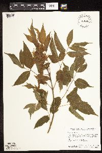 Acer negundo L. 803025[1093354]Smith, Welby 117901986-06-14 United States, Minnesota, Olmsted, Oxbow County Park. Olmsted County ... Oxbow County Park, about 3 mi N of Byron, on the banks of the Zumbro River; NW1/4 NW1/4 Sec. 17 T107N R15W. 107N 15W 17, 44.0769463 -92.6538925 |
MIN:Plants | 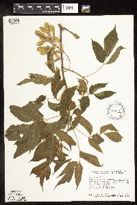 Acer negundo L. 804660[1093315]Smith, Welby 116201986-06-03 United States, Minnesota, Mower, Brandt-Larson Wildlife Management Area. Mower County ... Brandt-Larson State Wildlife Management Area, about 4 mi NE of Lyle, along Otter Creek ... NE1/4 SW1/4 Sec. 16 T 101N R 17W. 101N 17W 16, 43.5469437 -92.8813858 |
MIN:Plants | 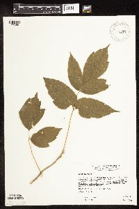 Acer negundo L. 814775[1093284]Wheeler, Gerald 109521988-06-26 United States, Minnesota, Traverse, Ca. 3 mi SW of Wheaton, E of rte 27, near airport, bordering the Mustinka River (S bank); N1/2 N1/2 Sec. 26 T127N R47W ( Ca. 3 mi SW of Wheaton, E of rte 27, near airport, bordering the Mustinka River (S bank); N1/2 N1/2 Sec. 26 T127N R47W (Lake Twp.). 127N 47W 26, 45.78135 -96.54189 |
MIN:Plants | 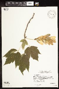 Acer negundo L. 816345[1093316]Wheeler, Gerald 120101988-09-02 United States, Minnesota, Wilkin, Breckenridge (W side), Welles Memorial Park, bordering the Red River; NW1/4 Sec. 9 T132N R47W (Breckenridge Twp.);;132N;47W;9, 46.2567 -96.59435 |
MIN:Plants |  Acer negundo L. 833779[1093353]Smith, Welby 140131988-05-14 United States, Minnesota, Benton, Benton County ... Sartell State Wildlife Management Area, about 2 mi NE of Rice; SW1/4 SW1/4 sec.15, T38N R31W;Sartell Wildlife Management Area;038N;31W;15, 45.786582 -94.186232 |
MIN:Plants |  Acer negundo L. 833836[1093451]Smith, Welby 141461988-05-31 United States, Minnesota, Lac Qui Parle, Lac Qui Parle Co. About 11 mi S-SW of Madison. NE1/4 NW1/4 sec 9, T116N R45W;;116N;45W;9, 44.87061 -96.28626 |
MIN:Plants |  Acer negundo L. 833944[1093355]Smith, Welby 140361988-05-20 United States, Minnesota, Kanabec, Kanabec County ... On the W side of the Snake River, just S of the Hwy 3 crossing. NE1/4 NW1/4 sec 22, T41N R23W;;041N;23W;22, 46.0238876 -93.2333298 |
MIN:Plants | 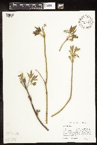 Acer negundo L. 834886[1093301]Haferman, J. 411995-05-06 United States, Minnesota, Scott, Scott Co. T115N R22W S36 SW of SW. Approx. 0.1 mi N-NE of intersection of State Hwy.13 and Co. Rd.44 on N side of hwy;;115N;22W;36, 44.72459 -93.40903 |
MIN:Plants | 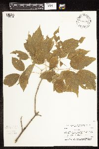 Acer negundo L. 837370[1093448]Smith, Welby 175731990-07-31 United States, Minnesota, Morrison, Camp Ripley Military Reservation. Camp Ripley Military Reservation. Morrison Co. On the N side of Livorno trail where it intersects East Boundary Road; UT Camp Ripley Military Reservation. Morrison Co. On the N side of Livorno trail where it intersects East Boundary Road; UTM: 392700E 5121400N T132N R30W SE1/4 of SE1/4 of Sec 13.. 132N 30W 13, 46.24572 -94.402 |
MIN:Plants | 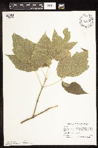 Acer negundo L. 838358[1093369]Smith, Welby 178711990-08-08 United States, Minnesota, Pennington, Pennington County ... At the southeast end of the town of St. Hilaire ... T152N R43W SE1/4 of SE1/4 of Se;;152N;43W;6, 48.0077782 -96.2050018 |
MIN:Plants | 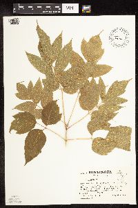 Acer negundo L. 508146[1093362]Kaul, R. 71451992-08-04 United States, Minnesota, Saint Louis, St. Louis Co.; cliff on shore of Lake Superior, Duluth;;050N;14W;, 46.81158 -92.11904 |
MIN:Plants |  Acer negundo L. 909129[1093321]Treiber, E.; et al. 172008-09-25 United States, Minnesota, Ramsey, Ramsey Co, Como Park, approx 129 meters southeast of Hamline Ave N and Horton Ave intersection.;;029N;23W;22, 44.9766667 -93.1563889 |
MIN:Plants | Acer negundo L. 511274[]Arboretum, Cary 73-11973-00-00 United States, New York, Dutchess, Dutchess Co. |
MIN:Plants | Acer negundo L. 511275[]US Nat. Arboretum staff s.n.1981-00-00 United States, Maryland, Prince Georges, Prince George's Co. |
MIN:Plants |  Acer negundo L. 899537[1093490]Smith, Welby 273371998-07-09 United States, Minnesota, Mahnomen, Mahnomen County...On the north side of McCraney Lake, about 12 mi east of Waubun...T143N R40W SE1/4 of NW1/4 of Sec 25;White Earth Indian Reservation / White Earth State Forest;143N;40W;25, 47.1722222 -95.6933333 |
MIN:Plants | Acer negundo L. 511273[]Bright, R. 71-171971-00-00 United States, Idaho, Franklin, [no further data] |
MIN:Plants | Acer negundo L. 511272[]Bright, R. 71-31971-00-00 United States, Idaho, Franklin, [no further data] |
MIN:Plants |  Acer negundo L. 508174[1093328]Kaul, R. 62011988-08-05 United States, Minnesota, Steele, Steele Co.; slope above the Straight River, near the Lemond Road, Owatonna.;;107N;20W;, 44.06611 -93.22607 |
MIN:Plants |  Acer negundo L. 508178[1093366]Kaul, R. 71641992-08-26 United States, Minnesota, Steele, Steele Co.; slope above Lemond Road by Straight River, Owatonna.;;107N;20W;, 44.06611 -93.22607 |
Google Map
Google Maps is a web mapping service provided by Google that features a map that users can pan (by dragging the mouse) and zoom (by using the mouse wheel). Collection points are displayed as colored markers that when clicked on, displays the full information for that collection. When multiple species are queried (separated by semi-colons), different colored markers denote each individual species.