University of Minnesota
http://www.umn.edu/
612-625-5000
http://www.umn.edu/
612-625-5000
Minnesota Biodiversity Atlas
Bell Museum
Dataset: MIN-Plants
Taxa: Sapindaceae
Search Criteria: excluding cultivated/captive occurrences
Bell Museum plants | |
 MIN:Plants | Acer ginnala Maxim. []Timothy J. S. Whitfeld 32012022-06-16 United States, Minnesota, Washington, Crystal Spring Scientific and Natural Area, 0.4 miles northeast of the intersection of Scandia Trail North and Hwy 95, 45.262375 -92.768363, 285m |
MIN:Plants |  Acer grandidentatum Nuttall 680296[1095068]Bright, R. 74-2361974-09-26 United States, Idaho, Franklin, Franklin Co, north end of Oneida Reservoir ... 17.5 mi NNE of Preston;;;;, 42.33057 -111.74507, 1433m |
MIN:Plants |  Acer spicatum Lamarck 429321[1094151]Smith, Welby 249061994-07-26 United States, Minnesota, Aitkin, about one mile west of Shumway Lake ...T50N R22W SW1/4 of SE1/4 of Sec 7;Savanna Portage State Park;050N;22W;07, 46.8286111 -93.1744444 |
MIN:Plants |  Acer spicatum Lamarck 429355[1094049]Smith, Welby 278381999-05-28 United States, Minnesota, Marshall, Caldwell Brook Cedar Swamp Scientific Natural Area. Marshall County ... Thief Lake State Wildlife Management area; about 5 miles NE of Gatzke ... T158N R39W NW1/4 of SW1/4 of Sec 19. 158N 39W 19, 48.4877778 -95.7297222 |
MIN:Plants |  Acer spicatum Lamarck 477391[1094130]Smith, Welby 291022000-09-08 United States, Minnesota, Cook, Superior National Forest. Cook County ... USFS campground at Temperance River; about 6 miles north of Tofte on Co Hwy 2 ... T 60N R 4W SE1/4 of NW1/4 of Sec 33. 060N 04W 33, 47.6399994 -90.8469467 |
MIN:Plants | 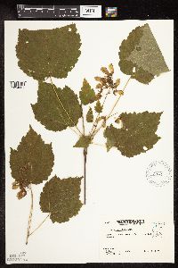 Acer spicatum Lamarck 483666[1094061]Kaul, R.; et al. 66541989-07-14 United States, Minnesota, Hubbard, Hubbard County...west side of Rose Lake;;;;, 47.08 -95.125 |
MIN:Plants | 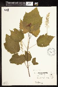 Acer spicatum Lamarck 483667[1094062]Kaul, R. 63841989-07-14 United States, Minnesota, Hubbard, Hubbard Co.; by Mary Lake;Itasca State Park;143N;35W;, 47.19579 -95.10779 |
MIN:Plants | 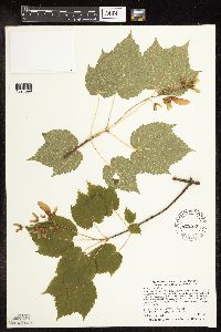 Acer spicatum Lamarck 479242[1094099]Smith, Welby 287112000-07-11 United States, Minnesota, Aitkin, Rice Lake National Wildlife Refuge. Aitkin County ... Rice Lake National Wildlife Refuge; about 5 miles S-SW of McGregor ... T 47N R 24W SE1/4 of SW1/4 of Sec 23. 047N 24W 23, 46.538887 -93.3422241 |
MIN:Plants | 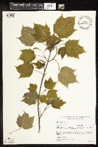 Acer spicatum Lamarck 482447[1094144]Gerdes, Lynden; et al. 24561998-05-22 United States, Minnesota, Cook, Boundary Waters Canoe Area Wilderness / Superior National Forest. T64N R03E S03NWNE. Cook County; Superior National Forest, BWCAW. In vicinity of portage between John Lake and the Royal River. Riparian zone between river and upland.. 064N 03E 3, 48.05748 -90.04601 |
MIN:Plants | 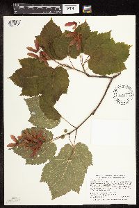 Acer spicatum Lamarck 429167[1094131]Smith, Welby 289142000-08-08 United States, Minnesota, Lake, Lake County ... Tettegouche State Park, about one mile west of Illgen City ... T 56N R 7W NW1/4 of SE1/4 of Sec 10;North Shore / Tettegouche State Park;056N;07W;10, 47.3463898 -91.2050018 |
MIN:Plants | 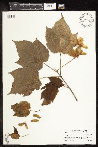 Acer spicatum Lamarck 461778[1094143]Little Jr., Elbert 427761991-07-22 United States, Minnesota, Cook, Cook Co.; Near Hovland fire tower, 5 mi N of Hovland;Grand Portage State Forest / North Shore;062N;03E;, 47.84984 -90.06495 |
MIN:Plants | 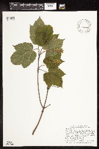 Acer spicatum Lamarck 916889[1094052]Smith, Welby; et al. 312972009-06-27 United States, Minnesota, Cook, Boundary Waters Canoe Area Wilderness / Superior National Forest. Cook County...Boundary Waters Canoe Area Wilderness, Superior National Forest. Just southeast of Frost Lake...T64N R 4W NW1/4 of NW1/4 of sec 35. 064N 04W 35, 47.9875 -90.8066667 |
MIN:Plants | 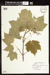 Acer spicatum Lamarck 910907[1094148]Smith, Welby 247531994-07-14 United States, Minnesota, Koochiching, Koochiching State Forest. Koochiching County...Along the Big Fork River, about 15 miles south of the town of Big Fork...T 63N R 27W NW1/4 of NE1/4 of Sec 14. 063N 27W 14, 47.9538889 -93.755 |
MIN:Plants | 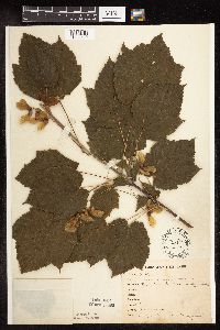 Acer spicatum Lamarck 151164[1094140]Bergman, H. 29091913-08-01 United States, Minnesota, Itasca, Deer River, Quadrat 1;;;;, 47.33306 -93.7925 |
MIN:Plants | 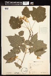 Acer spicatum Lamarck 151166[1094161]Bergman, H. 29261913-09-01 United States, Minnesota, Saint Louis, Ely;;;;, 47.90333 -91.86694 |
MIN:Plants | 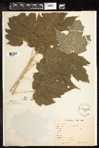 Acer spicatum Lamarck 151167[1094189]Bergman, H. 31691914-09-04 United States, Minnesota, Hubbard, Benedict, transect 2;;143N;32W;35, 47.15729 -94.6957 |
MIN:Plants | 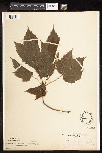 Acer spicatum Lamarck 151168[1094174]MacMillan, C.; et al. 2051894-06-01 United States, Minnesota, Lake of the Woods, Garden Island, Lake of the Woods;Northwest Angle;166N;33W;00, 49.19326 -94.89383 |
MIN:Plants | 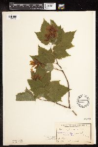 Acer spicatum Lamarck 151191[1094070]Anderson, A. An6261893-07-00 United States, Minnesota, Cass, Gull Lake [assuming Cass Co.];;;;, 46.41083 -94.35333 |
MIN:Plants | 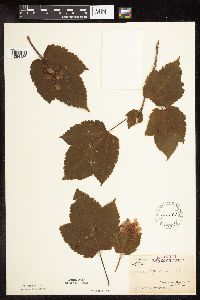 Acer spicatum Lamarck 151192[1094126]Arthur, J.; et al. B2281886-07-22 United States, Minnesota, Saint Louis, Vermilion Lake;;;;, 47.89167 -92.36667 |
MIN:Plants | 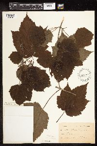 Acer spicatum Lamarck 151193[1094048]Roberts, Thomas s.n.1878-06-00 United States, Minnesota, Saint Louis, Duluth;;;;, 46.78333 -92.10639 |
MIN:Plants | 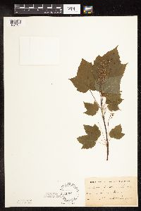 Acer spicatum Lamarck 151194[1094183]Lugger, O. s.n.1891-00-00 United States, Minnesota, Saint Louis, Tower;;;;, 47.80556 -92.27444 |
MIN:Plants |  Acer spicatum Lamarck 151195[1094077]Wheeler, William 6251899-08-24 United States, Minnesota, Houston, Brownsville;;103N;04W;, 43.71854 -91.31739 |
MIN:Plants |  Acer spicatum Lamarck 151196[1094184]Sheldon, Edmund S26591892-06-00 United States, Minnesota, Aitkin, Nichols;;044N;27W;04, 46.32387 -93.75721 |
MIN:Plants |  Acer spicatum Lamarck 151197[1094069]Ballard, C. s.n.1893-07-00 United States, Minnesota, Cass, Lake Kilpatrick;;135N;29W;, 46.5001626 -94.3290802 |
MIN:Plants |  Acer spicatum Lamarck 151198[1094167]Rosendahl, C. s.n.1902-06-00 United States, Minnesota, Houston, Spring Grove;;101N;07W;, 43.54392 -91.6707 |
MIN:Plants |  Acer spicatum Lamarck 151199[1094168]Rosendahl, C. 4141902-06-08 United States, Minnesota, Houston, Spring Grove;;101N;07W;, 43.54392 -91.6707 |
MIN:Plants | 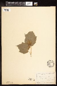 Acer spicatum Lamarck 151200[1094158]Manning, Sara s.n.1883-07-20 United States, Minnesota, Wabasha, Lake City;;111N;12W;04, 44.44702 -92.25898 |
MIN:Plants | 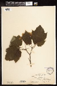 Acer spicatum Lamarck 151201[1094134]Rosendahl, C. 26101912-08-22 United States, Minnesota, Cook, Kimball Creek, E of Grand Marais;North Shore / Superior National Forest;061N;02E;, 47.79067 -90.20599 |
MIN:Plants |  Acer spicatum Lamarck 151202[1094103]Sandberg, John s.n.1885-06-00 United States, Minnesota, Saint Louis, Tower;;062N;15W;32, 47.80802 -92.27645 |
MIN:Plants | 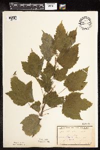 Acer spicatum Lamarck 151203[1094180]Ballard, C. B12931893-06-00 United States, Minnesota, Cass, Gull Lake;;N;;, 46.41083 -94.35333 |
MIN:Plants | 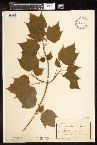 Acer spicatum Lamarck 151204[1094040]Sheldon, Edmund S22081892-06-00 United States, Minnesota, Mille Lacs, Mille Lacs Lake;;;;, 46.23333 -93.65 |
MIN:Plants |  Acer spicatum Lamarck 151205[1094101]Wheeler, William 2821899-06-00 United States, Minnesota, Winona, Winona;;107N;06W;00, 44.02403 -91.57548 |
MIN:Plants |  Acer spicatum Lamarck 151206[1094105]Roberts, Thomas s.n.1879-07-00 United States, Minnesota, Lake, Knife River;North Shore;052N;11W;31, 46.94743 -91.78709 |
MIN:Plants |  Acer spicatum Lamarck 151207[1094072]Aiton, G. s.n.1891-07-00 United States, Minnesota, Clearwater, Lake Itasca;Itasca State Park;143N;36W;, 47.19557 -95.23322 |
MIN:Plants |  Acer spicatum Lamarck 151208[1094175]Roberts, Thomas s.n.1898-07-00 United States, Minnesota, Saint Louis, Duluth;;;;, 46.78333 -92.10639 |
MIN:Plants |  Acer spicatum Lamarck 151209[1094127]Butters, F.; et al. 39661920-07-02 United States, Minnesota, Winona, North base of Gwinn's Bluff.;Great River Bluffs State Park;106N;05W;, 43.9633279 -91.4396202 |
MIN:Plants |  Acer spicatum Lamarck 151210[1094081]Butters, F.; et al. 39361920-06-28 United States, Minnesota, Houston, near old quarry, S17, Mayville twp. Houston Co.;;102N;05W;17, 43.65261 -91.48176 |
MIN:Plants |  Acer spicatum Lamarck 151211[1094035]Butters, F. s.n.1920-05-31 United States, Minnesota, Wabasha, lower end of Lake Pepin;;;;, 44.43333 -92.175 |
MIN:Plants |  Acer spicatum Lamarck 151212[1094197]Butters, F. s.n.1918-09-00 United States, Minnesota, Saint Louis, NE St. Louis Co.;;N;;, 47.58 -92.46 |
MIN:Plants | 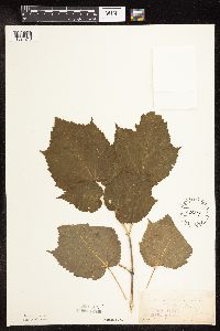 Acer spicatum Lamarck 151213[1094210]Sandberg, John s.n.1883-08-15 United States, Minnesota, Wabasha, Lake City;;111N;12W;04, 44.44702 -92.25898 |
MIN:Plants | 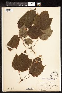 Acer spicatum Lamarck 151214[1094141]Rosendahl, C. 23671909-08-28 United States, Minnesota, Slopes near Pelican Lake;;;;, 46.576164 -94.176031 |
MIN:Plants | 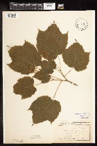 Acer spicatum Lamarck 151215[1094034]Wheeler, William 1631899-06-10 United States, Minnesota, Houston, Winnebago Valley;Dorer Memorial Hardwood State Forest;;;, 43.66667 -91.50056 |
MIN:Plants | 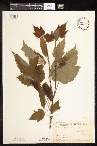 Acer spicatum Lamarck 151216[1094192]Sheldon, Edmund s.n.1892-07-00 United States, Minnesota, Mille Lacs, Milaca;;037N;27W;, 45.69205 -93.69879 |
MIN:Plants | 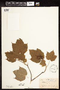 Acer spicatum Lamarck 151217[1094073]Sandberg, John 4261891-07-07 United States, Minnesota, Carlton, Thompson [sic];;048N;16W;00, 46.6342494 -92.3645882 |
MIN:Plants | 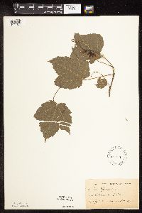 Acer spicatum Lamarck 151218[1094194]Herrick, C. s.n.1884-07-00 United States, Minnesota, Carlton, St. Louis River [prob near Wisconsin line];Jay Cooke State Park;048N;15W;, 46.649665 -92.330748 |
MIN:Plants | 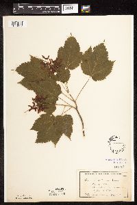 Acer spicatum Lamarck 151219[1094102]Wheeler, William 3191899-07-10 United States, Minnesota, Houston, Mayville, Houston Co.;;102N;05W;00, 43.63068 -91.43198 |
MIN:Plants | 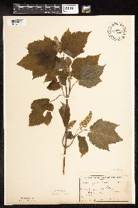 Acer spicatum Lamarck 151220[1094096]Sheldon, Edmund S48301893-06-00 United States, Minnesota, Lake, Waldo, Lake Co. [old village about 3 miles northward from Two Harbors];;053N;11W;23, 47.06187 -91.69931 |
MIN:Plants | 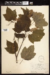 Acer spicatum Lamarck 224475[1094098]Butters, F.; et al. 44711924-06-29 United States, Minnesota, North Shore Lake Superior;;;;, 47.42065 -91.09863 |
MIN:Plants | 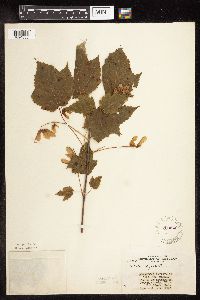 Acer spicatum Lamarck 262040[1094053]Stork, H. 12281925-06-00 United States, Minnesota, Itasca, Bowstring;Chippewa National Forest;;;, 47.54306 -93.79639 |
MIN:Plants | 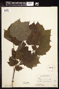 Acer spicatum Lamarck 262282[1094179]Butters, F.; et al. 42561922-06-00 United States, Minnesota, Houston, Winnebago Valley;Dorer Memorial Hardwood State Forest;;;, 43.67 -91.49 |
MIN:Plants | 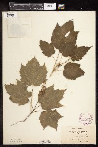 Acer spicatum Lamarck 264203[1094087]Holzinger, John s.n.1901-05-00 United States, Minnesota, Winona, Bluffs S of lake, Winona Co.;;;;, 43.96667 -91.76667 |
MIN:Plants | 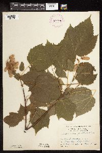 Acer spicatum Lamarck 276206[1094136]Grant, Martin 29851929-08-02 United States, Minnesota, Clearwater, Itasca Park, Lodge road, NW-NW-11, T143, R36;Itasca State Park;143N;36W;11, 47.2175215 -95.2014955 |
MIN:Plants | 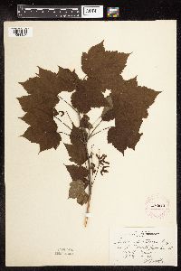 Acer spicatum Lamarck 276914[1094187]Huff, N. 91914-07-02 United States, Minnesota, Lake, North Kawishiwi Riv.;Superior National Forest;;;, 47.905455 -91.717359 |
MIN:Plants | 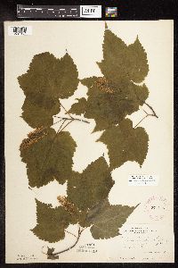 Acer spicatum Lamarck 277115[1094104]Rosendahl, C. 52771927-06-22 United States, Minnesota, Clearwater, East of Floating Bog Bay, Itasca Park;Itasca State Park;143N;36W;11, 47.21752 -95.2015 |
MIN:Plants | 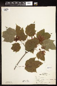 Acer spicatum Lamarck 282819[1094058]Butters, F.; Buell, Murray 4781932-07-20 United States, Minnesota, Cook, 5 mi. W of Grand Marais on Hwy. 1. T61N, R01E.;Superior National Forest;061N;01E;, 47.77746 -90.32524 |
MIN:Plants | 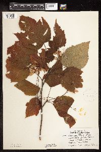 Acer spicatum Lamarck 304434[1094076]Lakela, Olga 13141935-09-17 United States, Minnesota, Saint Louis, N shore of Lake Superior, ca. 13 mi. from Duluth;;;;, 46.78333 -92.10639 |
MIN:Plants | 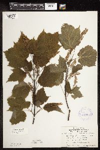 Acer spicatum Lamarck 337090[1094033]Lakela, Olga 14451936-06-23 United States, Minnesota, Saint Louis, St. Louis Bay side, S12, R14W, T49, Duluth;;049N;14W;12, 46.73977 -92.06396 |
MIN:Plants | 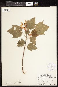 Acer spicatum Lamarck 345527[1094133]Lakela, Olga 23421937-09-04 United States, Minnesota, Saint Louis, NE slope of Hunter's Hill;;;;, 46.8 -92.1 |
MIN:Plants | 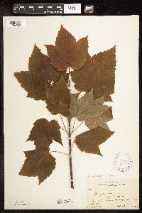 Acer spicatum Lamarck 352050[1094202]Benner, F.; Benner, J. 5091929-07-29 United States, Minnesota, Cook, 1 mi. E of Grand Portage;Grand Portage Indian Reservation / North Shore;063N;06E;, 47.95847 -89.70358 |
MIN:Plants | 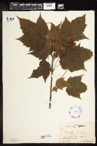 Acer spicatum Lamarck 352687[1094135]Benner, F.; Benner, J. 5671929-07-27 United States, Minnesota, Cook, 1 mi. E of Grand Portage, near lake shore.;Grand Portage Indian Reservation / North Shore;063N;06E;, 47.95847 -89.70358 |
MIN:Plants | 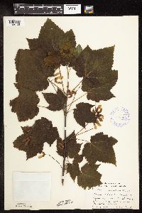 Acer spicatum Lamarck 356652[1094123]Lakela, Olga 31191939-07-08 United States, Minnesota, Saint Louis, Bardon's Peak, Skyline Parkway near Beck Road, Duluth.;;;;, 46.78333 -92.10639 |
MIN:Plants | 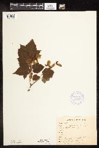 Acer spicatum Lamarck 356904[1094138]Saari, H. 981912-09-07 United States, Minnesota, Saint Louis, Meadowlands;;;;, 47.07194 -92.73222 |
MIN:Plants | 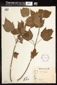 Acer spicatum Lamarck 357026[1094119]Stevenson, J. 351912-06-22 United States, Minnesota, Beltrami, Bemidji;;146N;33W;09, 47.47555 -94.87442 |
MIN:Plants |  Acer spicatum Lamarck 360252[1094137]Lakela, Olga 40491940-08-16 United States, Minnesota, Lake, Lake County...Encampment River, Hwy. 61.;North Shore;053N;10W;11, 47.09341 -91.57419 |
MIN:Plants |  Acer spicatum Lamarck 360273[1094176]Lakela, Olga 35741940-06-16 United States, Minnesota, Saint Louis, Beck's Road near Fond du Lac Jct, Duluth.;;048N;15W;, 46.65701 -92.25726 |
MIN:Plants |  Acer spicatum Lamarck 361440[1094163]Lakela, Olga 36921940-07-04 United States, Minnesota, Cook, Windigo Point, Sea Gull Lake;Boundary Waters Canoe Area Wilderness / Superior National Forest;065N;05W;, 48.149256 -90.887916 |
MIN:Plants |  Acer spicatum Lamarck 362648[1094154]Butters, F.; Moore, John 135891940-09-18 United States, Minnesota, Chisago, 3 mi. N of Taylors Falls;;;;, 45.44538 -92.65222 |
MIN:Plants |  Acer spicatum Lamarck 367153[1094153]Moore, John; Butters, F. 13439A1940-09-03 United States, Minnesota, Carlton, 8 mi. E of Barnum;;;;, 46.50294 -92.52007 |
MIN:Plants |  Acer spicatum Lamarck 367154[1094156]Moore, John; Butters, F. 134391940-09-03 United States, Minnesota, Carlton, 8 mi. E of Barnum;;;;, 46.50294 -92.52007 |
MIN:Plants |  Acer spicatum Lamarck 367199[1094155]Moore, John; Butters, F. 135111940-09-04 United States, Minnesota, Aitkin, along hwy 210, 2 mi E of Tamarack;;048N;22W;, 46.63658 -93.12692 |
MIN:Plants |  Acer spicatum Lamarck 368809[1094120]Lakela, Olga 46321941-07-29 United States, Minnesota, Lake, Lake Superior, Loranger Cottage near Little Marais;North Shore;057N;06W;20, 47.40971 -91.12032 |
MIN:Plants | 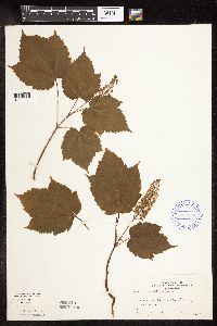 Acer spicatum Lamarck 369200[1094038]Gunderson, Harvey s.n.1940-06-23 United States, Minnesota, Lake, Two Harbors;North Shore;052N;11W;, 47.02278 -91.67056 |
MIN:Plants | 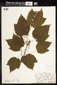 Acer spicatum Lamarck 369263[1094037]Lakela, Olga 43901941-06-22 United States, Minnesota, Saint Louis, Normanna Road, ca 14 mi N of Duluth;;;;, 46.986 -92.10639 |
MIN:Plants | 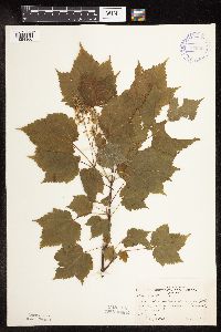 Acer spicatum Lamarck 370095[1094166]Moore, John; et al. 141611941-05-25 United States, Minnesota, Pine, Above the Kettle River, E of Sandstone, Pine Co.;Banning State Park;042N;20W;, 46.11447 -92.86658 |
MIN:Plants | 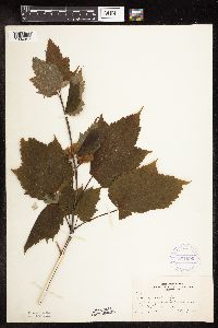 Acer spicatum Lamarck 371690[1094057]Lakela, Olga 48391941-08-17 United States, Minnesota, Cook, Shore of Lake Superior near Tofte. Cook Co.;North Shore / Superior National Forest;059N;04W;, 47.59936 -90.84419 |
MIN:Plants | 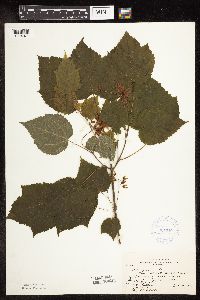 Acer spicatum Lamarck 381148[1094071]Rosendahl, C.; et al. 75251942-06-16 United States, Minnesota, Winona, Along Whitewater River, 3 mi N of Utica at Koehler's pond;;;;, 44.01901 -91.95472 |
MIN:Plants |  Acer spicatum Lamarck 392927[1094178]Lakela, Olga 68621947-06-21 United States, Minnesota, Saint Louis, Island Lake woods, S shore, 19 mi N of Duluth;;053N;14W;, 47.06821 -92.11178 |
MIN:Plants |  Acer spicatum Lamarck 393874[1094089]Dahl, A. 191945-06-16 United States, Minnesota, Cook, Poplar Lake. T64N, R01W, Sec. 6.;Superior National Forest;064N;01W;6, 48.05543 -90.50118 |
MIN:Plants |  Acer spicatum Lamarck 393875[1094083]Burns, G.; Hendrickson, M. 3791938-08-05 United States, Minnesota, Cook, S side Canoe Lake, T64N, T1E;Boundary Waters Canoe Area Wilderness / Superior National Forest;064N;01E;, 48.01924 -90.31793 |
MIN:Plants |  Acer spicatum Lamarck 393876[1094157]Moore, John; Butters, F. 107961939-07-01 United States, Minnesota, Cook, S side of John Lake W of inlet from McFarland Lake;Boundary Waters Canoe Area Wilderness / Superior National Forest;065N;03E;, 48.08161 -90.07641 |
MIN:Plants |  Acer spicatum Lamarck 393877[1094100]Butters, F.; et al. 6611940-07-01 United States, Minnesota, Cook, West side of North Fowl Lake. ;Boundary Waters Canoe Area Wilderness / Superior National Forest;065N;03E;00, 48.08161 -90.07641 |
MIN:Plants |  Acer spicatum Lamarck 405397[1094201]Lakela, Olga 80061949-05-14 United States, Minnesota, Lake, Lake County...Canoe Island in Basswood Lake;Boundary Waters Canoe Area Wilderness / Superior National Forest;064N;10W;10, 48.03273 -91.59564 |
MIN:Plants |  Acer spicatum Lamarck 407372[1094128]Lakela, Olga 95031949-08-28 United States, Minnesota, Saint Louis, Lake Kabetogama near Park Point Resort;Voyageurs National Park;;;, 48.48028 -93.055 |
MIN:Plants | 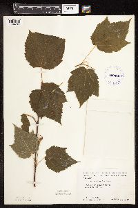 Acer spicatum Lamarck 409140[1094208]Moore, John; et al. 113401939-07-31 United States, Minnesota, Lake of the Woods, American Point. Lake of the Woods Co.;Northwest Angle;168N;33W;, 49.33962 -94.92545 |
MIN:Plants | 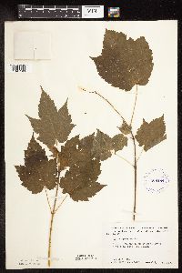 Acer spicatum Lamarck 409194[1094193]Moore, John; et al. 112661939-07-28 United States, Minnesota, Lake of the Woods, On the bank of Pine Creek, 1/2 mi. up from the mouth. Lake of the Woods County.;Northwest Angle;168N;34W;, 49.34462 -95.02889 |
MIN:Plants | 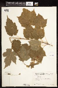 Acer spicatum Lamarck 412180[1094056]Moore, John; et al. 117291939-08-14 United States, Minnesota, Koochiching, Koochiching County...E side of Tilson Bay, T71N, R23W, Rainy Lake.;;071N;23W;, 48.61383 -93.28048 |
MIN:Plants | 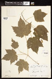 Acer spicatum Lamarck 412339[1094110]Moore, John; et al. 119951939-08-22 United States, Minnesota, Lake of the Woods, mouth of the Rapid River, Clementson. Lake of the Woods Co.;;160N;30W;, 48.66397 -94.49827 |
MIN:Plants | 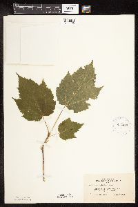 Acer spicatum Lamarck 416855[1094190]Lakela, Olga 83391949-06-20 United States, Minnesota, Saint Louis, Shorewoods of Armstrong Lake, S of Ely.;;062N;14W;14, 47.8521 -92.08324 |
MIN:Plants | 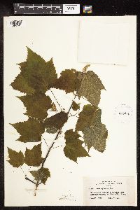 Acer spicatum Lamarck 419411[1094043]Lakela, Olga 103591950-06-11 United States, Minnesota, Saint Louis, Herseth's Vacation Camp, Lake Kabetogama;Voyageurs National Park;;;, 48.43778 -93.02722 |
MIN:Plants | 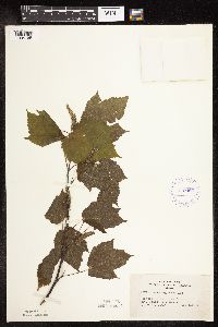 Acer spicatum Lamarck 419460[1094165]Lakela, Olga 103741950-06-13 United States, Minnesota, Saint Louis, St. Louis Co.; Orr;;064N;19W;, 48.021722 -92.765531 |
MIN:Plants | 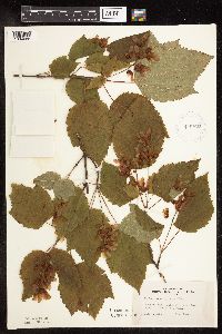 Acer spicatum Lamarck 419470[1094085]Lakela, Olga 111361950-08-06 United States, Minnesota, Saint Louis, Bassett Lake woods, Fairbanks Road, E St. Louis Co;Superior National Forest;;;, 47.36889 -91.90472 |
MIN:Plants | 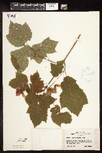 Acer spicatum Lamarck 420059[1094139]Lakela, Olga 112031950-08-02 United States, Minnesota, Saint Louis, Hwy 29, W of Floodwood, near the end of Savanna R.;;;;, 46.92917 -92.91944 |
MIN:Plants | 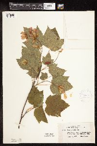 Acer spicatum Lamarck 420756[1094113]Lakela, Olga 115361950-08-21 United States, Minnesota, Saint Louis, St. Louis County...Iron Lake portage, at Curtain Falls, Crooked Lake;Boundary Waters Canoe Area Wilderness / Superior National Forest;066N;12W;06, 48.23079 -91.91703 |
MIN:Plants | 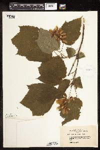 Acer spicatum Lamarck 422616[1094078]Anonymous 76721948-07-24 United States, Minnesota, Carlton, Jay Cooke State Park, near Fond du Lac.;Jay Cooke State Park;048N;16W;, 46.63425 -92.36459 |
MIN:Plants | 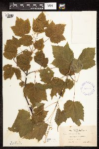 Acer spicatum Lamarck 422641[1094047]Lakela, Olga 75241948-06-19 United States, Minnesota, Saint Louis, Lakewood, Duluth;;;;, 46.86389 -91.9625 |
MIN:Plants | 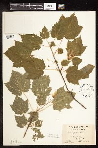 Acer spicatum Lamarck 427824[1094111]Jones, George Neville 184921946-07-25 United States, Minnesota, Saint Louis, Armstrong Lake, near Ely;;062N;14W;, 47.84461 -92.11535 |
MIN:Plants | 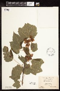 Acer spicatum Lamarck 427845[1094160]Jones, George Neville 181061946-07-15 United States, Minnesota, Saint Louis, Armstrong Lake, near Ely;;062N;14W;, 47.84461 -92.11535 |
MIN:Plants | 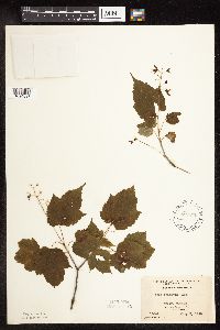 Acer spicatum Lamarck 427846[1094097]Jones, George Neville 180491946-07-05 United States, Minnesota, Saint Louis, Armstrong Lake, near Ely;;062N;14W;, 47.84461 -92.11535 |
MIN:Plants | 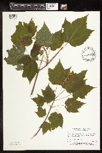 Acer spicatum Lamarck 434830[1094039]Myhre, K. 2122A1992-06-04 United States, Minnesota, Cass, Cass Co.; Located directly west of Inguadona Lake; T 140N R 27W NW1/4 of SW1/4 of Sec 7;;140N;27W;7, 46.9558 -94.1442 |
MIN:Plants |  Acer spicatum Lamarck 442568[1094125]Lakela, Olga 138651951-09-15 United States, Minnesota, Saint Louis, St. Louis Co.; Little Fork River bank at the bridge, Hwy. 1, SW of Orr.;Kabetogama State Forest;064N;20W;, 48.02192 -92.89466 |
Google Map
Google Maps is a web mapping service provided by Google that features a map that users can pan (by dragging the mouse) and zoom (by using the mouse wheel). Collection points are displayed as colored markers that when clicked on, displays the full information for that collection. When multiple species are queried (separated by semi-colons), different colored markers denote each individual species.