University of Minnesota
http://www.umn.edu/
612-625-5000
http://www.umn.edu/
612-625-5000
Minnesota Biodiversity Atlas
Bell Museum
Dataset: MIN-Plants
Taxa: Sapindaceae
Search Criteria: excluding cultivated/captive occurrences
Bell Museum plants | |
 MIN:Plants | 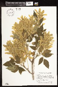 Acer negundo L. 897206[1093277]Smith, Welby 273221998-07-09 United States, Minnesota, Becker, Becker County...At Osage, where State Hwy 4 crosses the Straight River...T 140N R 36W NW1/4 of NE1/4 of Sec 29;;140N;36W;29, 46.9197222 -95.2533333 |
MIN:Plants | 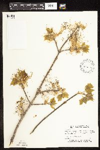 Acer negundo L. 428878[1093340]Myhre, K. 53511995-05-16 United States, Minnesota, Mahnomen, Mahnomen Co.; Located one half mile north of Tamarack Lake; T 145N R 39W SW1/4 of NE1/4 of Sec 15;White Earth Indian Reservation;145N;39W;15, 47.37522 -95.60493 |
MIN:Plants | 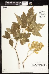 Acer negundo L. 477668[1093489]Smith, Welby 205851992-06-25 United States, Minnesota, Redwood, Redwood County ... In Alexander Ramsey city park in Redwood Falls ... in the Redwood River Valley ... T113N R36W NW1/1 of SE1/4 of Sec 36. 113N 36W 36, 44.5480537 -95.1244431 |
MIN:Plants | 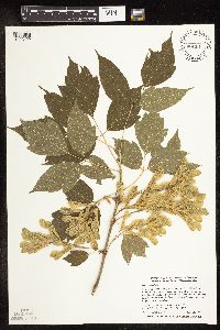 Acer negundo L. 429319[1093429]Smith, Welby 272791998-06-25 United States, Minnesota, Anoka, Anoka County ... Rum River North County Park, about 7 miles NW of East Bethel ... T 134N R 24W NW1/4 of NE1/4 of Sec 32;Rum River County Park;134N;24W;32, 45.3902779 -93.3550034 |
MIN:Plants |  Acer negundo L. 898957[1093367]Smith, Welby 273771998-07-10 United States, Minnesota, Otter Tail, Bluff Creek Wildlife Management Area. Otter Tail County...Bluff Creek State Wildlife Management Area, about 11 mi W of Sebeka...T136N R37W NE1/4 of NW1/4 of Sec 2. 136N 37W 2, 46.6286111 -95.3144444 |
MIN:Plants |  Acer negundo L. 918235[1093382]Smith, Welby 223591993-06-08 United States, Minnesota, Carver, Carver County...Carver Park Reserve; about 5 miles west of Chanhassen...T 116N R 24W SE1/4 of NE1/4 of Sec 11;Carver Park Reserve County Park;116N;24W;11, 44.8716667 -93.6644444 |
MIN:Plants |  Acer negundo L. 913728[1093383]Smith, Welby 227701993-07-09 United States, Minnesota, Rock, Rock County...About 0.5 mile southeast of Luverne...along the Rock River...T102N R45W NE1/4 of SE1/4 of sec 11;;102N;45W;11, 43.6505556 -96.1961111 |
MIN:Plants |  Acer negundo L. 150950[1093418]Taylor, B. T731891-06-00 United States, Minnesota, Le Sueur, Elysian;;109N;24W;, 44.2395 -93.70714 |
MIN:Plants |  Acer negundo L. 150957[1093324]Burglehaus, F. s.n.1891-05-00 United States, Minnesota, Hennepin, Hennepin Co.;;;;, 45.01667 -93.45 |
MIN:Plants |  Acer negundo L. 150958[1093379]Lyon, H. 1191899-06-17 United States, Minnesota, Houston, Winnebago Valley, Houston County;Dorer Memorial Hardwood State Forest;;;, 43.66667 -91.50056 |
MIN:Plants |  Acer negundo L. 150960[1093476]Sheldon, Edmund S10991891-07-00 United States, Minnesota, Brown, Springfield;;;;, 44.23889 -94.97556 |
MIN:Plants |  Acer negundo L. 150961[1093420]Oestlund, O. 120-11888-08-09 United States, Minnesota, Hennepin, Minneapolis;;N;;, 44.98 -93.26361 |
MIN:Plants |  Acer negundo L. 150962[1093432]Sandstein, E. s.n.1891-07-00 United States, Minnesota, Ramsey, St. Anthony Park [St Paul neighborhood near U of M];;029N;23W;, 44.99208 -93.16639 |
MIN:Plants |  Acer negundo L. 150963[1093323]Frost, W. F4831894-04-00 United States, Minnesota, Hennepin, Minneapolis;;N;;, 44.979965 -93.263836 |
MIN:Plants |  Acer negundo L. 150964[1093477]Taylor, B. T1571891-06-00 United States, Minnesota, Waseca, Janesville;;;;, 44.11611 -93.70778 |
MIN:Plants |  Acer negundo L. 150965[1093339]Manning, Sara s.n.1886-00-00 United States, Minnesota, Wabasha, Lake City;;111N;12W;, 44.4081 -92.25245 |
MIN:Plants |  Acer negundo L. 150966[1093453]Butters, F.; et al. 44291924-06-01 United States, Minnesota, Houston, Money Creek Valley, Houston Co.;Dorer Memorial Hardwood State Forest;;;, 43.77722 -91.59861 |
MIN:Plants | 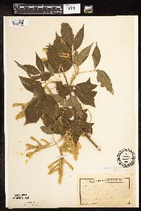 Acer negundo L. 150967[1093472]MacMillan, C.; et al. MS14191894-07-00 United States, Minnesota, Lake of the Woods, Sandy Beach [other collections by M&S indicated this in Northwest Angle];Northwest Angle;;;, 49.16861 -95.07694 |
MIN:Plants | 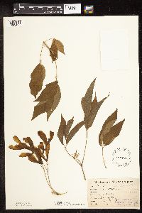 Acer negundo L. 150968[1093427]Lugger, O. s.n.1892-06-14 United States, Minnesota, Ramsey, St. Anthony Park [St Paul neighborhood near U of M];;029N;23W;, 44.99208 -93.16639 |
MIN:Plants | 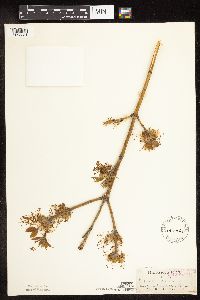 Acer negundo L. 150969[1093331]Sandberg, John s.n.1882-04-00 United States, Minnesota, Goodhue, Cannon Falls;;112N;17W;18, 44.50707 -92.90512 |
MIN:Plants | 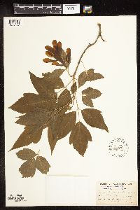 Acer negundo L. 150970[1093470]Burglehaus, F. s.n.1892-05-00 United States, Minnesota, Hennepin, Loc. near Minneapolis, river banks;;;;, 44.98 -93.26361 |
MIN:Plants | 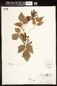 Acer negundo L. 150971[1093421]Holzinger, John s.n.1886-05-00 United States, Minnesota, Winona, Winona Co.;;N;;, 43.96667 -91.76667 |
MIN:Plants | 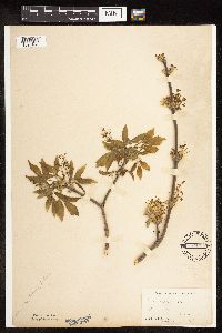 Acer negundo L. 150972[1093461]Moyer, Lycurgus s.n.1896-05-00 United States, Minnesota, Chippewa, Montevideo;;117N;40W;, 44.93463 -95.67577 |
MIN:Plants | 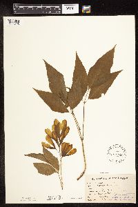 Acer negundo L. 150973[1093428]Lugger, O. s.n.1892-06-14 United States, Minnesota, Ramsey, St. Anthony Park [St Paul neighborhood near U of M];;029N;23W;, 44.99208 -93.16639 |
MIN:Plants | 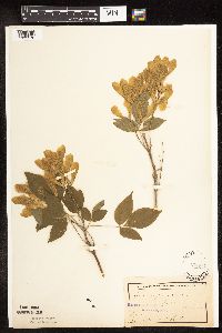 Acer negundo L. 150974[1093378]Frost, W. F1511892-06-00 United States, Minnesota, Meeker, Acton [pioneer village], Meeker Co.;;119N;32W;26, 45.08778 -94.66538 |
MIN:Plants | 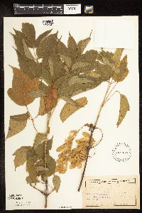 Acer negundo L. 150975[1093437]Anderson, A. A9521894-08-00 United States, Minnesota, Hennepin, Minneapolis;;N;;, 44.98 -93.26361 |
MIN:Plants | 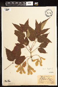 Acer negundo L. 150976[1093377]Aiton, G. s.n.1890-07-00 United States, Minnesota, Hennepin, Excelsior;;;;, 44.90333 -93.56611 |
MIN:Plants |  Acer negundo L. 150977[1093376]MacMillan, C.; et al. 422Sk1900-08-00 United States, Minnesota, Polk, Crookston;;150N;46W;30, 47.782 -96.60007 |
MIN:Plants |  Acer negundo L. 150978[1093394]Oestlund, O. 40-41888-08-22 United States, Minnesota, Hennepin, [no further data];;;;, 45 -93.47 |
MIN:Plants |  Acer negundo L. 150979[1093306]Sheldon, Edmund 1511892-06-00 United States, Minnesota, Meeker, Acton [pioneer village], Meeker Co.;;119N;32W;26, 45.08778 -94.66538 |
MIN:Plants |  Acer negundo L. 150991[1093407]Sheldon, Edmund S1621891-06-00 United States, Minnesota, Blue Earth, Madison Lake;;108N;25W;, 44.15249 -93.82835 |
MIN:Plants |  Acer negundo L. 264156[1093342]Holzinger, John s.n.1901-04-00 United States, Minnesota, Winona, Winona Co.;;;;, 43.96667 -91.76667 |
MIN:Plants |  Acer negundo L. 265413[1093478]Anonymous G2251912-00-00 United States, Minnesota, Rice, Northfield;;;;, 44.45833 -93.16139 |
MIN:Plants | 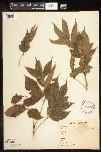 Acer negundo L. 265663[1093479]Anonymous 1051912-07-00 United States, Minnesota, Kandiyohi, Willmar;;119N;35W;, 45.12194 -95.04306 |
MIN:Plants | 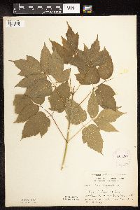 Acer negundo L. 281336[1093419]Moyle, J. 4551931-06-30 United States, Minnesota, Clearwater, Itasca Park. Banks of Lake Itasca near Green Monument. NW1/4 NE1/4 Sec. 11, T143N, R36W.;Itasca State Park;143N;36W;11, 47.21752 -95.2015 |
MIN:Plants | 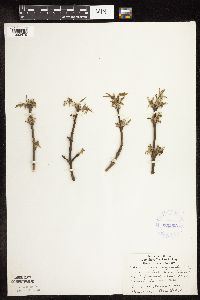 Acer negundo L. 336993[1093475]Lakela, Olga 1348b1936-05-11 United States, Minnesota, Saint Louis, Vacant lot, 4 blocks E from Duluth Ship Canal, Duluth;;050N;14W;, 46.81158 -92.11904 |
MIN:Plants | 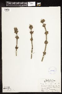 Acer negundo L. 336994[1093474]Lakela, Olga 1348a1936-05-11 United States, Minnesota, Saint Louis, Vacant lot, 4 blocks from Duluth Ship Canal, Duluth;;050N;14W;, 46.81158 -92.11904 |
MIN:Plants | 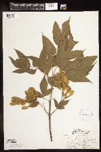 Acer negundo L. 336995[1093473]Lakela, Olga 16371936-08-06 United States, Minnesota, Saint Louis, Minnesota Avenue, 10th Street, Duluth;;;;, 46.78333 -92.10639 |
MIN:Plants | 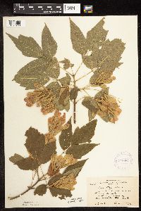 Acer negundo L. 348687[1093293]Cook, E. 591938-06-21 United States, Minnesota, Hennepin, On river bank near Botany greenhouse, University campus, Minneapolis.;;;;, 44.98 -93.26361 |
MIN:Plants | 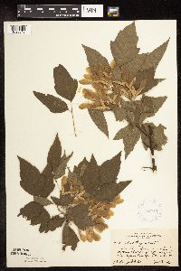 Acer negundo L. 352745[1093313]Jukkola, E. 301937-06-27 United States, Minnesota, Hennepin, East River Road, S of Botany Building, Minneapolis;;N;;, 44.98 -93.26361 |
MIN:Plants | 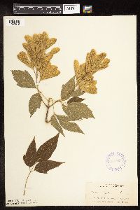 Acer negundo L. 357983[1093310]Rosendahl, C. 3791902-06-06 United States, Minnesota, Houston, Spring Grove;;101N;07W;, 43.543165 -91.672028 |
MIN:Plants |  Acer negundo L. 363167[1093279]Beach, W. 371913-04-29 United States, Minnesota, Ramsey, University Farm. Ramsey Co.;;029N;23W;, 44.99208 -93.16639 |
MIN:Plants |  Acer negundo L. 366932[1093425]Moore, John; et al. 102141938-06-26 United States, Minnesota, Dakota, 1/4 mi. W of 5th Ave. and just S of Church St, South St. Paul. Dakota Co.;;028N;22W;, 44.90523 -93.04507 |
MIN:Plants |  Acer negundo L. 366948[1093276]Moore, John; Butters, F. 134711940-09-03 United States, Minnesota, Carlton, Valley of little stream, 3 mi. S of Black Hoof.;;;;, 46.5505 -92.50103 |
MIN:Plants |  Acer negundo L. 367609[1093400]Moore, John; et al. 123761940-05-16 United States, Minnesota, Steele, River bank, N side of Owatonna;;;;, 44.08389 -93.22583 |
MIN:Plants | 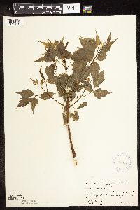 Acer negundo L. 367626[1093401]Moore, John; et al. 124241940-05-17 United States, Minnesota, Freeborn, E boundary, Sec. 32 Hayward Twp.;;;;, 43.62222 -93.22917 |
MIN:Plants | 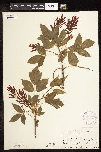 Acer negundo L. 367801[1093393]Moore, John; et al. 125441940-05-25 United States, Minnesota, Wright, Along the shore of Buffalo Lake, NE corner, Sec. 35, Chatham Twp. Wright Co.;;120N;26W;35, 45.15838 -93.92053 |
MIN:Plants | 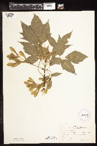 Acer negundo L. 369398[1093416]Moore, John 141961941-06-13 United States, Minnesota, Clay, Along Hwy. 75, 2 1/2 mi. N of Moorhead.;;N;;, 46.90284 -96.76722 |
MIN:Plants | 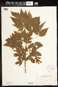 Acer negundo L. 369682[1093415]Moore, John 140021941-05-24 United States, Minnesota, Pine, Southeast shore of Cross Lake; NW1/4 Sec. 34, Pine City Twp. Pine Co.;;039N;21W;, 45.82461 -92.94985 |
MIN:Plants | 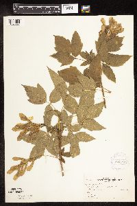 Acer negundo L. 370172[1093298]Moore, John; et al. 144351941-06-14 United States, Minnesota, Marshall, Bank of Tamarack River, near Stephen;;;;, 48.45 -96.87222 |
MIN:Plants | 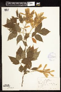 Acer negundo L. 370208[1093305]Moore, John; et al. 142161941-06-13 United States, Minnesota, Norman, Banks of Red River, beside hwy 75, 1 mi W of Perley;;;;, 47.17778 -96.8263 |
MIN:Plants | 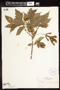 Acer negundo L. 370270[1093317]Moore, John; et al. 139161941-05-11 United States, Minnesota, Fillmore, Along hwy 16, 1 mi NE of Preston;;103N;10W;, 43.71699 -92.02946 |
MIN:Plants | 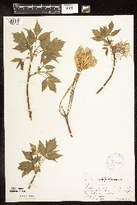 Acer negundo L. 370331[1093459]Moore, John; et al. 137481941-04-26 United States, Minnesota, Washington, Washington Co.; roadside, 1 mile south of St. Paul Park;;027N;22W;, 44.826326 -92.989026 |
MIN:Plants | 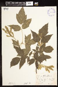 Acer negundo L. 371311[1093372]Moore, John; et al. 146691941-07-06 United States, Minnesota, Douglas, Douglas County...N tip of Lake Reno; 7 mi. N of Glenwood;;;;, 45.76501 -95.38776 |
MIN:Plants | 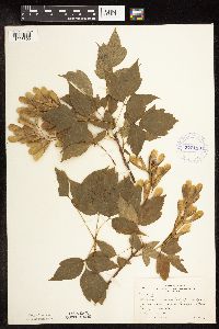 Acer negundo L. 372118[1093309]Moore, John; et al. 144541941-06-14 United States, Minnesota, Kittson, W bank of the South Fork of Two Rivers, 9 mi. NE of Karlstad.;;;;, 48.66952 -96.38107 |
MIN:Plants | 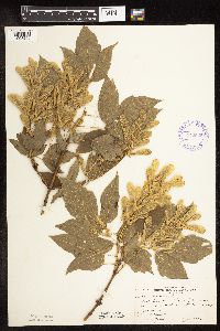 Acer negundo L. 372535[1093296]Moore, John; et al. 147501941-07-07 United States, Minnesota, Otter Tail, Otter Tail County...Anna Lake, 5 mi. N of Underwood;;;;, 46.34778 -95.85944 |
MIN:Plants | 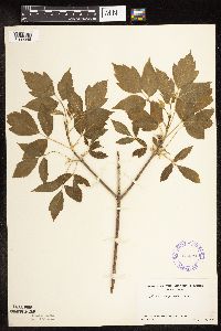 Acer negundo L. 374074[1093346]Linnaean Club, U of M, 1491940-05-19 United States, Minnesota, Rice, Nerstrand Woods;Nerstrand Woods State Park;110N;19W;, 44.32706 -93.10089 |
MIN:Plants | 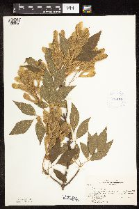 Acer negundo L. 381150[1093392]Rosendahl, C.; et al. 75191942-06-16 United States, Minnesota, Winona, Along pseudo-road, 3 mi. N and 1/2 mi. E of Utica.;;;;, 44.00516 -91.91711 |
MIN:Plants | 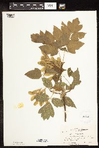 Acer negundo L. 381285[1093426]Moore, John 153791942-06-20 United States, Minnesota, Olmsted, 1 mi. N of Rochester on Hwy. 63.;;N;;, 44.1078 -92.48154 |
MIN:Plants | 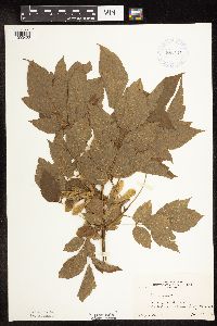 Acer negundo L. 381414[1093422]Moore, John 156281942-06-29 United States, Minnesota, Stearns, Bank of Sauk River, Sauk Center.;;;;, 45.7364 -94.9542 |
MIN:Plants | 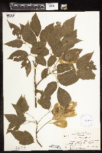 Acer negundo L. 381448[1093424]Moore, John; et al. 154411942-06-20 United States, Minnesota, Dodge, Hwy. 57, Zumbro River, 1 mi. NE of Berne, Milton Twp.;;108N;16W;, 44.15236 -92.73871 |
MIN:Plants |  Acer negundo L. 381594[1093297]Moore, John; et al. 151851942-05-23 United States, Minnesota, Beltrami, Red Lake Village;Red Lake Indian Reservation;;;, 47.87639 -95.01667 |
MIN:Plants |  Acer negundo L. 407785[1093311]Lakela, Olga 81051949-05-26 United States, Minnesota, Saint Louis, In a vacant lot, 20-21 Ave. E, Fourth Street, Duluth;;;;, 46.78333 -92.10639 |
MIN:Plants |  Acer negundo L. 412297[1093456]Moore, John; et al. 116111939-08-09 United States, Minnesota, Kittson, On the creek bank near the W line of Sec. 3, Richardville Twp. Kittson Co.;;163N;49W;03, 48.97032 -96.98547 |
MIN:Plants |  Acer negundo L. 412320[1093385]Moore, John; et al. 114801939-08-05 United States, Minnesota, Roseau, Longworth. Roseau Co.;;;;, 48.9825 -95.36472 |
MIN:Plants | 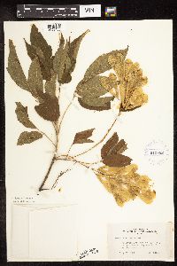 Acer negundo L. 419682[1093455]Lakela, Olga 109691950-07-30 United States, Minnesota, Saint Louis, St. Louis Co.; Floodwood Peat Processing Plant, on the grounds, Hwy. 2;;051N;20W;, 46.89584 -92.86911 |
MIN:Plants | 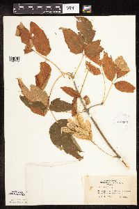 Acer negundo L. 422603[1093373]Lakela, Olga 78701948-09-18 United States, Minnesota, Saint Louis, St. Louis Co.; St. Louis River bank near Floodwood.;;051N;20W;, 46.89584 -92.86911 |
MIN:Plants | 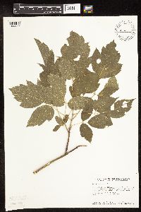 Acer negundo L. 427460[1093287]Smith, Welby 148701988-08-17 United States, Minnesota, Meeker, Meeker County...At the S end of Long Lake, about 1 mi N of Dassel...at the public access...SW1/4 SE1/4 sec.22, T119N R29W. 119N 29W 22, 45.102806 -94.307072 |
MIN:Plants | 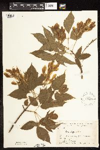 Acer negundo L. 437128[1093294]Moore, John; Hall, Robert 164971944-06-12 United States, Minnesota, Murray, 6 1/2 mi. E of Lake Wilson on Hwy. 47.;;;;, 43.99666 -95.91223 |
MIN:Plants |  Acer negundo L. 441087[1093343]Nation, R. 94-2501994-07-05 United States, Minnesota, Mower, Lake Louise State Park. Mower Co.; Tract 4B. T101N R14W SW1/4 of NW1/4 of sec. 28;Lake Louise State Park;101N;14W;28, 43.5221 -92.51896 |
MIN:Plants |  Acer negundo L. 442237[1093467]Moore, John; Huff, N. 190911946-08-17 United States, Minnesota, Swift, Swift Co. In city park at Benson;;;;, 45.315 -95.59972 |
MIN:Plants |  Acer negundo L. 443848[1093480]Lee, Michael MDL15941996-09-19 United States, Minnesota, Kandiyohi, Sibley State Park. Kandiyohi Co.; Sibley State Park. Seven miles WNW of New London; between Swan & Middle Lakes; T121N R35W SW1/4 NE1/4 Sec 4. 121N 35W 4, 45.3185 -95.08107 |
MIN:Plants |  Acer negundo L. 446178[1093291]Moore, John; et al. 173391945-06-20 United States, Minnesota, Red Lake, Red Lake County...1 mi. E of Red Lake Falls;;151N;44W;, 47.89041 -96.28819 |
MIN:Plants |  Acer negundo L. 446300[1093398]Moore, John; Huff, N. 187901946-07-31 United States, Minnesota, Benton, Benton Co. Along roadside 5 mi NE of East St. Cloud;;;;, 45.65821 -94.03885 |
MIN:Plants |  Acer negundo L. 448589[1093397]Moore, John; et al. 176791945-07-10 United States, Minnesota, Jackson, Des Moines River 1/2 mi S of Petersburg;;;;, 43.50138 -94.90385 |
MIN:Plants |  Acer negundo L. 448930[1093370]Moore, John; et al. 163871944-06-10 United States, Minnesota, Pipestone, Pipestone County...Pipestone quarry;Pipestone National Monument;106N;46W;01, 44.01585 -96.31767 |
MIN:Plants |  Acer negundo L. 448951[1093412]Moore, John; et al. 164301944-06-11 United States, Minnesota, Lincoln, Lincoln County...Lake Benton, 1 mi E of the town of Lake Benton;;109N;45W;, 44.412596 -96.267087 |
MIN:Plants |  Acer negundo L. 449019[1093292]Moore, John; Hall, Robert 167191944-08-01 United States, Minnesota, Aitkin, 10 mi. NE of Aitkin;;;;, 46.63533 -93.56119 |
MIN:Plants |  Acer negundo L. 449159[1093471]Moore, John 170051945-06-01 United States, Minnesota, Blue Earth, Along rr right of way 1 mi E of Lake Crystal;;;;, 44.11 -94.18316 |
MIN:Plants |  Acer negundo L. 456890[1093447]Myhre, K. 47671994-05-18 United States, Minnesota, Itasca, Chippewa National Forest / Leech Lake Indian Reservation. Itasca Co.; located 5 miles northeast of the town of Squaw Lake; north shore of Sand Lake; T 148N R 26W NE1/4 of NW1/4 o Itasca Co.; located 5 miles northeast of the town of Squaw Lake; north shore of Sand Lake; T 148N R 26W NE1/4 of NW1/4 of Sec 18. 148N 26W 18, 47.63644 -94.02286 |
MIN:Plants |  Acer negundo L. 457983[1093466]Garrison, O. s.n.1880-06-13 United States, Minnesota, Upper Mississippi;;;;, 47.218056 -95.207222 |
MIN:Plants | Acer negundo L. 461748[]Anonymous s.n.1952-00-00 United States, Minnesota, Steele, Medford;;108N;20W;, 44.17413 -93.246324 |
MIN:Plants | 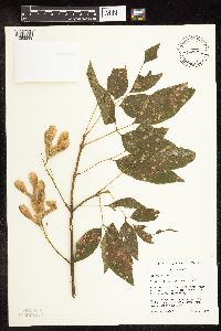 Acer negundo L. 466792[1093299]Husveth, J. 95-43271995-08-29 United States, Minnesota, Wabasha, Wabasha Co. T110N R11W SE1/4 of the SW1/4 of S22; Zumbro River;Dorer Memorial Hardwood State Forest;110N;11W;22, 44.31596 -92.11905 |
MIN:Plants |  Acer negundo L. 476431[1093409]Smith, Welby 129311987-06-09 United States, Minnesota, Washington, about 1 mi north of Afton. On the floodplain of the St. Croix River. SW1/4 NE1/4 of section [invalid latitude provided by collector];Belwin Outdoor Education Laboratory;028N;20W;15, 44.91261 -92.79186 |
MIN:Plants |  Acer negundo L. 500733[1093458]Moore, John 204561950-05-23 United States, Minnesota, Martin, Along the shore of Sisseton Lake at Fairmont;;;;, 43.65222 -94.46083 |
MIN:Plants |  Acer negundo L. 500743[1093319]Moore, John 204461950-05-12 United States, Minnesota, Stevens, Along the shore at the N end of Lower Pomme de Terre Lake.;;;;, 46.02111 -95.88222 |
MIN:Plants |  Acer negundo L. 500748[1093423]Moore, John 204401950-05-12 United States, Minnesota, Swift, Swift Co. 1 1/2 mi S of Appleton;;120N;43W;, 45.19594 -96.04182 |
MIN:Plants |  Acer negundo L. 500755[1093318]Moore, John 204311950-05-11 United States, Minnesota, Big Stone, W-facing bluffs, 5 1/2 mi. N of Ortonville.;;N;;, 45.33368 -96.44444 |
MIN:Plants |  Acer negundo L. 526127[1093380]Lakela, Olga 185741955-05-14 United States, Minnesota, Saint Louis, St. Louis Co.; Little Swan River bank north of Toivola near the bridge on hwy no. 5;;055N;20W;, 47.23954 -92.87435 |
MIN:Plants |  Acer negundo L. 526237[1093417]Moore, John 212651951-08-08 United States, Minnesota, Wilkin, W shore of pothole lake, Sec. 1, of Prairie View Twp.;;N;;, 46.58722 -96.34111 |
MIN:Plants | 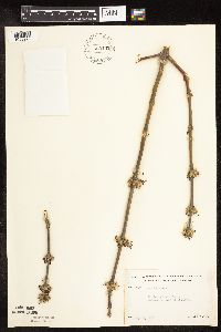 Acer negundo L. 529102[1093278]Lakela, Olga 195921956-05-13 United States, Minnesota, Saint Louis, St. Louis Co.; St. Louis River terrace, hwy #2, eaast of Brookston;;051N;17W;, 46.89533 -92.49119 |
MIN:Plants | 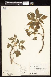 Acer negundo L. 529103[1093352]Lakela, Olga 196341956-05-30 United States, Minnesota, Saint Louis, St. Louis Co.; Bank of West Swan River, north of Toivola, hwy no. 5;;055N;20W;, 47.23954 -92.87435 |
MIN:Plants | 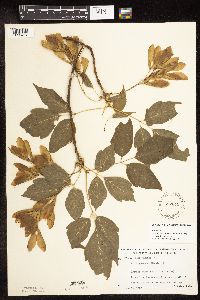 Acer negundo L. 532819[1093484]Lakela, Olga 199151956-06-19 United States, Minnesota, Saint Louis, St. Louis River bank south of the bridge on Ox-Bow road west of Zim.;;056N;18W;, 47.32817 -92.6199 |
MIN:Plants | 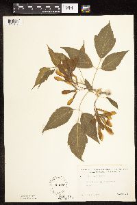 Acer negundo L. 532909[1093452]Lakela, Olga 196841956-06-11 United States, Minnesota, Saint Louis, St. Louis Co.; Bank of Sand Creek, Toivola.;;054N;19W;, 47.15272 -92.74749 |
MIN:Plants |  Acer negundo L. 539572[1093468]Lakela, Olga 212441957-05-13 United States, Minnesota, Saint Louis, Lester Park, 60th Ave. E.;North Shore;050N;13W;05, 46.84402 -92.0161 |
MIN:Plants |  Acer negundo L. 542375[1093485]Moore, John 217531952-06-05 United States, Minnesota, Watonwan, Watonwon Co. Along the SW shore of Wood Lake;;107N;33W;, 44.0833 -94.75 |
MIN:Plants |  Acer negundo L. 542416[1093469]Moore, John 215121952-05-19 United States, Minnesota, Koochiching, Koochiching Co.; along the river at Big Falls;Pine Island State Forest;154N;25W;, 48.1508 -93.84193 |
MIN:Plants |  Acer negundo L. 549989[1093351]Moore, John 221151954-09-15 United States, Minnesota, Sherburne, Along the W shore of Clear Lake;;;;, 45.44667 -94.04472 |
MIN:Plants | 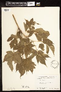 Acer negundo L. 550173[1093347]Moore, John; et al. 221911954-09-20 United States, Minnesota, Lyon, Yankton Lake. Lyon Co.;;;;, 44.22833 -95.85833 |
MIN:Plants | 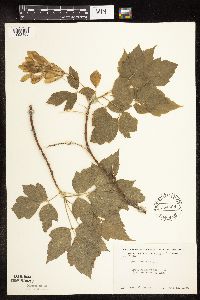 Acer negundo L. 554669[1093408]Moore, John 228671956-06-12 United States, Minnesota, Norman, 5.5 mi E of Ada;;;;, 47.29966 -96.3976 |
Google Map
Google Maps is a web mapping service provided by Google that features a map that users can pan (by dragging the mouse) and zoom (by using the mouse wheel). Collection points are displayed as colored markers that when clicked on, displays the full information for that collection. When multiple species are queried (separated by semi-colons), different colored markers denote each individual species.