University of Minnesota
http://www.umn.edu/
612-625-5000
http://www.umn.edu/
612-625-5000
Minnesota Biodiversity Atlas
Bell Museum
Dataset: MIN-Plants
Taxa: Sapindaceae
Search Criteria: excluding cultivated/captive occurrences
Bell Museum plants | |
 MIN:Plants |  Acer saccharum var. saccharum Marshall 448369[1093935]Moore, John; Huff, N. 189931946-08-10 United States, Minnesota, Becker, 1/4 mi. E of Two Island Lake [Twin Island Lake?];;142N;36W;, 47.1088 -95.23354 |
MIN:Plants |  Acer saccharum var. saccharum Marshall 448682[1094000]Moore, John; Huff, N. 192941946-09-14 United States, Minnesota, Scott, W facing bluffs of the Minnesota River Valley at Jordan;;;;, 44.66694 -93.62667 |
MIN:Plants |  Acer saccharum var. saccharum Marshall 449271[1094008]Moore, John; Hall, Robert 167551944-08-02 United States, Minnesota, Itasca, 12 1/2 mi N of Grand Rapids;;;;, 47.42158 -93.54172 |
MIN:Plants |  Acer saccharum var. saccharum Marshall 457877[1093932]Garrison, O. 11 United States, Minnesota, Upper Mississippi;;;;, 47.2181 -95.2072 |
MIN:Plants | 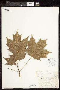 Acer saccharum var. saccharum Marshall 457878[1093896]Garrison, O. 2221880-07-20 United States, Minnesota, Upper Mississippi;;;;, 47.2181 -95.2072 |
MIN:Plants | 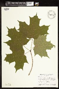 Acer saccharum var. saccharum Marshall 475502[1093957]Smith, Welby 152361989-05-31 United States, Minnesota, Freeborn, Myre Big Island State Park. Freeborn County ... Helmer Myre State Park, about 2 miles southeast of Albert Lea. On 'Big Island' in Albert Lea Lake; SW1/4 NW1/4 section 19, T 102N R 20W. 102N 20W 19, 43.625 -93.2874985 |
MIN:Plants | 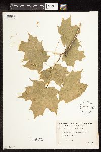 Acer saccharum var. saccharum Marshall 481202[1093886]Lakela, Olga 16055a1953-06-08 United States, Minnesota, Saint Louis, St. Louis County...Oak View Narrows, Vermilion Lake;Kabetogama State Forest;063N;17W;26, 47.91021 -92.47128 |
MIN:Plants | 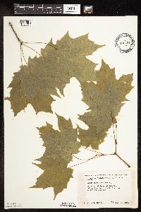 Acer saccharum var. saccharum Marshall 488431[1093925]Moore, John 199851949-05-24 United States, Minnesota, Olmsted, Along the Root River, 3 mi. S of Simpson;Dorer Memorial Hardwood State Forest;105N;13W;, 43.89144 -92.37849 |
MIN:Plants | 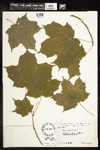 Acer saccharum var. saccharum Marshall 488482[1093884]Moore, John 199631949-05-23 United States, Minnesota, Fillmore, 1 1/2 mi. NW of Wykoff;Dorer Memorial Hardwood State Forest;103N;12W;, 43.71741 -92.26928 |
MIN:Plants | 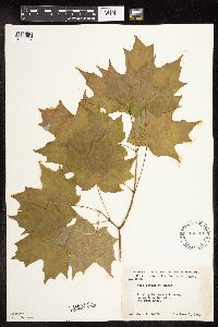 Acer saccharum var. saccharum Marshall 488761[1093927]Moore, John 200391949-06-01 United States, Minnesota, Otter Tail, Woods adjacent to Big Pine Lake;;;;, 46.61667 -95.5 |
MIN:Plants | 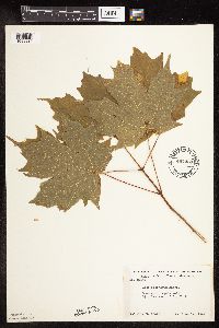 Acer saccharum var. saccharum Marshall 497430[1093924]Moore, John 201471949-06-14 United States, Minnesota, Itasca, 6 1/2 mi. E of Big Fork;;;;, 47.7444 -93.6542 |
MIN:Plants | 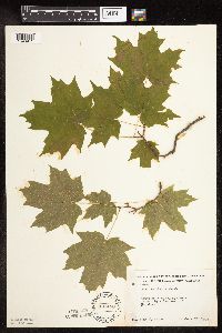 Acer saccharum var. saccharum Marshall 497458[1093941]Moore, John 203081949-06-27 United States, Minnesota, Otter Tail, 1 1/2 mi W of Popelius;;;;, 46.41 -95.71 |
MIN:Plants | 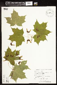 Acer saccharum var. saccharum Marshall 514875[1093718]Monson, Paul 59551984-06-06 United States, Minnesota, Cook, Ca. 5 mi. NW of Visitor Center.;Grand Portage National Monument / North Shore;064N;05E;26, 47.9982606 -89.7696604 |
MIN:Plants | 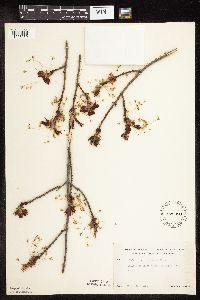 Acer saccharum var. saccharum Marshall 525980[1093989]Lakela, Olga 185641955-03-12 United States, Minnesota, Saint Louis, Arlington area, Duluth;;;;, 46.78333 -92.10639 |
MIN:Plants | 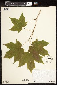 Acer saccharum var. saccharum Marshall 533167[1093971]Lakela, Olga; Elwell, M. 199991956-06-24 United States, Minnesota, Saint Louis, St. Louis Co.; Nett Lake Indian Reservation, W of Orr.;Nett Lake Indian Reservation;064N;21W;, 48.02295 -93.02381 |
MIN:Plants | 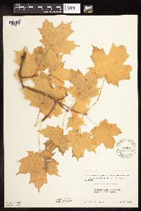 Acer saccharum var. saccharum Marshall 542349[1093917]Moore, John 214231951-10-11 United States, Minnesota, Steele, Along the S shore of Rice Lake.;Rice Lake State Park;107N;19W;, 44.06633 -93.10586 |
MIN:Plants |  Acer saccharum var. saccharum Marshall 542478[1093958]Moore, John 215781952-05-21 United States, Minnesota, Koochiching, Koochiching Co.; 1 mi. south west of Northome;;151N;29W;, 47.88944 -94.35371 |
MIN:Plants |  Acer saccharum var. saccharum Marshall 542762[1093938]Moore, John 216851952-06-03 United States, Minnesota, Brown, Sec. 17, Eden Twp.;;;;, 44.42 -94.81528 |
MIN:Plants |  Acer saccharum var. saccharum Marshall 551690[1093931]Johnson, Russell s.n.1947-04-12 United States, Minnesota, Isanti, Ca. 2 mi. N of Cambridge;;N;;, 45.60174 -93.22417 |
MIN:Plants |  Acer saccharum var. saccharum Marshall 554636[1093891]Moore, John; Hsi, Yu-tseng [Eugene] 233241957-08-05 United States, Minnesota, Blue Earth, On the S shore of Lake George;;;;, 44.03 -94.06 |
MIN:Plants |  Acer saccharum var. saccharum Marshall 558275[1093922]Moore, John 236731957-09-27 United States, Minnesota, Clay, NE1/4 Sec. 36, Tansem Twp.;;;;, 46.66833 -96.22583 |
MIN:Plants |  Acer saccharum var. saccharum Marshall 583385[1093904]Kellner, H. 2021956-07-04 United States, Minnesota, Lake, Lake County...Encampment Forest above Hwy 61;North Shore;053N;10W;11, 47.09341 -91.57419 |
MIN:Plants |  Acer saccharum var. saccharum Marshall 583416[1093906]Kellner, H. 3741956-06-18 United States, Minnesota, Cook, Atop Mt. Maude, near Mineral Center. Cook Co.;Grand Portage Indian Reservation / North Shore;063N;05E;, 47.93519 -89.80602 |
MIN:Plants |  Acer saccharum var. saccharum Marshall 583960[1093926]Gunderson, R. 4981961-07-18 United States, Minnesota, Washington, Washington County ... St. Croix River, 3 mi. N of Stillwater, N shore.;Saint Croix National Riverway;030N;20W;, 45.08498 -92.81735 |
MIN:Plants | 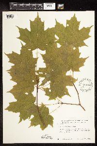 Acer saccharum var. saccharum Marshall 586455[1093943]Moore, John 264691963-08-16 United States, Minnesota, Anoka, Anoka Co.; Growing along the path into Crone Cabin, Bethel Twp, Cedar Creek Natural History Area.;Cedar Creek National History Area;034N;23W;, 45.42806 -93.204 |
MIN:Plants | 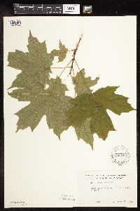 Acer saccharum var. saccharum Marshall 590076[1093902]Meierotto, R. s.n.1962-07-28 United States, Minnesota, Becker, Becker Co. S5, T142N, R36W;Itasca State Park;142N;36W;5, 47.14493 -95.26537 |
MIN:Plants | 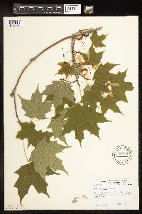 Acer saccharum var. saccharum Marshall 594335[1093872]Thorne, Robert 304851962-06-18 United States, Minnesota, Clearwater, near entrance to tourist campground, Itasca State Park;Itasca State Park;143N;36W;, 47.19557 -95.23322 |
MIN:Plants | 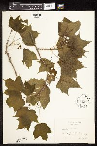 Acer saccharum var. saccharum Marshall 595430[1093887]Vogel, A. 271965-05-16 United States, Minnesota, Brown, KC Road, 3 mi. N of New Ulm, Minnesota River Valley.;;N;;, 44.35595 -94.46028 |
MIN:Plants |  Acer saccharum var. saccharum Marshall 602136[1093901]Westkaemper, Remberta s.n.1966-05-00 United States, Minnesota, Stearns, Stearns County...St. Joseph, college [of St. Benedict] woods;;124N;29W;10, 45.56617 -94.3117 |
MIN:Plants |  Acer saccharum var. saccharum Marshall 604007[1093949]Moore, John; Hsi, Yu-tseng [Eugene] 272061967-06-19 United States, Minnesota, Winona, 1 1/2 mi. NW of Witoka;;106N;07W;, 43.97675 -91.66018 |
MIN:Plants |  Acer saccharum var. saccharum Marshall 616471[1093897]Moore, John; et al. 621969-05-24 United States, Minnesota, Crow Wing, Crow Wing Natural Area. Crow Wing Natural History Area. Crow Wing County...Near the creek, S of the bridge, E side of Chandler Lake, SW1/4 Sec. 22, Garrison Twp.. 044N 28W 22, 46.27899 -93.86334 |
MIN:Plants |  Acer saccharum var. saccharum Marshall 685034[1093851]Stassen, Carol 111976-04-29 United States, Minnesota, Lyon, Lyon Co. Camden State Park, T111N, R42W, Sec. 5.;Camden State Park;111N;42W;5, 44.45066 -95.92783 |
MIN:Plants |  Acer saccharum var. saccharum Marshall 686849[1093888]Wheeler, Gerald; Glaser, Paul 12751977-05-15 United States, Minnesota, Itasca, Site 6. NW1/4 SW1/4 Sec. 32, T55N, R26W; ca. 6 mi. SW of Grand Rapids.;;055N;26W;32, 47.20343 -93.6714 |
MIN:Plants |  Acer saccharum var. saccharum Marshall 691213[1094001]Sperling, C. 3041976-06-14 United States, Minnesota, Douglas, 2 1/2 mi S of Garfield;;;;, 45.91187 -95.49167 |
MIN:Plants |  Acer saccharum var. saccharum Marshall 691502[1093908]Clemants, Steven 11181978-06-09 United States, Minnesota, Chisago, Goose Creek, ca 3 mi NE of Harris, T36N, R21W, intersection of S13, 14, 23, 24;;036N;21W;, 45.60063 -92.96037 |
MIN:Plants |  Acer saccharum var. saccharum Marshall 691504[1093929]Clemants, Steven 13351978-06-20 United States, Minnesota, Crow Wing, 2.9 mi. S of the jct. of Co. Rds. 5, 6, 36, on Co. Rd. 5. T137N, R25W, Sec. 23.;;137N;25W;23, 46.66547 -93.80985 |
MIN:Plants | 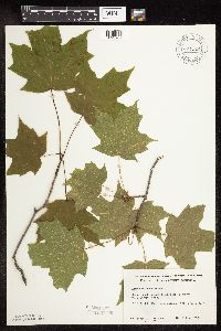 Acer saccharum var. saccharum Marshall 691512[1093907]Clemants, Steven 11071978-06-09 United States, Minnesota, Chisago, Goose Creek, ca 3 mi NE of Harris, T36N, R21W, intersection of S13, 14, 23, 24;;036N;21W;, 45.60063 -92.96037 |
MIN:Plants | 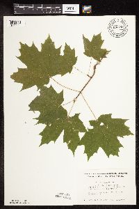 Acer saccharum var. saccharum Marshall 696749[1093964]Smith, Welby 7991978-09-23 United States, Minnesota, Wright, Wright Co. T121N, R26W, N1/2 S10; 1/4 mi NW of jnc of state aid rd 39 and co rd 111;Lake Maria State Park;121N;26W;10, 45.30396 -93.94289 |
MIN:Plants | 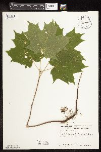 Acer saccharum var. saccharum Marshall 697818[1093905]Ownbey, Gerald 52231976-08-03 United States, Minnesota, Cass, Cass Co. T143N, R30W, NE1/4 S22, Ottertail Peninsula;Chippewa National Forest / Leech Lake Indian Reservation;143N;30W;22, 47.1857 -94.45621 |
MIN:Plants | 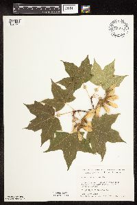 Acer saccharum var. saccharum Marshall 700931[1093871]Dorio, J. 7131977-08-02 United States, Minnesota, Morrison, Lake Alexander on Co. Rd. 6. T131N, R30W, Sec. 6.;;131N;30W;6, 46.18707 -94.50623 |
MIN:Plants | 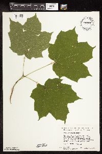 Acer saccharum var. saccharum Marshall 708785[1093946]Wheeler, Gerald 37721979-06-11 United States, Minnesota, Nicollet, Nicollet Co. Approx. 6 mi N of St. Peter on Hwy. 169. Overlooking a creek; ca. 1/8 mi. from the road. T111N, R26W, Sec Nicollet Co. Approx. 6 mi N of St. Peter on Hwy. 169. Overlooking a creek; ca. 1/8 mi. from the road. T111N, R26W, Sec. 16.. 111N 26W 16, 44.42054 -93.95977 |
MIN:Plants | 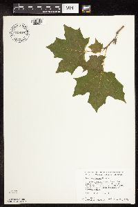 Acer saccharum var. saccharum Marshall 709015[1093883]Wheeler, Gerald 40031979-06-22 United States, Minnesota, Washington, William O'Brien State Park; just N of Marine on St. Croix on Rte. 95. T32N, R19W, Sec. 31.;William O'Brien State Park;032N;19W;31, 45.21715 -92.76414 |
MIN:Plants | 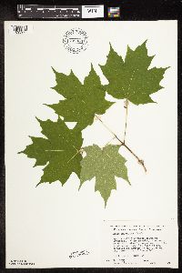 Acer saccharum var. saccharum Marshall 709064[1093920]Wheeler, Gerald 40531979-06-25 United States, Minnesota, Kanabec, Kanabec co. Approx. 2 mi S of Grasston; the woods about 0.5 mi E of the jct. of Rts. 70 and 107, on the S side of Rt. 70 Kanabec co. Approx. 2 mi S of Grasston; the woods about 0.5 mi E of the jct. of Rts. 70 and 107, on the S side of Rt. 70. T38N, R23W, Sec. 25.. 038N 23W 25, 45.75236 -93.15231 |
MIN:Plants | 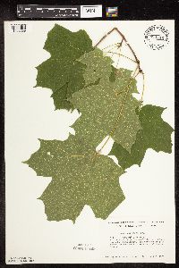 Acer saccharum var. saccharum Marshall 711716[1093999]Smith, Welby 17931979-09-08 United States, Minnesota, Rice, W1/2 Sec. 5.5 mi NE of jnc of Interstate 35 and State 65 in Faribault, W bank of Cannon River.;Cannon River Wilderness Park;111N;20W;34, 44.37765 -93.21131 |
MIN:Plants | 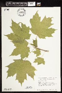 Acer saccharum var. saccharum Marshall 723632[1093923]Smith, Welby 20991980-05-12 United States, Minnesota, Wright, Wright Co. T118N, R26W, SE1/4 NE1/4 Sec. 24. S side of Co. Rd. 30; 4 mi. SE of Waverly.;;118N;26W;24, 45.01415 -93.90022 |
MIN:Plants | 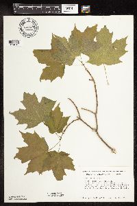 Acer saccharum var. saccharum Marshall 723667[1094015]Smith, Welby 21211980-05-12 United States, Minnesota, Wright, Wright Co. T119N, R24W, SE1/4 NE1/4 Sec. 20. On the W side of Hwy. 19, ca. 1 mi. N of it's jct. with Hwy. 55 in Rockfor Wright Co. T119N, R24W, SE1/4 NE1/4 Sec. 20. On the W side of Hwy. 19, ca. 1 mi. N of it's jct. with Hwy. 55 in Rockford.. 119N 24W 20, 45.10104 -93.73804 |
MIN:Plants | 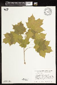 Acer saccharum var. saccharum Marshall 723732[1093961]Smith, Welby 21281980-05-12 United States, Minnesota, Wright, M Schmidt Crawford Woods Scientific Natural Area. Wright Co. T120N, R25W; NW1/4 SE1/4 Sec. 25. Near the SW shore of Schmidt Lake. Ca. 0.3 mi. N of Hwy. 34; 4.5 mi. E of Wright Co. T120N, R25W; NW1/4 SE1/4 Sec. 25. Near the SW shore of Schmidt Lake. Ca. 0.3 mi. N of Hwy. 34; 4.5 mi. E of its jct. with Hwy. 55 near Buffalo.. 120N 25W 25, 45.17276 -93.77599 |
MIN:Plants | 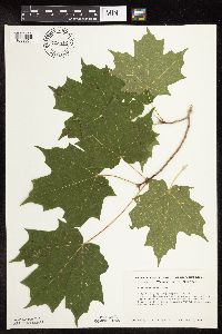 Acer saccharum var. saccharum Marshall 723812[1093951]Smith, Welby 32281980-08-10 United States, Minnesota, Wright, Wright Co. T120N, R23W, NW1/4 NW1/4 Sec. 18; about 2 mi. E of St. Michael. E-facing slope overlooking the Crow River.;;120N;23W;18, 45.20686 -93.63196 |
MIN:Plants | 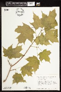 Acer saccharum var. saccharum Marshall 723934[1093921]Smith, Welby 21101980-05-12 United States, Minnesota, Wright, Wright Co. T120N, R25W, NE1/4 SW1/4 Sec. 19. SW side of Hwy. 55, 1/4 mi. NW of it's jct. with Hwy. 25 in Buffalo.;;120N;25W;19, 45.18703 -93.87894 |
MIN:Plants | 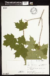 Acer saccharum var. saccharum Marshall 729046[1093719]Converse, C. 651980-06-02 United States, Minnesota, Chisago, Goose Creek Natural Area: 5 mi. SE of Rush City. NW1/4 NE1/4 Sec.;Wild River State Park;036N;21W;13, 45.60799 -92.90892 |
MIN:Plants |  Acer saccharum var. saccharum Marshall 729166[1093889]Berlin, N. 1451979-08-13 United States, Minnesota, Goodhue, Wacouta Pond Natural Area: 5 mi. SE of Red Wing. Portions of: Sec. 6, T112N, R13W, and Sec. 31, 32, T113N, R13W.;Wacouta Pond Natural Area, The Nature Conservancy;;;, 44.545 -92.43472 |
MIN:Plants |  Acer saccharum var. saccharum Marshall 729474[1093945]Cutler, S. 871980-06-16 United States, Minnesota, Pine, Pine Co. St. Croix Natural Area: 21 mi E of Hinckley. NW1/4 SW1/4 Sec. 33, T41N, R17W.;Saint Croix State Park;041N;17W;33, 45.99052 -92.4984 |
MIN:Plants | 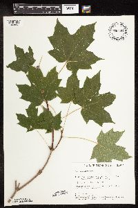 Acer saccharum var. saccharum Marshall 730150[1093892]Cutler, S. 1731980-07-25 United States, Minnesota, Chisago, Rush Lake Island Natural Area: 7 mi. WSW of Rush City. NE1/4 NW1/4 Sec. 28, T37N, R22W.;Rush Lake Island Scientific Natural Area;037N;22W;28, 45.6662 -93.09382 |
MIN:Plants | 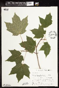 Acer saccharum var. saccharum Marshall 730157[1093937]Converse, C. 3581980-06-23 United States, Minnesota, Chisago, Rush Lake Island Natural Area: 7 mi. WSW of Rush City. E central island--SE1/4 SW1/4 Sec. 21, T37W, R22W.;Rush Lake Island Scientific Natural Area;037N;22W;21, 45.6805 -93.09363 |
MIN:Plants | 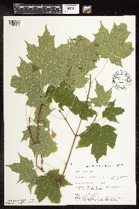 Acer saccharum var. saccharum Marshall 734898[1093968]Severson, M. 6861980-08-06 United States, Minnesota, Becker, Becker Co. Green Water Lake Natural Area: 5 mi. W of Ponsford. NW1/4 SE1/4 Sec. 33, T141N, R38W.;Greenwater Lake Scientific Natural Area / White Earth Indian Reservation;141N;38W;33, 46.98389 -95.4977 |
MIN:Plants | 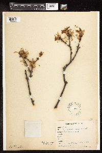 Acer saccharum var. saccharum Marshall 743801[1093976]Rosendahl, C. 20891909-05-17 United States, Minnesota, Ft. Snelling Reservation [old regional park spanning junction of Minnesota and Mississippi rivers].;Fort Snelling Reservation [former regional park];028N;23W;, 44.90516 -93.16646 |
MIN:Plants | 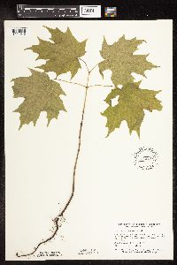 Acer saccharum var. saccharum Marshall 745237[1094016]Smith, Welby 37991981-05-18 United States, Minnesota, Mower, Wild Indigo Scientific Natural Area. Wild Indigo Scientific and Natural Area. Ca. 2 1/4 mi. E of the jct. of Hwy. 56 and Hwy. 2 in Brownsdale. SE1/4 SW1/4 Wild Indigo Scientific and Natural Area. Ca. 2 1/4 mi. E of the jct. of Hwy. 56 and Hwy. 2 in Brownsdale. SE1/4 SW1/4 Sec. 12, T103N, R17W.. 103N 17W 12, 43.7396 -92.81924 |
MIN:Plants | 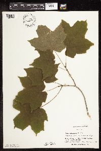 Acer saccharum var. saccharum Marshall 747207[1094004]Galatowitsch, S. 4611982-07-16 United States, Minnesota, Rice, Rice Co.; Trout Lily Preserve: T110N, R20W, S1/2 NW1/4 SW1/4 of Sec. 20, part of NE1/4 SE1/4 Sec. 9 [?];Cannon River Trout Lily Scientific Natural Area;110N;20W;, 44.32689 -93.22194 |
MIN:Plants | 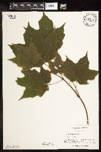 Acer saccharum var. saccharum Marshall 747272[1093939]Galatowitsch, S. 8011982-09-10 United States, Minnesota, Goodhue, Grace Nature Preserve: T109N, R18W, parts of NW1/4 SW1/4 and SW1/4 of Sec. 8.;Grace Nature Preserve, The Nature Conservancy;109N;18W;8, 44.26201 -93.01054 |
MIN:Plants | 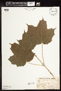 Acer saccharum var. saccharum Marshall 764892[1094006]Haig, Vincent s.n.1912-09-00 United States, Minnesota, Blue Earth, Mankato;;;;, 44.16361 -93.99917 |
MIN:Plants | 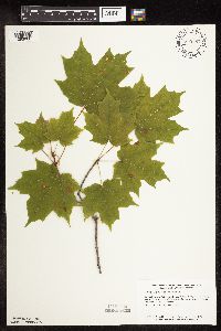 Acer saccharum var. saccharum Marshall 770187[1093900]Smith, Welby 85271983-08-01 United States, Minnesota, Carlton, Hemlock Ravine State Scientific and Natural Area, ca 2.5 mi S of Esko, NW1/4 SE1/4 S3, T48N, R16W;Hemlock Ravine Scientific Natural Area;048N;16W;3, 46.67056 -92.35393 |
MIN:Plants | 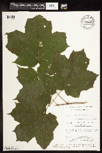 Acer saccharum var. saccharum Marshall 782528[1093982]Tenney, M. 5491982-08-18 United States, Minnesota, Fillmore, Forestville State Park, Fillmore Co. T102N, R11W, S18, SE1/4 SW1/4 NW1/4;Forestville State Park;102N;11W;18, 43.63793 -92.19918 |
MIN:Plants | 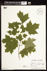 Acer saccharum var. saccharum Marshall 787523[1093977]Smith, Welby 106121985-07-01 United States, Minnesota, Hennepin, Wolsfeld Woods SNA. Hennepin County ... Wolsfeld Woods State Scientific and Natural Area, about 2 1/2 miles wes of Plymouth ... SW1/4 NE1/4 S27, T118N, R23W. 118N 23W 27, 45.002224 -93.5733337 |
MIN:Plants | 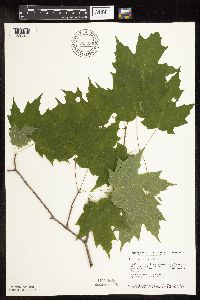 Acer saccharum var. saccharum Marshall 792086[1093960]Smith, Welby 105931985-07-01 United States, Minnesota, Stearns, Partch Woods Scientific Natural Area. Stearns County ... Partch Woods State Scientific and Natural Area, about 3 1/2 miles north-northeast of Avon SE1/4 NW1/4 S19, T125N, R29W. 125N 29W 19, 45.6222229 -94.3777771 |
MIN:Plants | 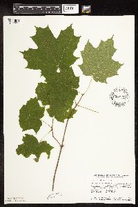 Acer saccharum var. saccharum Marshall 802985[1093864]Smith, Welby 117641986-06-14 United States, Minnesota, Olmsted, Oxbow County Park. Olmsted County ... Oxbow County Park, about 3 mi N of Byron; E-facing slope overlooking the Zumbro River. NW1/4 NW1/4 Sec. 17, T107N, R15W. 107N 15W 17, 44.0769463 -92.6538925 |
MIN:Plants | 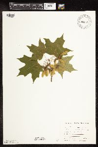 Acer saccharum var. saccharum Marshall 807721[1093874]Dorio, J. 671977-05-27 United States, Minnesota, Stearns, Stearns Co. Partch Woods;Partch Woods Scientific Natural Area;125N;29W;19, 45.6229 -94.37713 |
MIN:Plants | 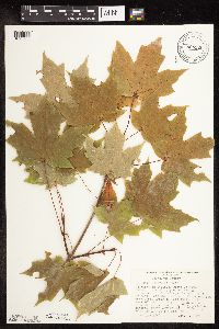 Acer saccharum var. saccharum Marshall 808520[1093965]Morley, T. 16841989-10-01 United States, Minnesota, Sherburne, 3.5 mi. SSW of Zimmerman, N of drainage channel, NW side of road. T34N, R26W, NW1/4 SE1/4 Sec. 32.;;034N;26W;32, 45.3928 -93.60261 |
MIN:Plants | 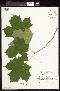 Acer saccharum var. saccharum Marshall 812340[1093865]Malody, K.J.A. 890011989-07-07 United States, Minnesota, Anoka, Anoka County ... N of Hwy. 23 and W of Interstate 35. On SE side of Howard Lake. NW1/4 SE1/4 Sec. 13, T32N, R22W;;032N;22W;13, 45.2555542 -93.023613 |
MIN:Plants | 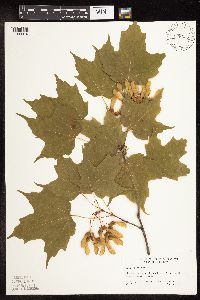 Acer saccharum var. saccharum Marshall 828638[1093910]Gordon, William; et al. 40-221940-06-24 United States, Minnesota, Clearwater, Clearwater Co, Itasca State Park, north of Bohall trail.;Itasca State Park;143N;36W;, 47.19557 -95.23322 |
MIN:Plants | 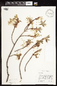 Acer saccharum var. saccharum Marshall 835691[1093850]Cholewa, A.; Engels, A. 21321995-05-18 United States, Minnesota, Aitkin, Savanna Portage State Park. Aitkin Co. Savanna Portage State Park, about 17 mi NE of McGregor, old homestead on NW end of Wolf Lake, T50N R22W S6 N1 Aitkin Co. Savanna Portage State Park, about 17 mi NE of McGregor, old homestead on NW end of Wolf Lake, T50N R22W S6 N1/2 of NE1/4. 050N 22W 6, 46.846 -93.17745 |
MIN:Plants | 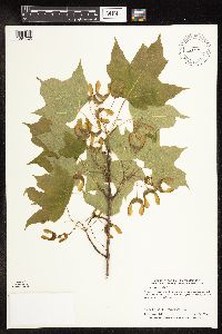 Acer saccharum var. saccharum Marshall 462362[1094020]Lake, Roger 00142000-05-26 United States, Minnesota, Koochiching, Koochiching County...T 63N R 23W SE1/4 of NW1/4 of Sec 34;Koochiching State Forest;063N;23W;34, 47.90102 -93.26383 |
MIN:Plants | 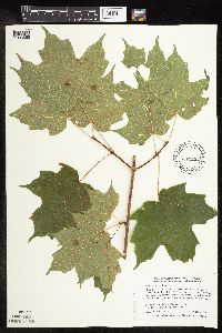 Acer saccharum var. saccharum Marshall 508898[1093855]Smith, Welby 290542000-08-24 United States, Minnesota, Mille Lacs, Mille Lacs County ... Mille Lacs State Wildlife Management Area ... T 40N R 26W SW1/4 of SW1/4 of Sec 14;Mille Lacs Wildlife Management Area;040N;26W;14, 45.9527779 -93.5569458 |
MIN:Plants |  Acer saccharum var. saccharum Marshall 540817[1093909]Smith, Welby 290282000-08-23 United States, Minnesota, Le Sueur, Le Sueur County ... Sakatah Lake State Park; about 2 miles east of Waterville ... T 109N R 23 NW1/4 of NE1/4 of Sec 25;Sakatah Lake State Park;109N;23W;25, 44.2241669 -93.5294418 |
MIN:Plants |  Acer saccharum var. saccharum Marshall 431986[1093857]Smith, Welby 290692000-09-01 United States, Minnesota, Wright, Wright County ... Ney County Park, on the west side of Mary Lake ... T 121N R 26W NW1/4 of SE1/4 of Sec 30;Ney County Park;121N;26W;30, 45.25979 -94.00402 |
MIN:Plants |  Acer saccharum var. saccharum Marshall 455575[1093915]Lake, Roger 00202000-08-13 United States, Minnesota, Koochiching, Koochiching County ... Along Holmstrom Spur road, 0.6 km east of Lofgrin Truck Trail ... T 63N R 24W NE1/4 of NE1/4 etc;Koochiching State Forest;063N;24W;16, 47.9445 -93.41427 |
MIN:Plants |  Acer saccharum var. saccharum Marshall 462353[1093963]Smith, Welby 292592002-05-01 United States, Minnesota, Ramsey, Ramsey County ... Battle Creek County park, in St. Paul ... T28N R22W SE1/4 of SE1/4 of Sec 3;Battle Creek County Park;028N;22W;03, 44.9361111 -93.0280556 |
MIN:Plants | 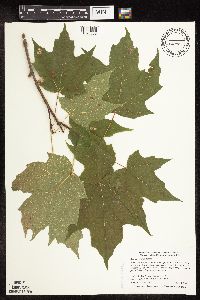 Acer saccharum var. saccharum Marshall 510148[1093858]Smith, Welby 287032000-07-11 United States, Minnesota, Aitkin, Rice Lake National Wildlife Refuge. Aitkin County ... Rice Lake National Wildlife Refuge, about 5 mikes S-SW of McGregor ... T 47N R 24W SE1/4 of SW1/4 of Sec 23. 047N 24W 23, 46.5388889 -93.3422222 |
MIN:Plants | 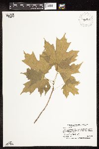 Acer saccharum var. saccharum Marshall 920153[1093878]Smith, Welby 221281993-05-19 United States, Minnesota, Becker, Becker County...About 2.5 miles east of White Earth...T142N R40W NW1/4 of NW1/4 of Sec 29;White Earth Indian Reservation;142N;40W;29, 47.0897222 -95.7816667 |
MIN:Plants | 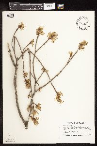 Acer saccharum var. saccharum Marshall 427091[1093852]Smith, Welby 255981995-05-04 United States, Minnesota, Nicollet, Seven Mile Creek County Park. Nicollet County ... In Seven-mile Creek County Park, about 7 miles north of Mankato ... T109N R27W NW1/4 of NE1/4 of Sec 11. 109N 27W 11, 44.2675018 -94.0347214 |
MIN:Plants | 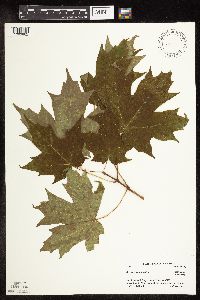 Acer saccharum var. saccharum Marshall 461701[1093882]Little Jr., Elbert 427701991-07-22 United States, Minnesota, Cook, Cook Co.; Near Hovland fire tower, 5 mi N of Hovland.;Grand Portage State Forest / North Shore;062N;03E;, 47.84984 -90.06495 |
MIN:Plants |  Acer saccharum var. saccharum Marshall 899147[1093914]Smith, Welby 273911998-07-15 United States, Minnesota, McLeod, McLeod County...About one mile southeast of Winsted in William May County Park...T117N R27W SE1/4 of SW1/4 of Sec 12;William May County Park;117N;27W;12, 44.9505556 -94.0194444 |
MIN:Plants |  Acer saccharum var. saccharum Marshall 923904[1093980]Cholewa, A. 27852011-05-12 United States, Minnesota, Freeborn, White Fox Campground.;Myre Big Island State Park;102N;21W;13, 43.6338889 -93.3 |
MIN:Plants |  Acer saccharum var. saccharum Marshall 921958[1093950]Smith, Welby 236041993-08-13 United States, Minnesota, Kandiyohi, Sibley State Park, about 8 miles west of New London...T 121N R 35W SE1/4 of NE1/4 of sec 4;Sibley State Park;121N;35W;04, 45.32 -95.0722222 |
MIN:Plants |  Acer saccharum var. saccharum Marshall 921936[1093979]Smith, Welby 249901994-08-02 United States, Minnesota, Wadena, About 2 miles south of Sebeka.. NW1/4 of NE1/4 of Sec ;;136N;35W;15, 46.5994444 -95.0825 |
MIN:Plants | 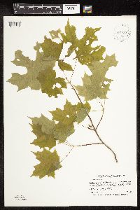 Acer saccharum var. saccharum Marshall 931684[1093981]Smith, Welby R. 202651992-05-21 United States, Minnesota, Polk, On the north side of Maple Lake, about 2 miles south of Mentor NW of SE of section;;148N;43W;05, 47.6638889 -96.1563889 |
MIN:Plants |  Acer saccharum var. saccharum Marshall 151154[1093861]MacMillan, C.; Skinner, A. 182Sk1900-08-00 United States, Minnesota, Polk, Crookston;;150N;46W;30, 47.77169 -96.609582 |
MIN:Plants | Acer saccharum Marshall []Timothy J. S. Whitfeld 32742022-07-01 United States, Minnesota, Washington, Crystal Spring Scientific and Natural Area, 0.4 miles northeast of the intersection of Scandia Trail North and Hwy 95, 45.25709 -92.763989, 264m |
MIN:Plants |  Acer saccharum Marshall 971283[1394760]M. H. Nee 665802020-00-00 United States, Wisconsin, Richland, SW side of Richland Center, residential area above Hwy. 80. T 10 N; R 1 E; NW¼NW¼ sect. 28., 43.320694 -90.388333, 232m |
MIN:Plants |  Acer saccharum Marshall 970941[1394409]Smith, Welby R WRS358942018-06-03 United States, Minnesota, Wright, Carl Johnson County Park, about 3 km (1.9 miles) SE of French Lake (town) at a heading of 160 degrees., 45.1746333 -94.1718333 |
MIN:Plants |  Acer negundo L. 431993[1093482]Smith, Welby 255991995-05-04 United States, Minnesota, Nicollet, Seven Mile Creek County Park. Nicollet County ... In Seven-mile Creek County Park, about 7 miles north of Mankato. Along the margin of 7-mile Creek ... T 109N R 27W NW1/4 of NE1/4 of Sec 11. 109N 27W 11, 44.2675 -94.0347222 |
MIN:Plants |  Acer negundo L. 917169[1093494]Smith, Welby 223681993-06-08 United States, Minnesota, Dakota, Dakota County...On the south side of Highway 54, about 3 miles east of Hastings, in the Mississippi River valley... T 115N R 16W NW1/4 of SW1/4 of Sec 31. 115N 16W 31, 44.7216667 -92.7919444 |
MIN:Plants |  Acer negundo L. 909794[1093492]Smith, Welby 246911994-07-13 United States, Minnesota, Polk, Polk County ... About 5 miles southwest of Erskine ... T148N R43W NE1/4 of NW1/4 of Sec 25;;148N;43W;25, 47.6094444 -96.0797222 |
MIN:Plants | Acer negundo L. 511276[]US Nat. Arboretum staff 11974-00-00 United States, District of Columbia, Washington |
MIN:Plants |  Acer negundo L. 898325[1093395]Smith, Welby 278191999-05-28 United States, Minnesota, Marshall, Marshall County...Along the Middle River on the west side of Newfolden...T156N R44W NE1/4 of NW1/4 of Sec 8;;156N;44W;08, 48.3563889 -96.3380556 |
MIN:Plants |  Acer negundo L. 428984[1093411]Smith, Welby 276041999-04-17 United States, Minnesota, Ramsey, Ramsey County ... Snail Lake County Park in Shoreview ... T 30N R 23W SW1/4 of SE1/4 of Sec 24;Snail Lake Vadnais Lake County Park;030N;23W;24, 45.0633333 -93.1161111 |
MIN:Plants |  Acer negundo L. 908430[1093491]Smith, Welby 311912008-08-19 United States, Minnesota, Beltrami, Red Lake State Forest. Beltrami County...Along the Tamarac River, near where it enters Upper Red Lake in Waskish...T 154N R 30W NW1/4 of NW1/4 of Sec 9. 154N 30W 9, 48.1755556 -94.5063889 |
MIN:Plants |  Acer negundo L. 429128[1093300]Smith, Welby 283662000-04-18 United States, Minnesota, Goodhue, Goodhue County ... Along the Cannon River Trail at Welsh [sic] ... T 113N R 16W NE1/4 of SE1/4 of Sec 28;Dorer Memorial Hardwood State Forest;113N;16W;28, 44.5630569 -92.7369461 |
MIN:Plants |  Acer negundo L. 904117[1093483]Smith, Welby 282211999-08-25 United States, Minnesota, Hubbard, Hubbard County...11th Crow Lake, about one mile N-NE of Akeley...T141N R32W NE1/4 of NW1/4 of Sec 22;;141N;32W;22, 47.0191667 -94.7186111 |
MIN:Plants |  Acer negundo L. 493457[1093488]Smith, Welby 286572000-07-05 United States, Minnesota, Anoka, Lamprey Pass Wildlife Management Area. Anoka County...Lamprey Pass State Wildlife Management Area, about 2 miles SW of Forest Lake...T 32N R 22W SW1/4 of NE1/4 of Sec 13. 032N 22W 13, 45.2619438 -93.0294418 |
MIN:Plants |  Acer negundo L. 508150[1093365]Kaul, R. 71101992-05-20 United States, Minnesota, Steele, Steele Co.; slope above Straight River along Lemond Road;;107N;20W;, 44.06611 -93.22607 |
Google Map
Google Maps is a web mapping service provided by Google that features a map that users can pan (by dragging the mouse) and zoom (by using the mouse wheel). Collection points are displayed as colored markers that when clicked on, displays the full information for that collection. When multiple species are queried (separated by semi-colons), different colored markers denote each individual species.